
Text taken from the club newsletter.
FIVE PASSES by PAUL CHRISTOFFEL
In mid-January 2012, Sharon and I took a rare trip to Queenstown, taking advantage of Jetstar’s new direct service from Wellington. We had booked our flights with no idea where we’d go tramping, so when a workmate suggested the five passes trip we thought we’d give it a go. I had seen the trip described in Sean Barnett and Rob Brown’s Classic Tramping in New Zealand, and it sounded great. But with no tracks or huts, in an area officially classified as ‘wilderness’, was it really a trip to be tackled by the navigationally challenged? We would soon find out.
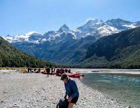
Route descriptions for the five passes usually start with the Routeburn Track, but we decided to do it in the opposite direction. We wanted to use a jet boat to avoid many hours of walking, and figured it would be easier to book a jet boat drop-off than pickup. In retrospect I’m not sure that’s true, but it certainly provided a spectacular start to our trip. We had delayed our departure a day due to some pretty cold and unpleasant weather. As a result, the surrounding mountains were covered in snow. The views as we headed up the Dart in gorgeous sunshine were spectacular. I could understand the popularity of the Dart River jet trip, which takes you right into the back country without having to break into a sweat or get your feet wet. The foreign tourists we shared our ride with were impressed. The murkiness of the river due to a large slip the previous year was the only blot on the landscape.
Eventually our jet boat took its scheduled stop at our destination—the head of the Beans Burn (Scottish names abound down south). It’s a popular spot—a tour company group was already there preparing to head up the ‘burn’ in inflatable boats. We said our goodbyes, donned packs while swatting sandflies, and headed off into the bush. Within a minute we spotted two kakariki.
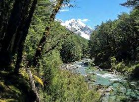
After about an hour we were enjoying the sun in open river flats, with snow-capped mountains towering on either side. They had cool names like ‘Mount Chaos’ and ‘Tantalus Peak’. The mountains are not that big by South Island standards—most are under 2000 metres— but they make up for it by their steepness and ruggedness According to our map the track ends at the river flats. In reality we were on a marked track most of the first day. We found when we finished our trip that the Routeburn end of the track, which the various accounts I had read described as ‘unmarked’, is actually signposted and the track has been cut and marked for a good 15 km or so up the Rock Burn. It seems the ‘wilderness’ is gradually being encroached upon.
We managed to lose the track for a while on the first day, where some of the cutting and marking had been a bit neglected. But we were soon back on course and by late afternoon we could see our destination—the Beans Burn rock bivvy—in the distance. By then the track had disappeared, along with the forest, and it took us seeming hours to fight our way through tussock and scrub to the bivvy. Note for future trips—the quickest route is probably straight up the river, even though it’s a bit deep in places.
ABOVE: Start of trip in Beans Burn Photos: PAUL CHRISTOFFEL
ABOVE: Beans Burn
We found we’d been beaten by a party of four, who had nabbed the only decent camping spot leaving the bivvy to us. The ‘rock bivvy’ was really a cave, with one entrance partially blocked by a crude stone wall to keep out the wind. You could sleep six in there no problem, so we had plenty of room to spread out. Our fellow campers were two couples from Pukekohe, who looked well into their 40s. They were taking it fairly easy having been dropped off the previous afternoon before staying in another bivvy at the first river flats. They hated their jet boat trip as much as we enjoyed it—zooming into sleet in an uncovered boat is apparently not much fun.
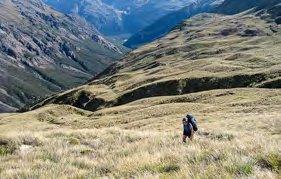
The Pukekohe group were early risers and were long gone by the time we finished breakfast. To keep their feet dry they travelled up the true right bank of the Beans Burn while we crossed to the left bank where the travel was easier. Several kilometres later we briefly caught up with them but parted company again as they headed up on a broad zigzag course. One of the various sets of instructions we’d printed off the net said the best route was straight up following a small dried-up stream bed. So straight up we went. It was very steep.
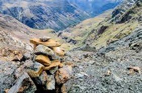
We were heading for Fohn Saddle, the first of the ‘five passes’ and one of two over 1,500 metres. The saddle soon disappeared behind large bluffs. There was no sign of the other party. Were we going the right way? The apparent lack of alternative options, and the occasional cairn, made me pretty confident we were on course.
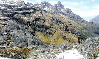
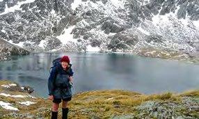
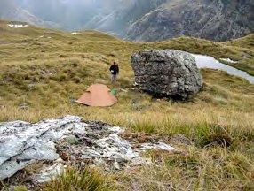
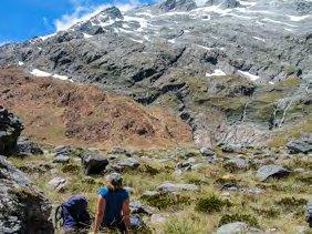
Eventually we hit snow. Queenstown DOC staff had mentioned reports of snow and suggested ice axes might be needed, and maybe crampons. My experience is that DOC suggests ice axes at the merest hint of snow despite the fact that ice axes and crampons are often useless, particularly in summer. There’s either so little snow that neither are needed or so much snow that you constantly sink in over your knees. In this case we largely avoided the snow anyway by climbing over large boulders. A pole on Fohn Saddle was a welcome sight and the last official-looking marker we were to see for the next few days. Our next destination was the Fohn Lakes. Although Barnett and Brown describe these lakes as ‘one of the highlights of the trip’, they actually require a detour of a couple of hours from the main route. After following some cairns in the wrong direction we eventually backtracked then sidled across the ridge until we could see the lakes in the distance. Within an hour we were lunching by the largest of the Fohn Lakes, surrounded by snow but in warm sunshine. The snow-covered Sunset, Corinna and Brenda Peaks towered above. On the way there we spotted the other party in the distance. They ignored the lakes and instead took the easy way down to the Olivine Ledge—a large grassy—well, ledge I guess—that provides good camping far above the Olivine River. The route down to the ledge from the Fohn Lakes is much tougher, and it took some time to pick our way through sharp boulders and slippery grasses. We eventually reached the ledge, set up camp by a large rock, and settled in to enjoy a surprisingly warm evening. Keas cried as they circled the sheer cliff tops far above.
The third day dawned clear. We needed to cross the Fohn Lakes outlet stream which from afar looked a major undertaking but once we got there was a doddle.
ABOVE: Fohn Lake
TOP LEFT: Climbing to Fohn Saddle
ABOVE: Camp on the Olivine Ledge
We were headed for Fiery Col, which was out of sight around a corner for most of the morning. On the way we ran into a couple who looked around 60, heading the opposite direction. This was clearly not a young person’s tramp!
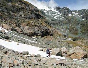
Fiery Col is the highest point on the trip, at 1,546 metres. It’s named after the red rocks that abound in the area, particularly on the southern side of the col. Apparently geologists love this area with its huge variety of rock types, particularly the red ultramafic rocks. Once they break up, these red rocks have very sharp edges, as we found. The steep southern side of the col had a generous covering of snow which we could, in theory, have avoided by taking a route over sharp rocks. Instead we donned our over-trousers and slid down on bums and boots, mainly the latter. Great fun!
We had caught up with the early-rising Pukekohe group, and joined them for lunch in the sun. On the way down we came across a group of five going in the opposite direction. Two of them looked in their 60s, and an old guy with a ZZ Top beard looked well over 70. The last two in the party were teenagers, presumably dragged out tramping with their grandparents. Don’t trampers in their 20s and 30s venture into the wilderness we wondered?
It seemed impossible to get lost as we could see Cow Saddle in the distance below so we followed our noses through craggy rock fields surrounded by towering cliffs. The country was spectacular. But we ended up taking a pretty roundabout route then had to head down a steep stream to get back on course. Although it was more picturesque than the standard more direct route we lost a lot of time with our detour, which took us into the headwaters of Hidden Falls Creek. Technically then, we had missed Cow Saddle which is a bit of a rise between the headwaters of Hidden Falls Creek and the Olivine River. It is counted as one of the five passes although it’s more of a boggy grass flat than a pass.
ABOVE: Leaving the Olivine Ledge
ABOVE: Fiery Col. Olivine Ledge right.
The travel down Hidden Falls Creek was slow going at times as it’s regularly flanked with huge red rockslides giving the country a slightly bleak appearance. Route descriptions from the internet said there was great camping further downstream but it was getting late and we were tired. Strong winds seemed to be coming from every direction but eventually we found a sheltered spot large enough for a single tent. The creek had mysteriously disappeared leaving nothing but a couple of pools by our camp. Even these disappeared overnight.
Shortly after 6 am it started raining. We took shelter under trees and packed as quickly as we could. The only obvious route seemed to involve heading straight down the creek bed clambering over huge boulders. After a time we found a cairn and a ground trail to the left of the creek which by then had built up to a small trickle. Within a couple of hundred metres Hidden Falls Creek became a torrent. Where had all that water been hiding?
ABOVE: Heading down from Fiery Col
BELOW: Resting below Fiery Col
We came to a large camping area, obviously the one described in our internet material. From there onwards we were frequently unsure of our route. We were using a combination of Moir’s Guide and internet advice to try and find the spur up to Park Pass. Navigation was not helped by the steady rain, and we backtracked several times. We eventually spotted a pink tie on a tree far to our right, denoting that the route did a sudden sharp turn. A short distance later, someone had attached an orange permolat marker to a tree, and scratched on it the words ‘last marker before Rock Burn’ (or something like that).
Yay! We’d found the start of the spur. From there we followed a good ground trail up to Park Pass.
It was a steep climb, and we were cold, wet and hungry by the time we sheltered under rocks for a quick lunch. The rain hadn’t let up for a second. We were too cold to linger for any longer than it took to gulp down a One Square Meal bar.
Gale force winds over the pass blew rain and sleet in our faces. Sharon got blown over several times and I struggled to keep my feet. Waves raced across a large tarn below us, looking like Wellington Harbour in a southerly gale. We were pretty glad to reach the other side. Eventually we found the rock bivvy that our various guides said was about 20 minutes over the pass. Eight people sheltered under the overhang—the Pukekohe group, who had decided that this was far enough for the day, an Australian couple who looked (you guessed it) well into their sixties, and a couple of guides they had hired to take them on the trip. We didn’t feel tempted to stop so pushed on after a brief chat.
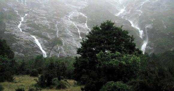
We had to twice cross the upper reaches of the swollen Rock Burn on the way down to the bush line. Once we hit the bush a marked track took us all the way down to the large river flats of the valley below. Getting there involved two stream crossings that at first looked impossible. The first stream was a narrow wild torrent that looked like it could sweep us into the Rock Burn and certain death below. I crossed it by holding onto an overhanging branch, then helped Sharon across. We had avoided getting into the FMC Journal ‘back country accidents’ reports, at least for the moment. The next crossing was easier after a bit of scouting around, and we soon reached the river flats. Huge waterfalls cascaded down giant cliff faces to our left, one of which had brought a large quantity of ice and snow with it.
The next stream we reached was clearly uncrossable, so we turned around and set up camp by a large patch of bush. It’s a bit miserable putting up a wet tent in the rain, but things stayed surprisingly dry inside. Warm in our sleeping bags we drifted in and out of sleep.
I opened my eyes to the drip, drip, of water off the trees. The rain had stopped! We unzipped the tent to be greeted by blue skies and sunshine. Cue frantic running around hanging things on bushes in the sun. The sun soon disappeared behind the mountains, but we managed to find enough dry wood to light a fire to keep warm, and dry the rest of our gear. Dinner and a warm fire—what more do you need? Nothing like nine hours of miserable rain to help you appreciate the simple things in life. We slept well that night.
On day five the waterfalls had disappeared and we crossed yesterday’s ‘uncrossable’ stream without getting our feet wet. We headed down the river flats in pleasant weather and debated whether to camp or to walk out. While we prevaricated we ran into the Aussie couple and their guides. They had decided to abandon their trip and retreat back to the Routeburn road end where they started, after hearing the long-range forecast on their satellite phone.
Actually, there was really only one guide, from Aspiring guides in Wanaka. His mate was a German guy he’d hired to help carry the tents and food. We joined them for lunch and chatted in the sun. The Aussies said they had done South Island guided trips several years in a row including the Young-Wilkin circuit the previous summer. They were pretty disappointed to be turned back by the weather, and were hoping it didn’t follow them up to Abel Tasman where they were going kayaking. The party offered us a lift into Glenorchy but we decided to camp. The weather looked settled, we had an extra day up our sleeve, and we were enjoying this glorious country.
On the way back to the clearing we spotted enough mice to convince use there must be millions of them in the bush. Maybe killing predators like stouts and rats had enabled the mouse population to take off. At our camp, sandflies harassed us for the first time so we donned plenty of clothes.
On the last day we had an easy walk out over Sugerloaf Pass, the last of the five passes. We were getting close to civilisation and could see Lake Wakatipu below. DOC promotes the trip up Sugerloaf Pass as a day walk and we ran into an American couple doing just that. Once we hit the Routeburn track ‘highway’ it took less than 30 minutes to reach the Routeburn shelter. Suddenly there were young people and family groups everywhere.
We nabbed the last two unreserved seats on the afternoon bus to Queenstown via Glenorchy. On the way the bus picked up four Aussie guys who had done another wilderness trip that overlapped our route. One guy said he took a great photo of the Park Pass tarn with mountains reflected in it. Not on the same day we were there I suspect. As we shared stories of our respective adventures, we felt like real wilderness trampers. Sure we saw a few people, there were marked tracks some of the way, and we were buzzed by the occasional sight- seeing plane. But most of the time we felt well away from it all. It was certainly a great introduction, and we looked forward to more.
ABOVE: Nearly home. Heading down from Sugarloaf Pass. Lake Wakatipu in background
TOP: Waterfalls above Rock Burn
Comments
Comments are not open yet.