
Text taken from the club newsletter.
TIMBER! RIDING THE TIMBER TRAIL by IAN HARRISON with MEGAN BANKS
I wake with a start. My right calf is cramping painfully. It’s Saturday at the start of Labour Weekend. We haven’t even begun yet and already my legs are
I manage to stretch out the cramp which was probably due to the long drive from Wellington to Taupo the previous night. Megan and I are here to bike the Timber Trail which starts in Pureora about 80 km west of Taupo.
The Trail was opened in March, 2013 by DOC. It runs for 85 km and makes use of existing walking and logging tracks as well as an historic tram line and newly formed sec- tions of trail. The main feature is the “timber”; Pureora being renowned for its native forest which was saved from logging by protest action in the 1970s. The other feature of the track are the eight suspension bridges. They were built by DOC specifically for cyclists and are incredibly impressive. Being able to ride over them is reason enough to do the trail.
At the Pureora car park we faff with panniers and our bikes. Two or three other groups are doing the same but without the panniers. They must have got one of the shuttle companies or friends to take their gear to the road-accessible camp at Piropiro half way along the track. My panniers are crap and I’m a bit worried they’re going to cause problems. Also I didn’t have time to check the bikes before leaving other than to dribble some oil on the chains. I do have tools and am confident I should be able to keep us moving in the event of a breakdown. Then a cyclist appears asking if any- one has a crank tool. One of his party has had their cranks fall off only a few metres down the track. No one has a crank tool... ...I’m not so confident now.
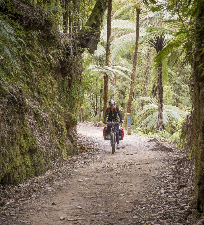
The start of the track has the rich- est forest of the area. We hear long tailed cuckoos, tui, kakariki and kaka. The riding is easy going but soon starts to climb as we break out of the forest into clear fall; or as DOC euphemistically describes it: “an area complaining!
of recent logging history”. It’s a steady but gradual climb up the lower slopes of Mount Pureora and back into the bush. I’m faster uphill than Megan so go ahead but I’m soon held up by traffic; a lady on her bike doesn’t hear me behind her. It’s time for lunch anyway so I stop and wait for Megan.
After sandwiches we continue climbing to almost 1000m (about the same elevation as the Desert Road). DOC signs warn to prepare for an “alpine environment” even though we never leave thick bush. I wait again for Megan around the corner from a short steep section. Megan heralds her arrival by crashing into the ditch. “You OK?” I shout; walking around the corner to see a pile of limbs, wheels and panniers. “It reared like a horse!” she explains. Heavy panniers on the back and a steep track are a bad combination! She’s unhurt and we’re soon enjoying a good downhill run. My crap panniers, which I’m sure were designed by someone that had never ridden a bike other than maybe doing a couple of laps of a car park, are unhitching themselves at regular intervals. I’ve bungeed them on so they can’t fall right off, but I still need to stop and re-seat them on my carrier.
My seat also is giving me reason to complain. It was designed by a sadist. The brand name is Fi’zi:k, and you’d think it’s unusual to have a name with random symbols in it... until you ride the +#%:ing thing and see it makes every poor ^*#!ing bastard who owns one to use a lot of %-#*ing symbols. It’s partly my own fault as I didn’t get around to swapping over my trusty seat from my road bike; which makes me even more annoyed by it.
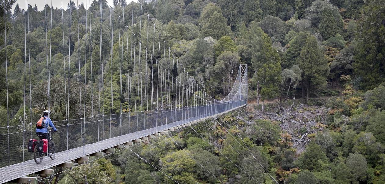
However, discomforts are soon forgotten as we round a bend to see the first suspension bridge. It’s an impres- sive sight and shows what can be done if there’s the will and money available. (There was the will and money for building the Timber Trail because it is part of Nga Haer- enga, the New Zealand Cycle Trail). I stop in the middle of the bridge to get the full experience of being suspended over 50 metres above the ground, but starting off again is nerve wracking as I have trouble clipping my second foot into the pedal and the panniers are putting me off balance. The bridge looks very well made, but the nylon mesh on the sides to prevent certain death in the event of tipping off your bike, looks very thin although it’s somehow reas- suring that health and safety isn’t the main criterion for the bridge design. It’s an idyllic scene. I hear a group of women whoop with delight behind me as they catch sight of the bridge. People at the other end have stopped to regroup and enjoy the view.
From here the track to Piropiro is mostly downhill. For the entire length of the Timber Trail DOC have put in ki- lometre marker posts. These are really helpful as the small map we have doesn’t have most of the landmarks (i.e. bridges) marked on it, and the undulating terrain makes it difficult to work out exactly where you are. With the markers everyone knows how far they’ve come. We cross a further four suspension bridges before coming out on to sections of gravel forestry roads with the bush replaced by scrub near Piropiro. Our sore bums are happy to arrive at the campground about six hours after setting off. There’s heaps of room to camp and people have set up quite elabo- rate caravans with dogs, utes, quadbikes and woodpiles for campfires.
Megan crossing the Maramataha Bridge
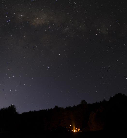
Campfire under the Milky Way at Piropiro
The evening passes uneventfully punctuated by ruru calls and the hyaena laugh of a drunken lout in a neigh- bouring group of campers. Happily, the lout passes out as the Milky Way appears in the night sky and the ruru continue to call to one another.
We wake early on Sunday morning. I’m anxious to get going early. I booked a shuttle from the end of the track for 2:30 p.m. This is earlier than we would have liked but the shuttle company specified the time so we could be included with another group. The day before we took six hours to cover 40 km and today we have 45 km to do. We’re rolling by 8 a.m. It’s quite cold and overcast and I’m thankful for my new warm cycling gloves.
The Maramataha Bridge hoves into view after only a few kilometres. It’s the biggest of the track at 141m long and 45m above ground at its highest point.
The first hour passes as we ride undulating terrain. We’re not going fast but are on schedule. After about 10 km the undulations are replaced by nice sections of downhill. The kilometre posts flash by in quick succession and it’s apparent we have plenty of time up our sleeves. Some of the downhills are great fun despite having to repeatedly stop to fix my panniers.
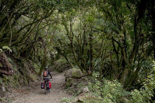
We come to the section of track that follows the historic Ellis and Burnand Ongarue Tramway that was used to extract logs between 1922 and 1958. It follows the contours with frequent cuttings and a few cliff ledges.
On a flat section we’re passed by two fit looking cyclists on flash full suspension bikes. Just ahead is a small muddy patch spanning the full width of the track. The first of the pair starts to power through it but quickly becomes bogged and in super slow motion topples over in ridicu- lous fashion. “Ha that would’ve been me” says Megan who was leading up until a minute ago. It’s a funny moment and the toppled cyclist can do nothing but laugh at him- self.
The final notable feature of the track is the Ongarue Spiral. It allowed the old tram line to lose elevation in a short distance without steepening the gradient. We cycle over a bridge that goes above the track and then loop around to the left and through a short tunnel to come out under the bridge we just crossed. It’s pretty cool. Railway spirals all seem to be described, as this one is, as “a great feat of engineering”, but I suspect it was a well-established technique for railway builders.
We’re on the final stretch of downhill. I throw caution
Riding down the Ellis and Burnand Ongarue Tramway to the wind and let the bike go full speed. Then for the first time one of my panniers falls completely off. Suitably reprimanded I reattach it and continue at a more pedes- trian pace.
We make it to Ongarue by 12:30. The shuttle com- pany is based in town and kindly offer to take us back to Pureora straight away.
Megan and I are both in agreement we want to do it again - without panniers. I’d even love to try and do the whole thing in a day. We were lucky with the weather and given a good forecast it’s a lot of fun and highly recom- mended.
Comments
Comments are not open yet.