
Text taken from the club newsletter.
THE MUNGO HUT
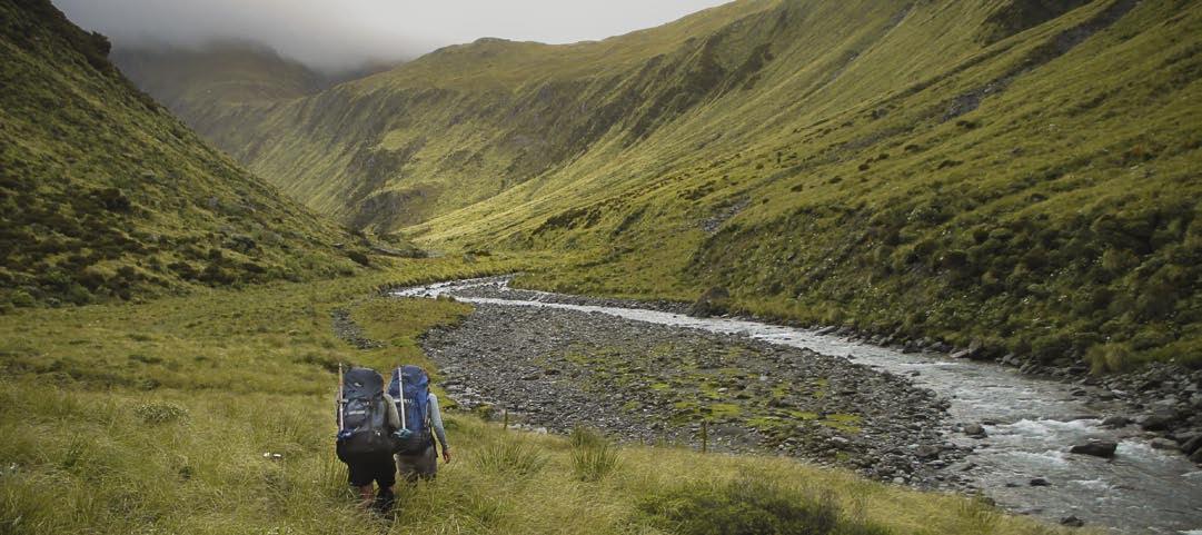
Heading up the Mungo River towards Mungo Hut
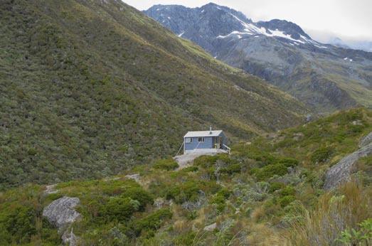
According to the ‘isolated huts’ website Mungo gets only a handful of visitors each year. Some may think, “Well, maybe it’s not worth visiting then”, but to others “rarely visited” means an irresistible challenge.
by PAUL CHRISTOFFEL photos MEGAN SETY with: KATY GLENIE, SHARON BRANDFORD and MIKE PHETHEAN
In a clearing near the banks of the Mungo River sits Mungo Hut, one of many huts installed on the West Coast by the New Zealand Forest Service back in the day. The huts were built for deer cullers, but after culling by foot was made redundant by helicopter hunting, they remained as shelter for trampers and recreational hunters.
When Mike prepared six alternative West Coast routes for a WTMC post-Christmas trip, all included a stay at Mungo. He had tramped the area before and bagged little- visited huts like the Sir Robert, but Mungo had eluded him. So any route we chose into the isolated ranges east of Hokitika was going to include a visit to Mungo.
DAY ONE
Friday 27 December 2013 dawned fine and sunny in Hokitika. After a half hour drive, our party of five set out from the road end just south of Lake Kaniere, near the confluence of three rivers – the Kokatahi, the Styx, and the Toaroha. We followed the last of these; first to Cedar Flat hut for lunch, then on to Upper Toaroha Hut for the night. We said farewell to the other WTMC group, who we’d see again in a week.
We set out across farmland in the warm sunshine. Was this really the West Coast? Soon we joined a bushy sidle track that eventually met up with the Toaroha River. After a kilometre of boulder hopping we headed inland again, avoiding the Toaroha Canyon. We ran into a party of young people heading out, one carrying a canoe with the intention of kayaking out once they hit the river. They were impressed that we expected to head all the way to Upper Toaroha that day. We soon found out why.
To state the obvious, a pack with seven days worth of food is pretty heavy. As a result, we weren’t making the progress we had hoped for. DOC says it takes 3-4 hours to get to Cedar Flats, and Mike had banked on three given we were a reasonably fit group. It took four hours. The DOC time to Upper Toaroha is 5-6 hours. It looked like we were in for a long day.
We decided to lunch in Cedar Flat Hut to avoid the heat and sandflies. There are actually two huts, including an historic one, but we opted for the modern version. No one was tempted to try out the nearby hot pools – they’d seem more appealing in cooler weather.
After Cedar Flat the track got rougher, and in places had collapsed altogether, leaving us scrambling up and down crumbling banks. Mike went ahead to set up the mountain radio for the 7.30 p.m. schedule. The sun had disappeared behind the mountains as the rest of us arrived at Upper Toaroha after 7p.m It had been a tough 10 hour day.
Upper Toaroha Hut has a stunning spot in a basin sur- rounded by high peaks. We made the most of our limited remaining daylight to enjoy the scenery before a cup of tea and dinner. This was the first of our dehy meals that the punters from the two groups had prepared in the preced- ing weeks. Sharon and I were late entrants to the trip so had only contributed financially. As we were to discover some months later, it’s a lot of work preparing a dehy meal for a large group. So many thanks to all those who did the cooking and dehydrating – your efforts are much appreci- ated. And the meals were way better than the Backcountry version.
DAY TWO
The mountain radio guy promised fine weather for Saturday, and so it was to be. Mike promised us a much shorter day as we headed for the legendary Mungo Hut. But first we had to get over Toaroha Saddle.
The route started off very steeply and in places some- one (possibly DOC workers) had installed chains to help trampers haul themselves up. We paused after the main climb to admire the spectacular view back down the Toaroha Valley from where we had come. The hut looked tiny in the distance. Then it was on to Toaroha Saddle where we enjoyed great views of the snow-covered peaks towards the western edge of the Arthur’s Pass National Park.
Toaroha saddle lies between the Diedrichs and Toaroha ranges and is the site of a bivvy. We chatted to a hunter who had spent two nights there after hurting his knee. He was preparing for a slow trip out, hopefully in time to compete in a West Coast tennis tournament. We didn’t fancy his chances of getting out quickly (or of success in the tennis tournament), but wished him luck all the same.
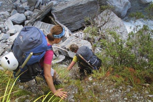
From the saddle it was a precipitous 600 metres downhill, followed by a bit of sidling. The sidle track at one point joined a steep stream (more of a waterfall really), which we had to clamber down for about 20 metres before picking up a track down to the Mungo River.
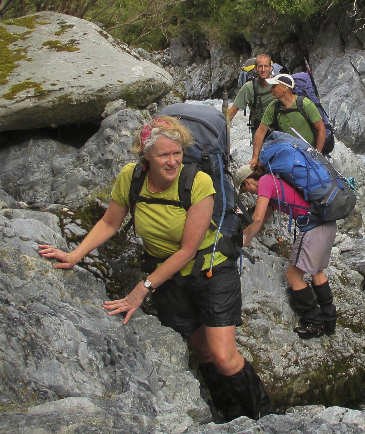
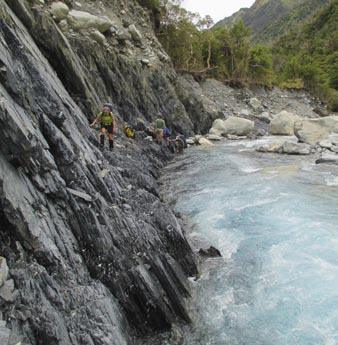
We lunched in the sun by the river before heading off on the final stretch to the legendary hut. Eventually we had to cross the river, no easy task, but the crossing point wasn’t too bad. Shortly after crossing we hit a nasty looking black stone bluff, which looked a major challenge. Thankfully it wasn’t as bad as it first appeared and we all traversed it in no time.
Further up the true left bank the others found a hot pool with just enough room for one person. But the
Decending from Toaroha Saddle to Mungo River weather was still too warm to sit in hot water, so we continued on. Eventually we reached the Brunswick Stream, which looked impossible to cross. Katy found a sidle track through the bush and we followed the pink ribbons until we emerged further upstream at what was presumably a crossing point. But it still looked uncrossable. Was that a cairn further upstream? We went to investigate. It soon became apparent that the ‘cairn’ was actually a large boulder atop an enormous boulder. How it got there who knows, but clearly people weren’t involved.
Megan and I decided to head still further upstream to try and find a cross- ing point. Why was there so much water? We figured that several days of warm sunny weather must have melted the snow, filling up the waterways. Our upstream expedition was fruitless, and we returned to find Mike futilely shot-putting large rocks into the Brunswick, presumably in the forlorn hope of creating a crossing.
MUNGO PARK
We had wasted well over an hour to no avail. And no-one even took a photo of the stream! There was nothing for it but to retrace our steps then con- tinue down river to Poet Hut.
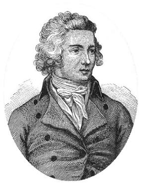
The Mungo River and hut are named after the Scottish explorer Mungo Park (born 1771); the first European to find the source of the Niger River.
Disconsolately we trudged back the way we came. I was getting tired, having been lumbered with much of the heavy gear. Then I hit a nasty looking black stone bluff, which looked a major challenge. How were we going to get across it? Hold on, wasn’t this where we crossed the river? Sure enough, there was an easy crossing point right there.
Near Mungo Hut is Park Stream, and into Park Stream flows the Niger stream; the final clue in the puzzle. Of course, how a short river on the West Coast of the South Island came to be named after a Scottish explorer of Africa is another mat- ter. I pass on that one. According to Wikipedia, there’s only one other Mungo River in the world, and that’s in Cameroon.
After we had crossed the river, Mike pointed out that it was the wrong place. So, after a bit of faffing, we re-crossed and headed over the ‘nasty looking black stone bluff’, which I belatedly realised was of course the exact same one we had traversed on the way in. Doh!
At 6.30 Mike and I arrived at Poet Hut. I was knackered. Despite Mike’s promise, it had been another 10 hour day.
Poet Hut may be a pretty name but it’s also a highly misleading one. The floor was barely visible for rat droppings. Mike set up the mountain radio while I tried to clean the place up a bit before the girls arrived.
After much sweeping the hut looked a lot better, although that didn’t stop the others spending a further 10 minutes cleaning up once they got there. Katy announced there was no way she was sleeping in the hut, so Mike’s enormous tent (buried in my pack) was going to get an airing. Megan said rats didn’t bother her as she’d lived in a house with rats before. Sharon, as a psychologist, had done plenty of experiments with rats, so sleeping in the hut didn’t faze her either. I said nothing. There was no option given Mike and Katy were sharing the tent.
Mungo Park drowned on his second trip to Africa in 1806- something to bear in mind later in this story.
Historians are rarely of much value on tramping trips, but sometimes we have our uses.
That evening lights were out in the hut for barely 10 minutes when there was a loud scream. A rat had run across Sharon’s bare shoulders. Megan grabbed her torch and soon caught a large and frightened looking rat in its beam. The
Traversing a bluff beside Mungo River rat ran to and fro looking for a way out before heading up the chimney of the open fireplace. I had a poor sleep that night. I suspect Sharon didn’t sleep that well either.
DAY THREE
The weather people again promised fine weather and Mike promised us a short day. The sky was a bit cloudy, but it remained fine. We were heading up to Bluff Hut, only a few hours away. This time it looked like we really would get a short day.
We headed down the Mungo to the point where it meets the Hokitika River. Although the Hokitika seemed to be no more than a large creek thundering into the Mungo at an absurdly steep slope, the Mungo from then on gets renamed the Hokitika. There seems no logical reason for this quirk of naming, but the result is that the Mungo River is no more than 9 km long.
The suspension bridge just past the confluence of the rivers was only installed in 2009 after an earlier version was washed away in a flood. After crossing the bridge we climbed 650 metres up to the hut passing some impressive rocky bluffs towards the top. We were all there by mid-af- ternoon. Mike had delivered on his promise of a short day.
Bluff Hut
Bluff Hut is in a magnificent location on a flat spot at the end of the Conway Ridge. It had great views back the way we had come; particularly of the Diedrichs Range, and also of the Homeward Ridge to the east. The old hut was moved to a more stable location in 2009 and was pretty much rebuilt. Only the corrugated iron cladding remains. Sturdy cables keep Bluff Hut affixed to the rock, a reminder that it can get windy.
There was little wind forecast according to the moun- tain radio guys. Instead they predicted rain. As we had a bit of river work to do the next day, it looked like we could be in for a hut day. And so it was to be. DAY FOUR
In the early hours of Monday morning there was a bit of a kerfuffle, as Katy and Mike got up to investigate noises outside. They claimed a possum had been trying to steal our ice axes. The possums are quite welcome to mine, I thought. We had brought ice axes on the off-chance that one of the various proposed routes might take us high into snow. As 1300 metres was the highest we got, they remained strapped uselessly to out packs, regularly getting caught up in overhanging vegetation and adding un-need- ed extra weight.
The rain wasn’t heavy come daylight, but it was steady enough to deter us from going anywhere. We were thank- ful for a warm and comfortable hut, nothing like the one the night before. Sorry Harry, but there’s something to be said for these flash new huts. We chatted, played cards, read – the usual stuff. We may well have lit a fire; I don’t recall. It wasn’t particularly cold.
Mike again aired his disappointment at not getting to Mungo Hut, but Katy had lost interest. She now had her sights set on Sir Robert, another of those hard-to-get- to huts. I failed to notice it at the time, but only a few kilometres from Bluff Hut lies Frisco Hut, on a spur far above the other side of the Hokitika River. According to remotehuts.co.nz, the Forest Service and DOC haven’t maintained the access tracks since the mid 1970s, but in 2011 ‘permolat’ volunteers associated with the remote huts website restored an access track from the Hokitika River. The website proudly boasts that the hut now gets a couple of visitors each year. Even more remote is the Serpentine Hut, on the gorgy bit of the Hokitika River beyond the new swing bridge. The Serpentine is apparently generally visited only by the occasional kayaking group, although it did get a foot visitor in 2009 and another in 2010. More huts for Mike’s list perhaps?
The mountain radio guys predicted better weather for Tuesday, but more rain the rest of the week. Mike was concerned about a crossing we’d have to do in a couple of days, over the worryingly-name Rapid Creek. We’d have to cross that bridge when we came to it, so to speak - except that, according to the maps and Mike’s memory, there was no bridge.
DAY FIVE
Light rain was falling as we set off on Tuesday, but nothing to worry about. We headed up the Hokitika River (little more than a large creek at that point) most of the way to its headwaters. Then the route swung abruptly west
Heading towards Frew Saddle before a steep 200 metre climb up to Frew Saddle, the highest point on our trip. Just over the saddle was another bivvy where we stopped for photos before heading down into Frew Creek. We could see a hint of blue sky in the distance, but where we were showers persisted on and off.
Although there is a track marked on the map, in reality you head about two kilometres straight down Frew Creek. Thankfully the travel was pretty easy – in fact quite fun most of the time. After that a track led, after several kilo- metres of rough bush travel, to Frew Hut. This is another comfortable newish hut with a luxurious 10 bunks. It sits on the banks of the legendary Whitcombe River, named after John Whitcombe who, with Jakob Lauper, crossed from Canterbury to the West Coast in 1863. The First Crossings guys re-created their epic journey in the first episode of their first TV series. It was one hell of a trip, ending with Whitcombe drowning not far from their des- tination. In 2013 descendents of Whitcombe recreated the journey (sans the drowning bit) in celebration of its 150th anniversary.
Frew Hut was inhabited by a hunter who had spent the previous night at Frew Biv. When we told him of the weather forecast he decided it might be a good time to head out, or at least on to Rapid Creek Hut. But before he left he provided us with some very welcome information. Rapid Creek now has a swing-bridge. Our worries that we might spend several days stuck at Frew Hut diminished, although hadn’t disappeared altogether. There were still other creeks on the way to worry about.
That night we got a message to the other WTMC group that we expected to be back in Hokitika in a couple of days. They were doing a second trip further south, but would be out in good time to join us. Everything seemed to be falling into place, as long as the gods played ball.
DAY SIX
On Wednesday morning it was raining, as predicted by the mountain radio guys (well, really by the Met Service, whose forecasts they read out). We didn’t have far to go, so aimed at leaving as soon as the rain diminished. At lunch Megan offered me some of her food, as she had plenty left. It consisted of Tararua biscuits spread with her special homemade mixture with ingredients that included peanut butter, coconut cream powder, and some unidentified incredibly sweet stuff. It was like rocket fuel in its effect (although not its taste) and I soon became hyperactive. The weather was clearing, and I decided it was time to go. Those who have tramped with me before will know that I’m a notorious faffer, but I was packed and ready to go in no time, waiting impatiently for the others. No wonder Megan was so often full of energy!
Not long after we left the hut the sun came out, and it even got pretty hot. Most of us stopped to put on sun screen. Five minutes later it started pouring with rain and the temperature plummeted. The rain continued for the rest of the afternoon.
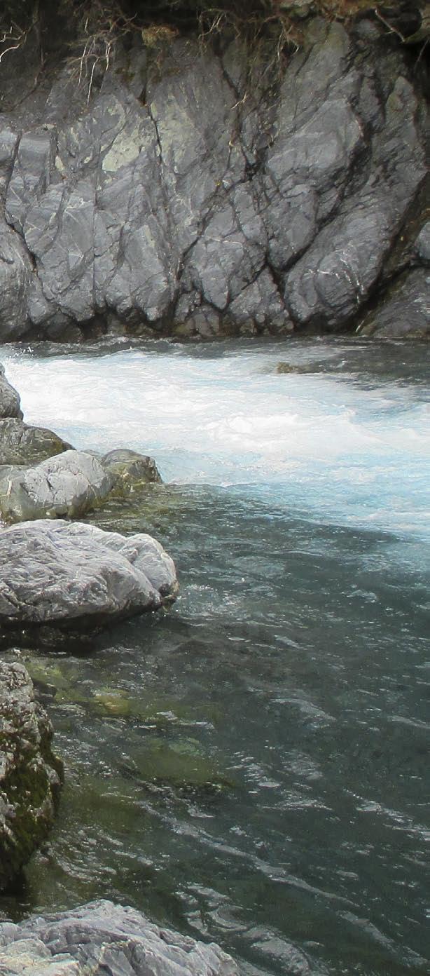
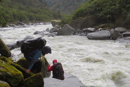
The route followed the Whitcombe River, which raged a frightening brown colour. Many of the rocks were slip-
The Whitcombe River in flood pery, making us super-careful. One slip and we would be following the likes of Mungo Park and John Whitcombe to a watery grave. At one point we had to swing on vines to get over the worst of the hazards. It was slow going and we were getting cold from the persistent rain.
A few kilometres from Rapid Creek Hut the steep river banks flattened out making travel easier and less scary. Eventually the Whitcombe River met up with the Hokiti- ka River, which had headed through a series of deep gorges since we last saw it the previous day. Consistent with the apparent naming rules in the area (ie, ‘Hokitika’ trumps all other names), the Whitcombe became the Hokitika River as soon as the two rivers met.
After a long detour through the bush we finally came to the Rapid Creek swing bridge. Nasty looking waters surged below us. We would never have got over without a bridge. Five minutes later we reached Rapid Creek Hut.
As the rest of us changed out of our cold wet gear, Mike stoically set up the mountain radio in the rain. He organised the mountain radio guys to book a taxi van to
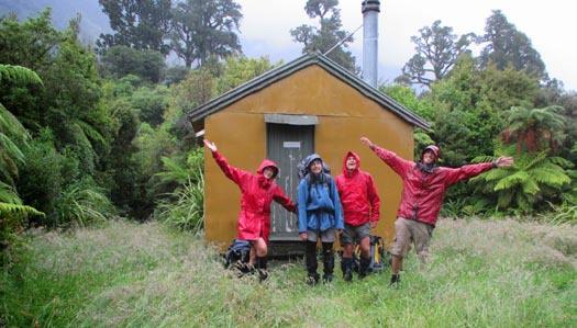
Thank-you Rapid Creek Hut!
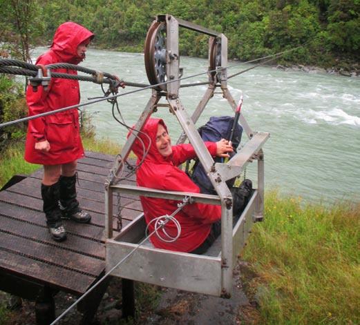
Cable-way over the Hokitika River pick us up from the road end. A pretty good service this mountain radio!
DAY SEVEN
Our final day was uneventful, the highlight being a re- ally long cable-way across the Hokitika River that required us to crank each other across. It rained most of the day and we were all soaking wet again by the time we reach civilisation.
Civilisation came disconcertingly quickly in the form of a large DOC parking area complete with toilets, a shelter, and some informative displays. We huddled under the shelter to keep dry, a smelly bedraggled crew blocking the view of the information boards for the tourists who regularly arrived. The main attraction there was a highly- groomed walk that ended with a spectacular lookout over the river.
Finally our ‘taxi’ arrived – actually a bus. Mike had wisely kept large amounts of cash to pay for our trip back to Hokitika. Once there we booked into a backpackers to await the arrival of the other group. To my surprise there was still hot water left even after the others had finished their showers. What luxury!
This was one of the longest trips I’ve done, and it was very satisfying getting into country that I didn’t even know existed. And maybe one day some of us will make it to the elusive Mungo Hut.
Comments
Comments are not open yet.