
Text taken from the club newsletter.
MAKARETU TO EAST WAITEWAEWAE by HARRY SMITH with SHAY BENDALL
A trip from Ohau to Otaki Forks via Makaretu Stream and the East Waitewaewae is one that I have wanted to do for a long time...
On the map it looks like an obvious line, with the two catchments linked by a fairly low saddle, but I don’t recall the club ever doing it (at least not in my time in the club, although I have vague memories of seeing a trip report in an old club newsletter from the 70’s or early 80’s that went into this area). I had been into the Makaretu before, on the way out from Oriwa Bivvy, but I had never been into the Waitewaewae catchment at all, and for me this whole area constituted a fairly large and significant blank on the map of my explorations of the Ta- raruas. The East Waitewaewae sounded like a serious gorge with nowhere decent to camp, so it would be necessary to get all the way through to the junction of the East and West branches of the Waitewaewae on the Saturday. This looked like it could be a long, slow day of gorge travel, so the trip went down on the schedule in January rated as fit- ness essential (FE) – one of very few FEs in recent years! In
Makaretu Gorge camp Mid-Makaretu flats the end I only got one punter signed up – Shay Bendall, a new and enthusiastic club member who I had never met before.
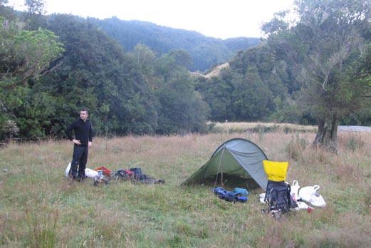
We got dropped off on Friday night at the Ohau Pipe Bridge by Alistair Young in the club van – Alistair was leading a trip into Waiopehu Hut via Blackwater Stream and would pick us up at Otaki Forks on the Sunday. From here we walked for about 10 minutes across farmland to the start of the Makaretu Gorge, where we camped.
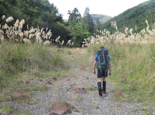
Next morning we were away at 7:45 and set off up the lower gorge. Two and a quarter hours later we arrived at the middle flats. There were some nice campsites here – one sunny day I’d like to come in here and just camp for the weekend.
Beyond the flats the river closed in again until at 12:30 we came to the bottom of the spur running down from Oriwa Bivvy, where we stopped for lunch. Already we were behind time – I had originally hoped to have lunch on the saddle leading over to the East Waitewaewae!
After lunch we continued upstream until we came to a major fork. I was looking for a major fork and I was about 95% sure this was it, but I had expected to pass an earlier one marked on the map and I hadn’t seen it. I decided it was better to be safe than sorry, so I dropped my pack and headed back downstream for 5 or 10 minutes, where I found the earlier one – a tiny trickle of water coming down out of a steep cleft in the bush and easily over- looked. Back at the correct fork, we headed up the open Western branch before climbing out up a grassy rib. This was steep and exposed – we were hanging on to the grass and you wouldn’t want to fall. Eventually we entered into the bush and the going became easier. After a long climb we sidled out to the left and eventually found ourselves on the saddle. It was now 3 o’clock and we still had the whole of the East Waitewaewae before us!
Travel down the East Waitewaewae was typical slow gorge travel. At first the river was only a small stream clogged with vegetation and we sidled along above it. Later, as it grew larger, we dropped down into it and fol- lowed the river bed. At first this was more like travelling in a tunnel, with the vegetation arching over our heads above us, until it eventually widened out into a full- sized river.
“I began to envis- age spending the night
At around 5 o’clock we came to the junction between the two major headwater branches of the East Waitewaewae. Normally at 5 o’clock you would be beginning to think about stopping and camping but at this point we still had a long, long way to go! The next couple of hours consisted of long, slow gorge travel – boulder-hopping down the sides, following gravel beaches, wading pools, criss-crossing the river, and negotiating log jams. It became clear that we weren’t going to make it to the junc- tion with the West Waitewaewae before dark, so I decided that at 7:30 we would begin looking for somewhere to camp. It would be getting dark at about 8:30 or 8:45, so that would give us an hour to find somewhere to stop for the night.
sitting perched on a boulder or some damp ledge halfway up the gorge wall”
At about quarter past seven we came to a particularly evil-looking section of gorge. At the top was a pool with no way around. Our options were either to take a swim or take to the hillsides! We clambered up the gorge wall on the true left and began sidling downstream. Below us the gorge looked dark and nasty, so I decided to continue si- dling for a while in the hope that the river would improve.
Salvation campsite, East Waitewaewae Gorge
But the hillside was very steep and before long sidling became impossible, so we had no choice but to drop back into the river again. This proved difficult, but Shay found a way down a steep gut with an unpleasant vertical step halfway down.
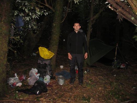
Back in the gorge we found the going OK again. (In hindsight I suspect the pool at the top of this section was the only impassable bit, and we should have dropped back into the river immediately beyond it, rather than trying to continue to sidle.) As we carried on down the gorge I tried to find somewhere to camp. There were one or two places where I thought we might just have been able to pitch a tent on a gravel beach or bar but it was really desperation stuff – the spots were tiny and within inches of the water, both horizontally and vertically, and we would have been completely trapped if it rained and the river came up. I began to envisage spending the night sitting perched on a boulder or some damp ledge halfway up the gorge wall. We kept on going downstream, hoping against all the evidence that we would stumble upon somewhere decent. Then at about 8:20, with no more than 20 minutes of daylight left, Shay spotted a possible place out to the right. I hadn’t even noticed it, and even looking at where Shay was pointing it didn’t look like anything to me, but I went over to have a look. Entering through a barrier of trees we
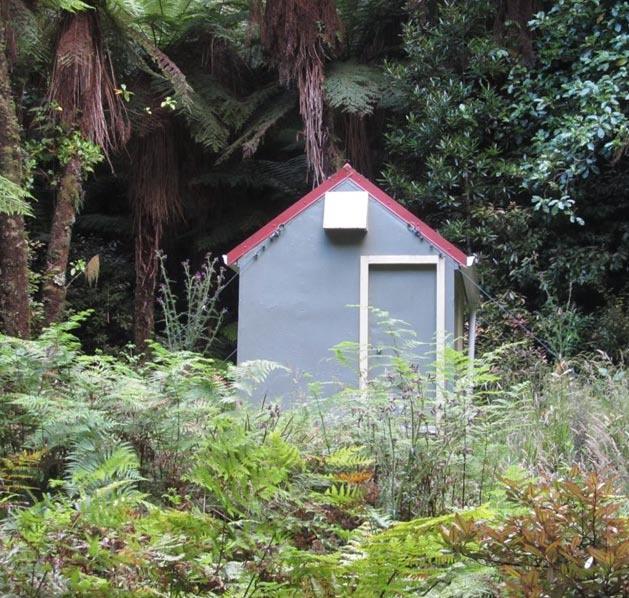
“Island Forks” Hut (not at Island Forks!)
came upon a perfect campsite – flat and dry, soft and leafy, high enough above the river to be safe except in the case of a serious flood, sheltered amongst trees, and with enough space to pitch two or three tents! I felt a surge of joy pass through me. In the space of about 30 seconds I went from total worry and despondency to complete and absolute relief. Just when it looked like we were in deep trouble, we had been saved. Shay, you’re welcome back on one of my trips anytime!!
We still had a long day before us on the Sunday so next morning we were away by 7:15. About quarter of an hour down river from our campsite we came upon a small wa- terfall in the river but we scrambled down easily through the trees on the right. An hour later the river began to open out as we neared the forks with the West Waitewae- wae. A hundred metres before the forks we came across a small two-bunk hut in amongst bracken fern on a terrace up to the left. Again, it was Shay who spotted it – I walked right past it with my eyes focused firmly on the ground in
Waitewaewae – Otaki forks front of me! I had been told there was a new hut in this area but I thought it was at Island Forks, which at least in my understanding is actually a short distance up the West Waitewaewae at the junction with Prout Stream. However, the names of the forks in this area are confusing - the topo map does not name the forks between the East and West branches of the Waitewaewae at all, and while the name Island Forks does appear on the map, it is not clear what it is actually referring to. Reading the map, you would naturally assume that it refers to the most important forks, the junction between the two branches of the Waitewae- wae itself.
We stopped here for a while to check out the hut, which has been put in for work by Project Kaka in the area. To add to the geographical confusion, it is even of- ficially called Island Forks Hut.
From here we continued down what was now the com- bined Waitewaewae towards the main Otaki River. It was still mostly slow travel in the river itself but I was surprised to pass some nice grassy flats and good campsites – I had assumed it would be fairly enclosed all the way down. As with the Makaretu, one day I’ll have to just come in here and camp.
After an hour and three-quarters we reached the forks with the Otaki River and I was now back in familiar ter- ritory. After a quick rest we carried on down river around a couple of large lazy bends until we spotted the swing bridge ahead of us and we were soon at Waitewaewae Hut. It was 11:15 and time for an early lunch. Just as we were finishing lunch, who should turn up but Spencer Clubb, who had come down from Shoulder Knob.
Now all we had left to do was the walk out on the track up over the Plateau and down to Otaki Forks. The climb up around the big slip in the Waitatapia didn’t seem as bad as I remembered it, but the bit around the top was very exposed – the slip has obviously been growing and they are going to have to push the diversion track a bit further up the hillside. Further down the Waitatapa out of the bush the track was at one point being undermined by another major slip and it probably won’t be long before another di- version is required at this point as well. When we reached Otaki Forks at about quarter to five, we found Alistair waiting for us asleep in the sun!
This proved to be an excellent trip through an interest- ing and little-visited part of the Tararuas, but it is one that you would only want to do in summer when the day- light hours are long and the river isn’t too cold. And you wouldn’t want to even consider going into the East Wait- ewaewae if the river was at all up or rain was threatening. I based my estimated times for the trip on Merv Rodgers’ guidebook Tararua Footprints, but as in the past I found he understated the travel times by quite a bit (or maybe I’m just slow!). It is a good twelve hours or more between the Ohau Pipe Bridge and the junction with the West Waitewaewae River, and you would have trouble find- ing somewhere decent to camp in the East Waitewaewae Gorge. We were very lucky to find the excellent campsite we did but we could have easily walked right past it and I suspect I might have some difficulty trying to locate it again.
Comments
Comments are not open yet.