
Text taken from the club newsletter.
ARTHUR’S PASS TO
MT COOK
12 days wasn’t quite enough by TONY GAZLEY
The idea was very simple—we would start at Arthur’s Pass, head south, and just keep going until we reached Mt Cook. We would stay on the eastern side of the Southern Alps as the weather and terrain would likely be better. We knew the biggest problem would be crossing the wide rivers that flow from the mountains outwards to the east, the Rangatata, Clyde, Havelock, Godley and particularly the Rakaia. We had met these rivers before and knew they we not to be trifled with.
So we planned a trip of about 12 days. A food drop would be needed—and one at Erewhon at the junction of the Clyde and Havelock Rivers would be perfect as it was almost exactly halfway. In the couple of weeks before we started Illona, Megan and Kev cooked up all our evening meals and then cranked up the dehydrator. Together we packed up all our second-half food plus a few luxuries and I took a couple of days to get the cooker and fuel to Arthur’s Pass and the remainder to Erewhon.
On 21st December we flew to Christchurch and next day caught the train to Arthur’s Pass. Geoff and Rene were at their home-stay at the village and gave us coffee and yummy home-baked cake before driving us to Klondyke Corner.
Shortly after mid-day we were on our cheerful way up the Waimakariri Valley with heavy packs, clearing weather, and only an afternoon’s easy walk to Carrington Hut. We spent a relaxed first night in the company of a few others and left early next morning with a solo Dutch tramper in tow who had asked if he could follow us as far as Harman Pass—the first on the Three Pass trip.
We left our new friend at the pass and headed off towards the next—Whitehorn Pass. Although the mist meant we didn’t get much of a view we had lunch in sight of the leering Cronin Icefall before heading down the Cronin Valley to Park Morpeth Hut. It had taken us a bit longer than expected to get here and so instead of continuing on down the Wilberforce River as planned we made ourselves comfortable in the cute old hut, and set the alarm for an early start next day.
The Wilberforce is a very pretty valley and easy travel took us past the historic Urquhart’s Hut and on to Moa Stream. We headed upstream here passing some mistletoe in glorious full flower in the forest beside the stream—something seldom seen in the NZ bush nowadays. We continued on to Moa Stream Hut for the night.
It rained quite heavily overnight—the only significant rain we had on the whole trip—and it was midday before we left for the next of our passes. The travel up Moa Stream above the hut was not particularly difficult but took some time with a bit of bush-bashing needed here and there. We topped the pass into Boundary Basin just as the mist rolled in obscuring our view of the way down. We knew there were big bluffs below and it took some time navigating in the low visibility to get to the valley. We set up our two tents and cooked a hasty tea.
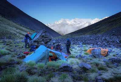
Next morning we woke to frozen tents and frost on the ground outside—a bit of a surprise. We left before the sun reached us and started down Boundary Stream. We knew it was tricky travel in the lower parts of the stream and that we had to get past two significant waterfalls. Fortunately after a rather lucky guess and some steep bush-bashing down the side of the falls we emerged onto the flats of the North Mathias.
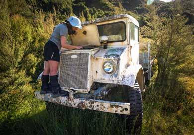
Travel down the Mathias was easy but the sun was blazing from a clear blue sky and there was no shade to escape the roasting heat. For our lunch stop we had to crawl under some matagouri bushes as best we could to get out of the sun. Towards the end of the day we pitched camp close to Centennial Hut where Megan did her best to start an abandoned 4x4 truck that strangely still had a fully charged battery—but without luck.
The next day was to be a bit of a crunch day for us—for we had to cross the Rakaia River, something we weren’t looking forward to. The hot weather was causing rapid snow melt and the rivers were running higher than normal for early summer, and even under its usual flow the Rakaia is a real problem. So we spent a while deciding whether to go our planned route up Jerusalem Stream and down Cattle Stream, or continue down the Mathias and around Manuka Point which would give us more opportunities to cross—but if we couldn’t then we faced a long walk up to the Ramsey Lake to cross there. By the time we crawled into our tents the decision was made to go around Manuka Point.
We walked down valley Christmas morning and followed the vehicle track around towards Manuka Point homestead where we headed straight across the valley towards the river. All too soon we could see the first braid and clearly it was uncrossable—the water was very deep, very wide and moving very fast. As we stood pondering our next move far across the valley we noticed a distant vehicle slowly weaving its way towards us. Obviously the driver knew the river and was moving up and downstream crossing each braid at just the right place. We watched fascinated—because if we could see where he crossed then maybe we could too.
But soon we realized he was going to cross the final braid almost at the point we were waiting. The flash new Landcruiser pulled up beside us and we introduced ourselves to the driver then asked, ‘can you give us any idea where we should cross this river’?
‘Do you enjoy swimming’? came the laconic reply. The driver turned out to be Don, the owner of Manuka Point who had been into town to collect who we assumed to be his mum.
Don explained that, yes, the river was way above normal and that he hadn’t been able to drive across
Waimakariri Valley
Whitehorn Pass
Boundary Basin Wilberforce Valley
Mathias Valley yesterday and that today was right at the limit and, no, it was very unlikely that we could get across anywhere.
We chatted for a while then suddenly he said, ‘get in and I’ll drive you across, I won’t sleep tonight worrying about you if I leave you here’.
So his mum hopped out and waved cheerfully to us as she stood in the blazingly hot sun surrounded by a cloud of swarming sandflies while we jumped in and headed off across the river with the water almost lapping over the bonnet and us thinking we were going to float away downstream. It was a classy demonstration of off-road driving.
Don turned and headed back and we stood on our side of the Rakaia rather stunned—we couldn’t quite believe how we were so suddenly across the biggest obstacle of the trip so easily and so improbably. Kev’s explaination was because we had all been such good boys and girls it was our special Christmas present.
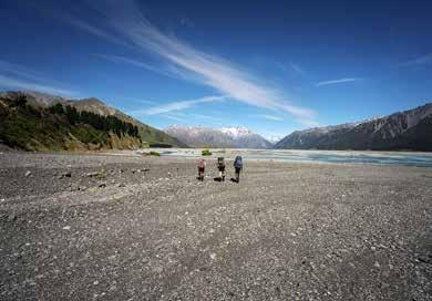
We got underway heading up the valley and walked for a few hours to find some shade for a rest and early lunch. I had been up the valley many times years before and remembered it as easy travel with a couple of sidles where the river ran against bluffs. But the original track had fallen away in many places and the going now was slow and difficult with lots of matagouri. We were scratched and bruised and tired when we stopped for the day well short of our intended camp, but very happy at least we were on the right side of the river.
Our camp was a nice grassy glade among the matagouri and we had a very pleasant Xmas tea—which actually was the last evening meal we were carrying and we still had two days to the food drop. But Megan was wearing her Father Xmas hat and we went to bed happy.
We were supposed to get to Erewhon the next day but we were behind time and clearly wouldn’t make it, but we planned to get as far as possible. We left early and Illona and Megan took off from camp at a great rate of knots—we did 10 kms upriver in under two hours. Then the steep uphill to Mein’s Knob in the heat left us searching for shade in a small patch of scrub before the last climb up to Butler Saddle. There was a long bumslide down a snow slope on the other side but after that the travel was slow and awkward. It was 14 hours after we left camp when we finally set up our tents on a shingle bank of Butler Creek just above the junction with the Lawrence River.
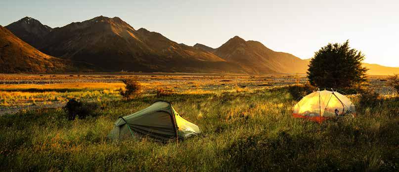
Next day was easy travel down the Lawrence but the Clyde River was its usual troublesome self. Too difficult to cross, it ran against the bluffs a number of times which meant some tricky sidles and hours went by with very little distance gained. But eventually we arrived at Erewhon, collected our tins of goodies, and found the absolutely most perfect campsite for a rest-day.
The following day was spent in glorious lassitude,
Why won’t this stupid thing start?
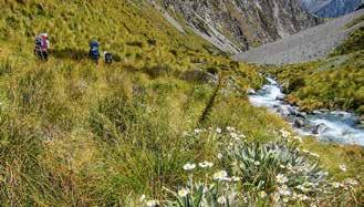
Starting up the Rakaia Valley
On Butler Saddle with Lawrence Valley in the distance
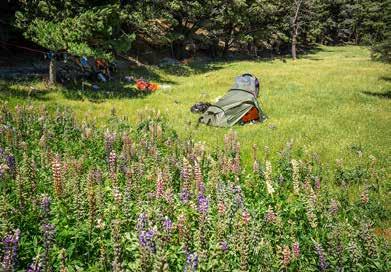
A very lazy rest day
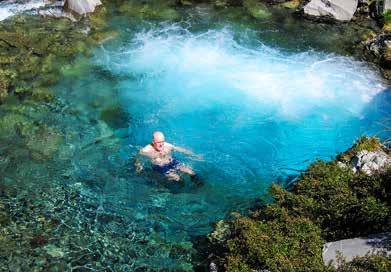
Our own outdoor spa
Growler Stream
Growler Valley
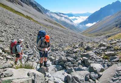
Traversing from Balaclava Col to Plata Col
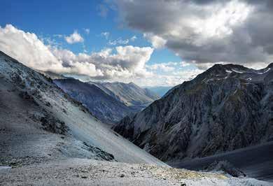
Plata Col
Bath and fire at Macaulay Hut
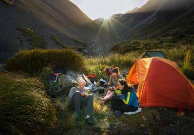
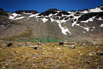
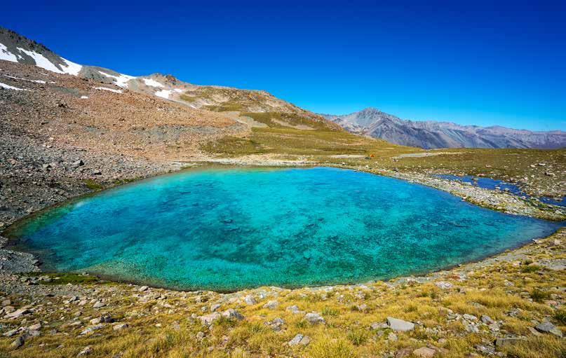
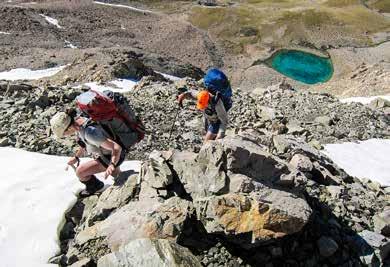
The following day we left at midday and headed up Lower Tindall Stream as far as the high basin. Here we pitched our tents close to the deep, turquoise coloured tarn in probably the most spectacular campsite of the trip. Kev swam in the cold deep tarn and then we all bathed in a smaller one with sun-warmed tepid water. The afternoon sun was so hot we sought out the shade of the tents for a few hours before tea time. It was a calm evening and then at night the inky black sky blazed with a myriad stars. Tindill Basin eating our luxury goodies, dozing among the lupins in the warm shade of the towering pine trees and slowly getting organized for the second half of the trip.
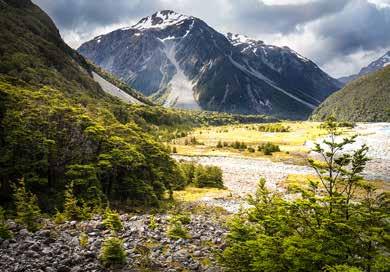
Next morning we were off again—this time across the Clyde which to our pleasant surprise was divided into four braids which were easily crossed. Then into the Havelock Valley cutting the corner on an old vehicle track. We continued to Growler Stream and then climbed the valley to the last obvious camp site and pitched our tents. Once again it was a warm and calm evening and we ate tea as the sky darkened and the first stars appeared.
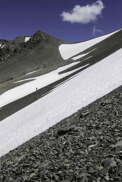
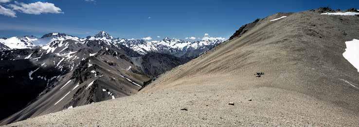
Next morning was straightforward as far as Balaclava Col, but once there the way down the other side wasn’t at all obvious. We walked back and forth along the ridge until we found a slightly dodgy descent to the easier scree and snow slopes below. From here it was a long slow sidle to Plata Col. Then an easy scree descent to Toms Stream and mixed travel as far as a very scary waterfall. We climbed onto a small side spur to sidle this and then it was easy going to the Macaulay Valley where three hunters welcomed us into the spacious Macaulay Hut.
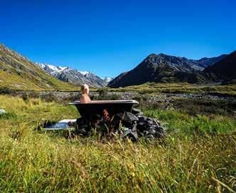
This very fancy stone hut is free (donations welcome), has solar lighting, gas and firewood supplied, and best of all an outdoor bath heated by lighting a fire underneath. The weather forecast for the next day was for mostly low cloud and light rain so the decision to stay a day was easily made especially when the hunters offered us newly roasted tahr with fresh bread and butter for tea.
Tindill Basin
Above Tindill Basin
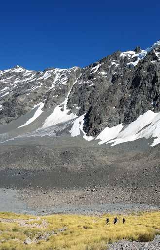
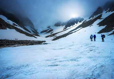
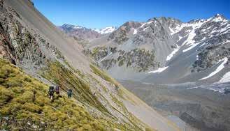
Next morning we climbed to the col behind our camp and dropped into the old glacial valley head of the Godley River North Branch. Piles of moraine and avalanche debris slowed us down for a while here but further down the valley travel was easier although we made a mistake traversing on the wrong side of the river for a bit and ending with some difficult bush bashing. We came to the Godley Valley and our last big river. We had expected this to be a relatively easy crossing as the river has many braids in most places but the final one caught us out a bit and we struggled to stay on our feet in the deep fast- flowing channel.
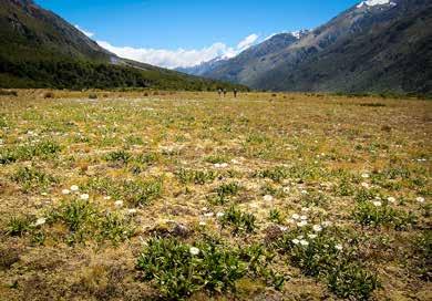
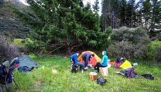
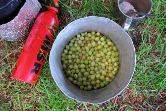
A big tree had fallen on Rankin Hut and squashed it flat so we pitched tents on the grassy river terrace nearby. Around the hut grew wild raspberries and gooseberries so we collected enough to cook and, with some crushed Tararua biscuits, made a tasty crumble for pudding.
We were now running out of days to meet our transport at Mt Cook, and the forecast for the next few days was
Head of Godley River North Branch
Godley River North Branch
Near Rankin Hut
Yumm for deteriorating weather. We talked over our options and eventually decided to call it quits and arrange for a taxi (that looked a lot like a helicopter) to get us the last short leg to Mt Cook. It seemed a shame not to cross the final two passes to the Murchison and then on down to the Tasman but the alternative was to miss our booked transport which would cost us more than the flight, plus Kev would not make it back to work on time.
The chopper arrived next morning and we flew up valley and over Rankin Pass which was to be our second-to-last high crossing. Rain was pattering on the helicopter screen and all the peaks were covered in mist. The landscape below looked rather desolate compared to the sunlit terrain we had crossed over the last 12 days, but still we were sad not to be down there and completing the trip.
We had a celebratory lunch, then tea, with mountain guide Charlie Hobbes at the Old Mountaineers, then next day left on the bus for Christchurch, and on to Wellington.
Although we had cheated on the final leg we were a very happy group that had finally made Mt Cook and we had thoroughly enjoyed a wonderful alpine tramping adventure on the way, passed through some wild landscapes, and had fine weather almost the whole trip—and you can’t really ask for more than that.
Those on the trip were Illona Keenan, Kevin Cole, Megan Sety and Tony Gazley.
Godley Valley
Comments
Comments are not open yet.