
Text taken from the club newsletter.
The alarm went off at 6 am in what appeared to be a delivery suite at the former Karamea Maternity Hospital. Gareth and I had just spent two days riding the Heaphy Track. However, we had another two days ahead of us on the Old Ghost Road. The origins of the trip had been back in February, somewhere in the middle of Queen Charlotte Sound the plan was hatched. It was to extend Queen’s Birthday weekend by a day and ride the Heaphy and Old Ghost Road back-to-back. The kicker was to ride the Old Ghost Road (only 85 km) in reverse to all the guide’s recommendations, as well as having the 78 km warm up ride on the Heaphy Track.
We left Karamea before dawn broke. The heater in the car was on full and various discussions about Karamea and its place on the coast and in the world took place. By the time we reached the gravel of the road end in Seddonville an hour later we have solved Karamea’s power problems and thrashed out the apex and capex of road maintenance and building on the West Coast. The irony of these discussions would come full circle later on that morning but more of that later.
The sun was still low in the sky and had not reached into the valley that Seddonville lies, so it was cold. The warm car was appealing, for a moment, to return to the end of the coast in Karamea, but we were here to ride and the forecast for the next couple of days was outstanding—just like the previous two days had been.
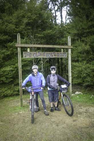
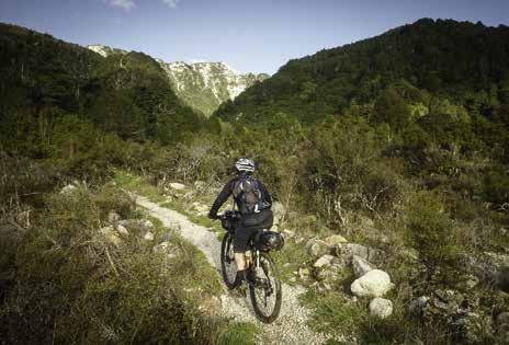
After a small amount of faffing and the obligatory photo at the sign post by the Rough and Tumble Inn it was time to start. The first kilometre is in fact a recently built track to link up the best patch of gravel in the area (known as the car park) and the remains of the old tram track that starts off the main track for a bit. Starting what appeared to be a gentle climb up the lower reaches of the Mokihinui George we had our first minor up hill. It definitely warmed us up and made sure all the gear was safely stowed both on the bike and the rider. After that the track calmed down a little. There was the location of one of the gold mining settlements which had caused this area to be explored and settled in the first place.
We passed the location of where the former coast road once headed north to Karamea but the bridge was damaged in the Murchison earthquake of 1929 and was never rebuilt. The remains of the bridge are still clearly lying in the
THE OLD GHOST ROAD
The best MTB ride in NZ by PETE GENT, photos GARETH GRETTON river below. The track veered off from the side of the river for a while along a well-made former tram track that was well graded and straight—a strange sight not normally found in the back country apart from board walks. A morning snack in a rare sunny spot was taken with the resupply of food in Karamea courtesy of the local Four Square offered up some decent cake that needed eating to reduce the weight we were carrying. As the sun was still rising, finding a gap in the valley to allow the sun was not too easy but a suitable spot by a water source was found eventually.
After that the track climbed overall but undulated in places. The valley then closed in again getting narrower and requiring more and more sections cut in to the rock. Eventually we came to a number of bridged sections that were one of the first parts of the track reconstruction. Lots of rope and helicopter work would have been required to build them as there was no obvious location above the water line to provide the launching point for all the construction. At one bridge section we met a lone tramper, not our first of the day (or the last), but she noted that the mayor of the Buller District was in the hut ahead. After the conversation earlier in the morning about roading in the district the wheel was turning so to speak. After negotiating the final exposed and bridged sections a sweeping downhill to the right followed by a complementary grind up through a small wooded section brought the track up to Specimen Point Hut. The long-drop door is a work of art in itself but it appeared that reading matter was somewhat sparse and it is definitely a BYOTP kind of ride. Eventually we headed into the hut to join the local elected official for an interesting discussion. This is possibly not the medium to discuss my road building preferences but needless to say, the Whangapeka Track is being eyed to be elevated to State Highway status despite the geotechnical, planning and funding hurdles in the way. I’m not sure we solved the power issues either (long lines and few customers north of Westport) but it appears that Gretton Consulting Incorporated has been contacted nonetheless.
After the extended break we left and carried along upstream to the true left of the river. A bit more mud and uphill later we arrived at the next hut at Mokihinui Forks. There appeared to be the secret mountain bikers’ ball in full swing here so we rode on in search of a suitable lunch spot. The track headed away from the river itself for a few kilometres and about 20 minutes later we found a patch of sun when my stomach had started to rumble a little incessantly. Another half an hour beyond lunch brought us out back to the bank of the river of now the south branch of the Mokihinui. The bridge across has a possum gate half way across to stop them changing banks and bringing the taste of the rare west coast snails from one side of the bank to the other. Photos and water were refreshed from a small beach and then we headed inland away from the river to the picturesque and historic Goat Creek Hut.
When we arrived there was a group of Nelson based bikers who had ridden down from Ghost Lake and were heading to Specimen Point for the night. They commented that we would get nowhere near Ghost Lake Hut despite our optimism when booking the huts three months before. The hut at Goat Creek slept four and the story goes that it is two foot shorter than planned as a number of the building timbers were damaged when they were dropped too hard from a helicopter when being landed. The hut is worth an excursion in itself and has some proper character to it, much as modern huts may be a little sterile, this is definitley a prime example of the authentic back country hut, now with a new lease of life as a stop for mountain bikers topping up their tea levels.
Scrambling back across Goat Creek to the bikes it was time to head away from the Mokihinui and up and over a small saddle parallel to Goat Creek. Not big on the topo map but big enough to get the legs working and avoiding the next wave of bikers heading towards their dinner on the West Coast. With what turned out to be the final climb of the day started out at an unmarked worker’s camp further up Goat Creek, and wound up and up the hill. The gradient was fine to sit in the granny gear and make it up with a minor sweat. There were a few blind corners with one final rider of the day coming the other way making me slightly nervous. It gave rise for the opportunity to pull over on a slightly wider section to alleviate fears of a crash and have a small break. The track took a couple of unexpected hair pin bends and summited at around 700 meters at Solemn Saddle. A quick snack break was taken as I waited for Gareth to catch up as I knew he would be significantly faster on the descent into Stern Valley.
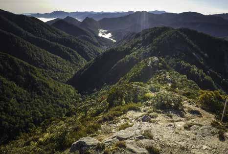
As the sun fell behind a mountain out towards the West Coast it cooled quickly despite the recent 300 metre ascent. A handful of snow patches were encountered along with numerous hairpin bends through a section known as the Bone Yard. Exiting past what would be an awesome picnic table stopping place on a summer’s day with two small lakes back-dropped by the mountains marking the south Mokihinui Valley, the track descended down to the floor of Stern Valley for the final 10 minutes into Stern Valley Hut.
We were greeted by the local weka at the hut and after a little bike TLC, wood was collected, gear stowed in the predator proof porch and the fire lit. Dinner was consumed quickly in the very recently built 10 bunk hut as we tried to keep warm. The huts are all well stocked apart from cooking equipment so remember to pack the stove. Not sure how all the crockery was transported in, but I’d hate to be the one having to ride in with a replacement full dinner set.
Next morning the alarm went off 6.45 am as we wanted to move as the sun rose an hour later. With the minimal amount of gear that we were carrying, the biggest hazard in packing the bikes was having items misappropriated by the locals.
The track rose gentlly at first from Stern Valley following the valley floor for the first kilometre or two. It then zigzagged up the side of the valley to start gaining the height to reach the core section of the whole track. Heavy wear was experienced on a lot of the hairpin bends. With the track having only been fully open for 7 months at the time of riding, a lot of maintenance will be needed to keep it in prime condition. Some 90 minutes later and some very frosty but ridable sections we arrived at the base of the steps. The story of the steps is one of the linchpins of the whole project. Those building the track were struggling to come up a with a solution to bridge the final gap. The short version is one of the Kennett Brothers made the suggestion to the track builders of building steps on top of the rock rather than drilling stairs into the rock in the middle of protected DOC land. The result is 260 odd steps of bike carrying but it does the job perfectly.
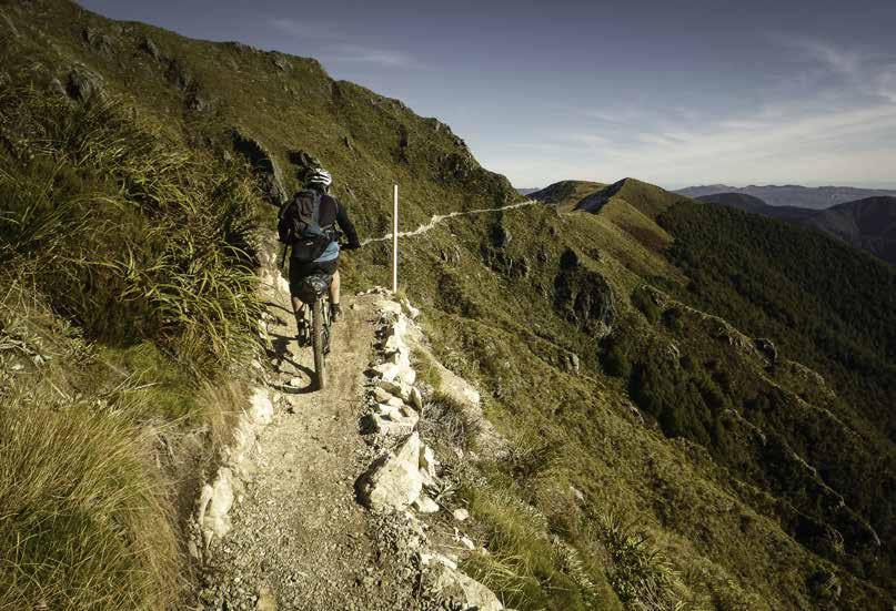
As you arrive at the top of the steps the tantalising glimpses across the Rainbow Range and surrounds come into full view. For those needing to post that view to social media cell phone coverage is marked above the steps, however, screen time is recommended to be kept to an absolute minimum so you can soak in the view and not fall over the edge of the track. The centre 4 km is what completes the Old Ghost Road. For those who will ride it the right way, you will have two stunning down hills, lots of grade 4+ sections, unprotected corners and frankly some of the best scenery on two wheels in the upper south island. Riding the other way offers, well, a slightly different mix of track but the views stay the same. A refreshment stop along with photos was taken on the section above the steps. This allowed a group of riders to come down too as it was still quite icy in places. Once off the lower section you cross a small saddle onto the second uphill. This is another 200 meters of climb with a number of X and XX lines to make your day. We had to contend with some mud (frozen and not so frozen), frosty hairpin bends and a five metre patch of ice with no viable hand holds either. To be fair to the trail builders they warn of ice and avalanche risks at the base of the hill but it’s a little late if you didn’t pack the snow tyres or ice axe by then.
The final few hundred metres above the steep section is a board walk alongside the frozen Ghost Lake. Despite the slight visual intrusion of the board walk on the landscape it helps protect the delicate environment around the lake and offers a crisp sound as the frost is cracked under tyres, as well as the opportunity to ride right up to the front door of Ghost Lake Hut.
After an extended lunch and photo stop here it was time to depart. Despite the previous hour or two coming up hill there is still more to go. The track has been benched into the side of the hill with some exposure to the north and rising up to just below the summit of Rocky Tor at 1,456 metres. A quick photo stop was taken and then the rest of the ridge was taken on. We encountered one short patch of snow just along from the high point. It appeared to be in all day shade and riding this section proved no problem unlike our patch of ice earlier in the day below Ghost Lake.
We almost rode past the Lyell Saddle Hut but decided to pop in and complete the hut bagging for the weekend. A few minutes afterwards a group arrived coming uphill (this being early afternoon) which contained one of the track builders. It was really interesting listening to the effort that went into assembling one bridge, let alone the whole track. A last glance into the South Mokihinui Valley was had, then it was time to head for home.
The final 17 km down from the hut took place mostly be in a blur. There was a shuttle somewhere off SH6 which had our names on it and it contained fresh socks! I did manage to overtake some of day riders who we had seen earlier on the ridge line. With a stop for kebabs in Richmond, we checked our bikes in on time. Arriving back home only 90 minutes after being dropped off by the shuttle was a little anticlimactic, after what would go down as the most perfect weekend of the year—well at least for mountain biking.
For those interested in story of the Old Ghost Road, there is an excellent book written by one of the initiators of the project called Spirit to the Stone. It’s not a long read but offers an insight to those people who in the past 10 years have created what is already a world class multi-day mountain biking track.
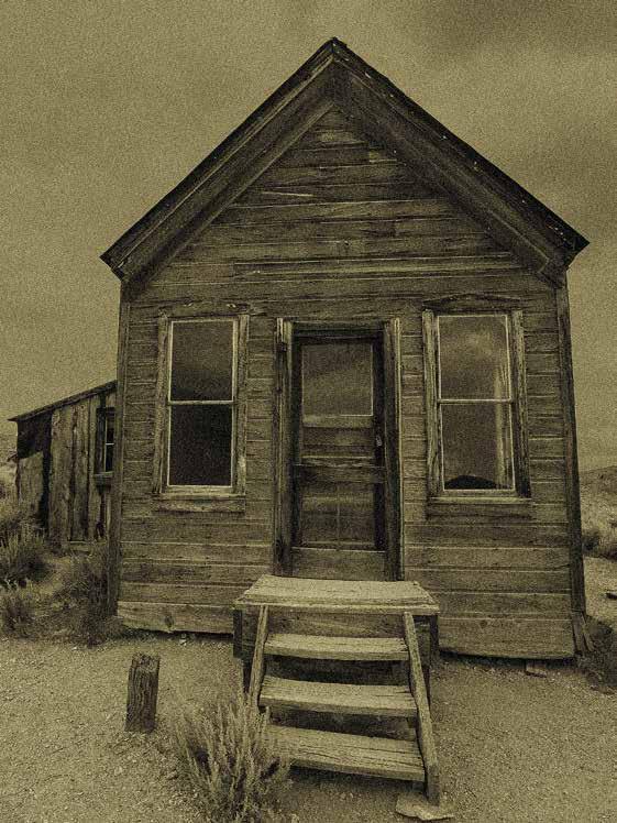
Which Tararua hut is this?
Go to the WTMC newsletter for an answer
Comments
Comments are not open yet.