
Text taken from the club newsletter.
LAKE WAIKAREMOANA
Easter tramping by JANE LATCHEM photos IAN HARRISON
On my first WTMC visit to Lake Waikaremoana in April 2015 we enjoyed beautiful calm weather and glorious vistas all around the lake—except, unfortunately, on the very day we day-walked the steep slopes of Panekiri. Hoping for the renowned spectacular views, a group photo was taken at the top against a completely white backdrop, no view whatsoever. Forward three years to June 2018 … fingers crossed!
On Tursday evening we 10 of the original 12 departed from Wellington Railway Station and drove all the way to the Big Bush Holiday Park near Tuai. We arrived at 1:20 am, sorted out cabins, and headed gratefully to bed.
Day 1: Onepoto to Panekire Hut
Afer a bit of a lie-in—and nice to start with a hot shower—we lef at 9:30 and drove 4 km to the start of the track at Onepoto Bay. Te plan was to walk clockwise from Onepoto, spending nights at Panekire, Marauiti, and Whanganui Huts and then take a water taxi back to our starting point on the fourth morning. From Onepoto Shelter to Panekire hut is a 9 km uphill slog. DOC estimates this should take 4 to 6 hours; we took 5.
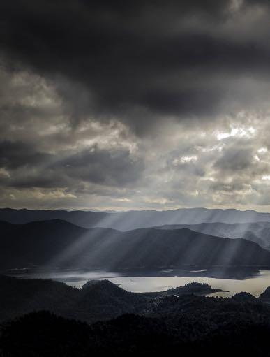
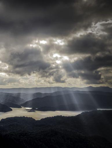
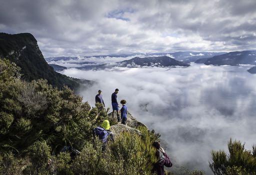
Te first half of our day’s journey began with a fairly steep climb from 600 m to about 1,100 m. Te going was easier for the second half as the track meandered up and down across the flattish top of Panekiri Bluff. A local jogger passed us, a regular runner from Onepoto to the top and back. Of other walkers we saw only a few. Higher up, patches of snow lay under the trees, remnants of a snowfall a week earlier. Small side tracks took us to the open bluff edge where we could really take in the panorama across lake and never-ending hills stretching toward the horizon. Te lake’s name—Waikaremoana means ‘sea of rippling waters’—very apt. We were delighted with the views. Each vantage point brought fresh perspectives and a great many photographs were taken. Mist and clouds reflected in the lake in a fascinating way; it was sometimes hard to tell whether we were looking at the lake or the sky.
Mid-afernoon we arrived at Panekire Hut. Inside the hut the temperature was cool; earlier arrivals said they’d had a go at lighting the fire but hadn’t succeeded. Richard then demonstrated how to light a fire when you lack paper, decent kindling, and fire starter cubes. Patiently he prepared small flakes and curls of wood using a blade on the available wood supply. With successive layers of chips, twigs, and sticks ready to add, he gradually coaxed tiny flames into a decent blaze and eventually the interior reached a more comfortable temperature.
Panekire Hut was fairly full that night, with a convivial atmosphere as we prepared our meal of vegetable and chicken korma. Afer dinner we relaxed in the communal area then headed off to bed. Te hut has two bunk rooms with 36 bunks arranged in three levels, the top-most seeming suitable only for children or the small and flexible.
Day 2: Panekire Hut to Marauiti Hut
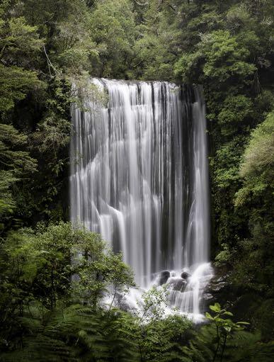
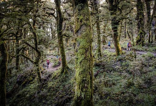
Day two was our longest day at 20 km to Marauiti Hut. But since the first 8 km was downhill and the remaining 12 km kept close to the lakeside we expected a longer but relatively easy day. We headed out into the hazy forest at about 8:30 am. Te track downhill was on the slope away from the lake so there weren’t the expansive views of the previous day, but instead intriguingly misty forest and ferns. DOC estimates 3-4 hours for the downhill section but we got to lakeside Waiopaoa Hut by 10:30 for a snack break. Te next section, to Korokoro campsite, took just over an hour. Afer a quick lunch stop most of the group set off for Korokoro Falls. Te return journey to this impressive waterfall added another hour to our walking time and was pronounced well worthwhile. But David and I enjoyed a leisurely lunch and read.
From Korokoro to Marauiti Hut the track mostly followed the shoreline, sometimes alongside, sometimes overlooking the lake. On topo map and track elevation profile it doesn’t look much but by the time we climbed Whakaneke Spur, half a kilometre from Marauiti Hut, I for one was starting to feel the distance already travelled. Daylight was fading as we reached the hut. But there was just enough time for a keen bunch—Ken, Karen, Rohan, and Viola—to take a quick, refreshing dip in the lake.
Te hut’s 26 bunks were filling up fast and we were among the last to grab our spots. Te bunkroom and the kitchen area are in separate rooms, accessed via the front verandah, meaning the door to the kitchen was always opening. Fortunately there was a roaring good fire. We took full advantage of that and soon damp clothing was festooned all around the fireplace. Dinner was pesto pasta. Viola did her best to make it closer to the Italian style than the recipe allowed and everyone enjoyed the result. No lefovers! Tree young guys turned up afer dark and were not best pleased to discover all the bunks already full. Tey had booked, and everyone else said they had too. Nothing for it but to get comfy on the floor near the fire.
Megan and Ian were sure they heard kiwi calling during the evening. Other birds spotted during our trip were kereru, tui, kotare (kingfisher), korimako (bellbird), piwakawaka (fantail), putangitangi (paradise shellduck), miromiro (tomtit), and black swans, some with cygnets. Dan probably saw and heard more birdlife than anyone.
Day 3: Marauiti Hut to Whanganui Hut
We lef Marauiti Hut just before 8:30 am in light rain. On the other side of Marauiti Bay the track passes over some innocent-looking but treacherously slippery rocks and afer two of us came crashing down, I waited to warn the rest of the group. Just afer 10 am we reached Waiharuru Hut and stopped for a break. Waiharuru is a large, modern hut surrounded by extensive lawns sloping down to the lake. Te bunkroom sleeps 40 and the equally large cooking, eating, and hanging out area is housed in a separate building, the two connected by a broad deck. So spacious but so empty on this winter morning.
Te day’s journey was a mere 11.5 km and we were making good progress as we lef the lakeshore and climbed Puketukutuku Peninsula. Puketukutuku is the site of a kiwi recovery programme on an ‘inland island’. Whanganui Hut is close enough to the sanctuary that we hoped to hear kiwi calls that evening.
Around lunchtime we reached Whanganui Hut. With concerns that there might again be more people present than there were bunks available, some were in a stroppy mood as we approached the hut. And so it proved. Tere were already 11 people ensconced in the compact 18-berth hut, who assured us they did indeed have documentation and radioed to two guys out on a boat to return with the evidence. So, if they had bookings for 11 and we had bookings for 12, how could that be possible? Was the DOC online booking system at fault?
Te voice of reason (Richard) said we should consider all the options. We could stay at the hut— tentative arrangements about doubling up on bunks were proposed—but the living area was small, the table sat only six, the bunks were stacked three high, and the fishing group had such a large quantity of gear taking up floor space there was little room to relax. And it was raining and forecast to continue; fly-camping was not a promising alternative.
Or we could walk back 2 hours to Waiharuru Hut, then rise early to make it back to Whanganui Hut for our 10 am water taxi pickup. Another possibility was to wait until that day’s 2 pm water taxi arrived and see whether we could all fit on board, even though our booking was for the following day. And if there wasn’t room on board for all of us, perhaps some could go by water taxi, and then drive the long and winding route to the road end near Hopuruahine Landing while the rest of the group walked the extra few kilometres.
We quickly determined the favoured option to be a swif exit by water taxi. Fortunately there was just enough room for every last one of us and we boarded happily, donned life-vests, and settled back for a 20-minute ride back to Onepoto Bay.
Te usually enjoyable ride across the lake was rather chilly. Low cloud and mist shut down the views. On the way we pondered whether to spend the night at the Lake Waikaremoana Holiday Park, or in Napier (Ocean Spa pool complex!), or drive all the way back to Wellington.
Wellington won. A good decision as it turned out, because bad weather was closing in from the north-west.
Comments
Comments are not open yet.