
Text taken from the club newsletter.
To Drac and Back
Sam Harrison | 30 Jun 2025 | Tararua Forest Park
The same old story. A long weekend coming up. No plans. Rubbish forecast. What to do. James and I ended up flipping a coin. Heads for Tararuas and tails for Ruapehu. The coin is suspended in the air before landing in my hand. I flip it over and check its face. Heads. Tararuas it is. There was a cluster of remote huts in the untracked western fringe of the range that I was keen to explore. James reckoned that this sounded like an alright idea. The plan was to head to Waiopehu Hut on Friday night. The next day we would walk down Oriwa Ridge before dropping down a spur to Island Forks. We would then have the option if time permitted to troop down the river to Waitewaewae Hut for the night. Sunday we would walk up the Ōtaki to Ōtaki Hut. From there we would follow a spur up to the Main Range and Dracophyllum Hut. We would celebrate the King’s birthday on Monday by traversing the Main Range over Pukematawai, then turning back in the direction of Waiopehu and Poads Road. Simple.
1. Return to Waiopehu
Poads Road to Waiopehu I picked James up outside his flat in town before coming back to Tawa to pack my bag. Cue an hour of faff while I tried to find my tramping things while a bemused James watched on. It was 5pm by the time we left Tawa, travelling up Transmission Gully as the sun set over the Kāpiti Coast. We were donning headtorches by 6.30pm, soon heading through the gate to the path across a farm. We were immediately confronted by a million glistening eyes as disgruntled cows stared at us in curiosity. With some careful shuffling we negotiated our way through the inhabitants of the paddock and soon we were entering the forest. It wasn’t long until the track steepened. I had just finished training for a charity climb of the Skytower so this was easy work for me. Could not say the same for poor James, who huffed and puffed up behind me. Lucky for him there was plenty of weird and wonderful nightlife giving us an excuse to stop.
It was gusty as we travelled up the ridge. Through the trees we could see the twinkling lights of Levin. Dare I say it, it was rather beautiful. After three hours of walking we reached the hut. I had been up here several months ago and it was just as I remembered it. After a bit of discussion on our route for the next day we hit our pits, eager to get a good nights sleep in preparation for the uncertain day ahead of us.
2. A route lost to time
Waiopehu Hut to Waitewaewae Hut via Island Forks Hut Myalarm went off unexpectantly at 6am. As a result James slept through the alarm he had set for 6.30am, meaning we slept in till 7am. Such luxury. It was claggy and windy when we left the hut around 8am. James charged ahead of me, striding through the goblin forest and out onto the open tops. As we neared Waiopehu we had a short discussion about where the route would be before proceeding to crash through the scrub with blind faith. The travel was easy enough, soon we found the cairn that marked the summit itself. Directions from here were less clear, with cloud obscuring any view of our objective. Of course we didn’t let this stop us. Soon enough we had forged a path through spikey sub-alpine scrub to penetrate the forest on the far side. Unfortunately we discovered that our chosen point of entry only led to a very steep slope, with Oriwa hiding behind an impenetrable wall of leatherwood. We retraced our steps, traversed along for a bit and soon discovered a much easier trail leading us into the bush on the ridge.
The forest was short and stunted in parts, a moss-covered maze. Periodic marker tape led us safely along the ridge. Faint foot trail also helped.
It took us about 2 hours to reach the site of the old Oriwa Bivvy. Prior to 1928 there had been a lakelet here too, but an earthquake caused that to drain leaving a swampy hollow in its place. The bivvy too was absent, having been removed by DOC in 2007. A small rain collector now occupies the site, while a hunters camp hides in the trees beyond the hollow.
Oriwa Ridge was first used by Māori as a route over the range into the Wairarapa; this path running from Pana-te-waewae and Oriwa to Waiopehu and on to Arete. The name Oriwa itself is shrouded in mystery, with one suggestion being that it comes from a mistranslation by surveyors of a te reo Māori word for the large natural clearing near the summit ‘oriwha’. The first traverse by pākehā was completed in 1928 by three Tararua Tramping Club members — J. W. Butcher, G. B. Wilson and W. Neill.
After a snack and a drink we continued along the ridgeline, slipping and sliding as we went. We marveled at the intricate topiary as we pushed through stands of dripping horopito. Twice we were almost punished for not paying enough attention to navigation; the first time on a spur towards Makaretu and the second heading to Murray Creek.
In the early 1930s Oriwa Ridge was a popular backcountry route for trampers. The ‘Big Storm’ of 1936 wrecked havoc on the western Tararuas, claiming the life of Ralph Wood on Waiopehu and shattering the forest on Oriwa Ridge. Dave Capper put it this way in a 1960s edition of the WTMC club journal:
“If the ridge were divested of bush it would make a reasonable weekend trip. A passing storm in 1936 had this in mind and started flattening the bush — unfortunately it did not finish the job and the ridge today presents a picture of fallen, tangled and rotting logs, thick second growth, and blankety blank bush lawyer.”
Merv Rodgers wrote a similar anecdote in his 1996 guide to the Tararuas:
“Twenty years after the storm, this section was toilsome indeed […] there used to be aerial traverses over jumbles of logs, alternating with undignified muddy grovelling beneath them.”
The ridge seemed never ending. Sometimes through treefall, sometimes open. Always mossy. We passed over the imaginatively named ‘Not-Oriwa’. The further we went the faster our progress became. Following a quick lunch we found ourselves at the end of the ridge. From here we headed to the northwest, soon picking up the spur towards Island Forks.
Much to our delight there was good ground trail down here and we made a rapid descent. The spur led us to a terrace above the river. From there we headed down to our left, emerging behind Island Forks Hut at quarter to three.
The hut was neat and tidy, but the surrounds were a bit dank. Sitting on the little porch of the hut James and I debated our next move. We had been meaning to stay the night here, but we still had another two hours of daylight. With quiet nods of approval we changed our plans, setting our sights on Waitewaewae Hut. I jammed my mouth full of sour squirms before shouldering my pack once again.
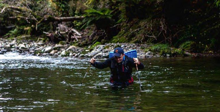
Our route from Island Forks to Waitewaewae Hut followed the Waitewaewae River. The water was surprisingly warm for mid-winter, making the many hundreds of river crossings more bearable. The river rock was slippery and the river was full of deep pools. Not a place to lose concentration. On three occasions a waist deep submersion was required (although in retrospect we could have faffed around trying to sidle around these).
I slammed my shin on a rock. Ouch. Other notable incidents included James attempting to tickle a trout and the discovery of a glittering object on the riverbank. At first I wondered if this was a survival blanket. I hoped there was not a body attached. Instead, it turned out to be a balloon in the shape of a ‘2’ with two blue ribbons. Bizarre. James stuffed this into the side of his pack and we continued. Below Chaney Creek the river began to widen, with stony banks perfect for ambling.
The sun was setting as we approached Waitewaewae Ōtaki Forks, the landscape becoming illuminated by dull orange and pink tones. We crossed to the true-right before a wide bend of the river, before fording diagonally to reach a large island on the true-left. From here it was a simple walk down to the swingbridge. We crossed this in twilight, stumbling along the track in the dark till we came upon the hut.
Inside we found we found an older gentleman with his dog. He was a gruff looking bloke with a Swandri and short shorts. There was also three young bucks who were chomping at the bit for a hunt. Over the course of the night they pulled out all manner of weird and wacky objects out of their backpacks including a cast- iron frying pan. The juxtaposition between the two parties amused me greatly.
3. The tale of the disappearing track
Waitewaewae Hut to Dracophyllum Hut via Ōtaki Hut The young bucks cleared out of the hut well before the crack of dawn. James and I followed suit, managing to get on the track just as the sun was beginning to think of rising. We used our torches till the bridge over the Waitewaewae, and from here sauntered up the river retracing our steps.
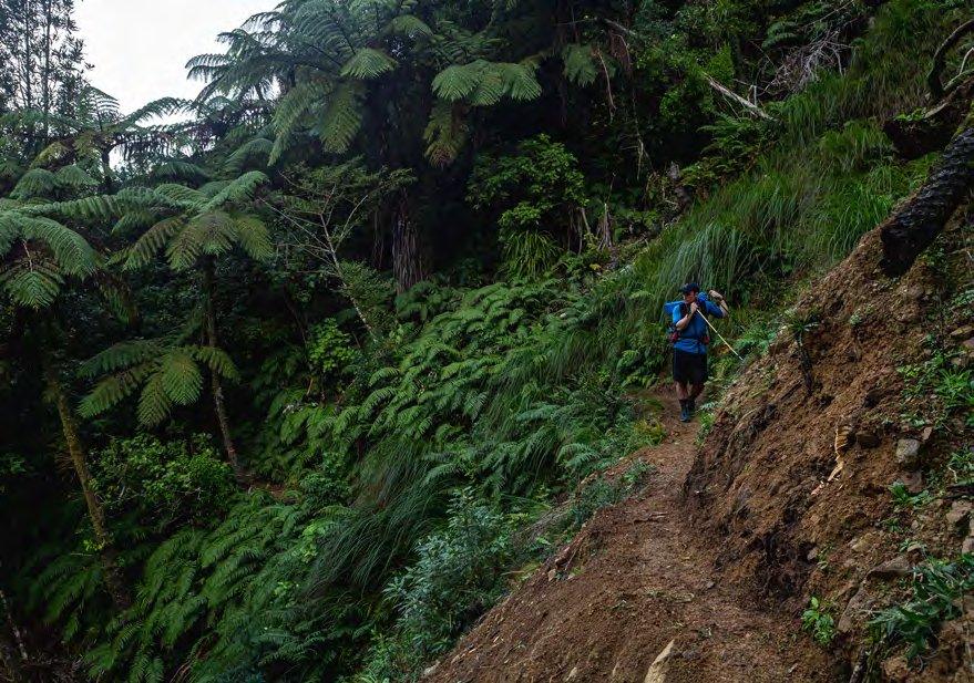
One of the boys in the hut had warned us about a few swims via the river route and the possibility of markers in the bush. With this in mind, rather than walking up to the confluence with the Ōtaki we ducked into the bush to have a hunt around for any vestiges of track. To both of our surprise we quickly found a line of blue triangles. We followed these deeper in the bush, slowly climbing up the 320m contour.
Following the markers was easy enough until we reached the second creek draining Shoulder Knob. Here a plethora of markers seemed to explode in every direction. Some had vague acronyms scribbled on them, adding to our puzzle. The biggest mystery was that following the markers in any direction only led to a deadend, with no more to be seen despite much search. Eventually we gave up in frustration, deciding to just cut through the bush in the general direction of a big marked slip by the river. We made reasonable time, even finding the odd rusty tin marker among the tree- fall and fern.
By about 8:30am we emerged next to a large bluff, the river far down below. To reach it (and its relatively vegetation free banks) we had to walk downriver till we could scramble down. From here we alternated in and out of the river, trying our best to avoid the deep sections to keep our undies dry.
For the most part this could be achieved by scooting through the open forest either side of the river, however this was not always as doable as we would have hoped. Sometimes it worked, sometimes it didn’t.
At one particular juncture I had got myself into a bit of a pickle. I had scrambled down to the river and the only way forward was to clamber around a rocky outcrop. In doing so I discovered that this terminated in a deep pool. I could go for a swim or maybe just maybe I could do a little parkour and jump down to a submerged rock. I was pleasantly surprised when this acrobatic feat paid off. James was not so lucky, misjudging his jump, ending up submerged.
Passing Kelleher Creek the river began to mellow, with wider banks opening up on either side. A few trout gave us a wary passing gaze. Sun shone down onto us, making the long submersion of our feet in the water a lot more bearable.
It wasn’t far from Kelleher Creek to the wide open flats where Mid Ōtaki Biv was. On approach there was a rather unpleasant smell, which turned out to be a deer carcass left carelessly close to the hut. We didn’t let this ruin an enjoyable lunch in the sun at the hut’s picnic table.
“It looked so ledge like, you wouldn’t believe it”
There used to be a Forest Service blaze up the spur to Kelleher (1182m) and this was our intended route to the tops. We departed around 12pm, first heading up foot-trail behind the hut before ducking into the bush to begin our climb. After an initial short grunt up to bushy terraces we began our steady climb to the tops.
There was the odd marker, but for the most part we were simply following a faint footpad up the hill. The hill gradually became steeper as we climbed, till the point we were pushing through dwarf trees to stay on a narrow rocky pinnacle. RIP James’ foam mat.
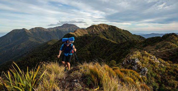
The upside of these pinnacles was that they offered our first views, out over Oriwa Ridge and our exploits of the day before. Nearing the bushline the forest again transformed into a mossy wonderland before finally relenting to the altitude. Stretched out before us was the main range, Pukematawai (1432m) seeming impossibly distant to the north, while to the south Nichols (1242m) looked now much larger than it had when I was inspecting it on the map.
We had a relatively easy climb to the summit of Kelleher. From there we dropped quite steeply to join the many many marker poles of the main range track. There were many rude undulations and a bit of mud, but for the most part we were quite happy having a track for what felt like the first time in two days.
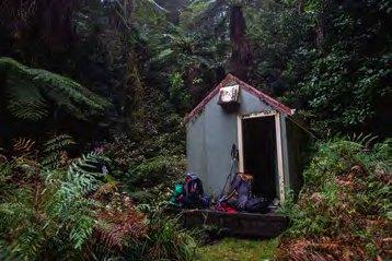
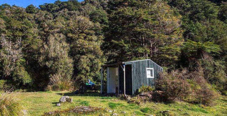
The last insult was a stiff climb to Dracophyllum Hut. We collapsed outside the door around 3.30pm, more than happy to put our legs up for the day. Despite the early hour there was no hesitation in getting dinner rehydrating. As we sat out in front of the little hut the sky became ablaze in pinks and oranges. The setting winter sun illuminated the twisted forest in the most otherworldly way. It was truly a sight to behold.
Once the sun had disappeared and dinner was finished we hit the hay, crawling into our sleeping bags at the respectable hour of 6.30pm.
4. The hide-and-go-seek mountain
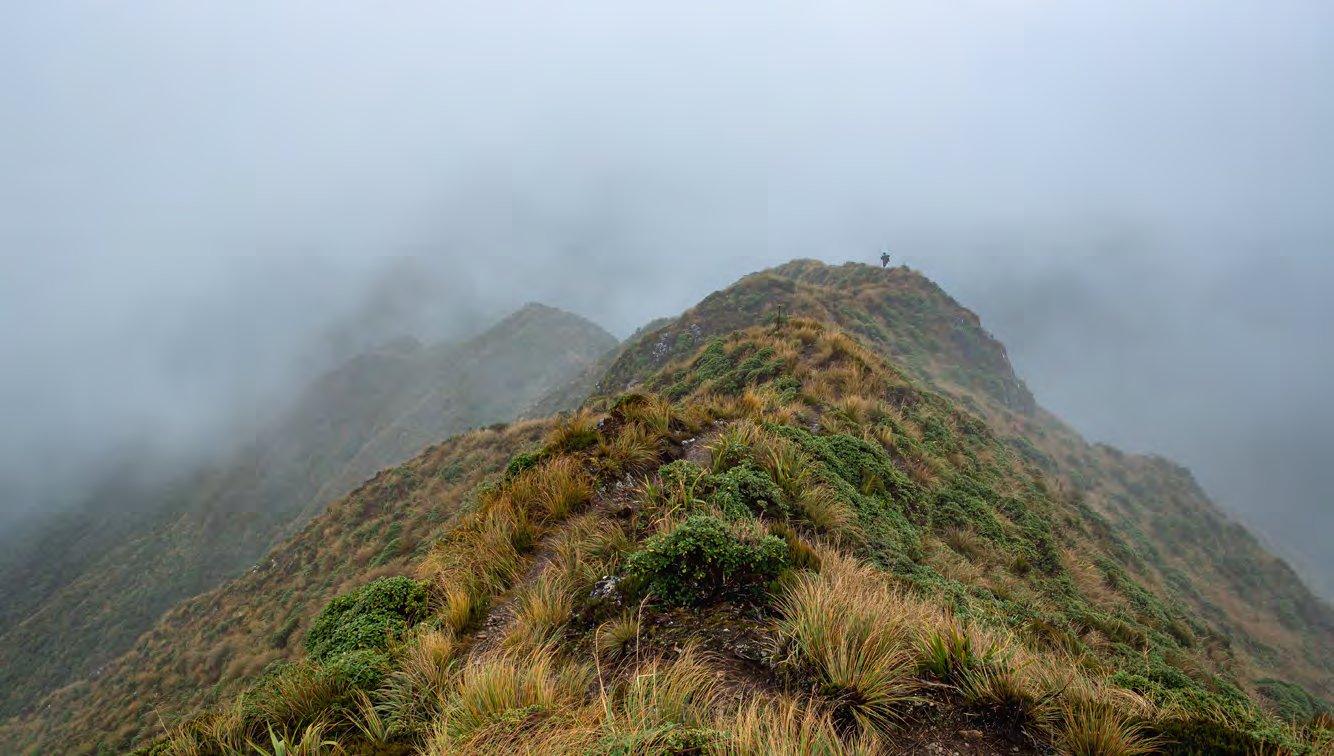
Dracophyllum Hut to Poads Road via Gable End Ridge Wind and rain buffeted the hut through the night. By the time we left the hut around 7.30am the rain had stopped but the wind continued to cut through the air. There was no sunrise to be seen, clag was holding to the ridge tops with an ironclad grip. We began with a muddy stomp through goblin forests. Despite the suboptimal weather we were soon overheating, regretting the extra layers we had left on in the hut.
The climb to Pukematawai seemed to consist of a series of never-ending knobs, the sequels that no one asked for. At first it almost seemed as if the weather was improving, we even got a tentative sighting of Te Matawai Hut.
However, as we gained elevation our world became one of rain and wind, with only the occasional view down into the Park Valley to give us our bearings.
The hostile climate striped us of our inhibitions, soon we were raving mad, singing our lungs out as our glutes screamed. By the time we neared the top I had long since lost feeling in my fingers. We huddled under a rock under the summit to put extra layers on, scoffing back some sour squirms before working up the strength to move on. Passing the summit we stumbled down the Dora Track, rapidly losing elevation in our quest for Te Matawai.
Despite our best efforts, every brief glimpse at the hut made it seem as if it was moving further away.
It was a full hour of rocks and mud before we finally graced the porch of Te Matawai Hut around 11am. We sat outside and demolished the last of our snacks, including a full bag of nachoes that James had been babysitting for the best part of three days.
From Te Matawai we continued down the Dora Track in search of Butcher Saddle. We had both lost a bit of our sparkle by this point, with our minds firmly fixed on a hot shower and a decent bed. To motivate James I felt it my duty to shout abuse at him, in hope that his anger would prompt him to try and catch up with me. There was a sense of relief once we broke above the treeline again, sloshing our way up until we finally crested Richards Knob at 12:15pm.
What a hill. At the track junction we had a decision to make. Mud-fest down Gable End or more climbing to go down the ‘easy way’ via Waiopehu. We flipped a metaphorical coin (rain was going sideways, I wasn’t prepared to lose ten cents). Gable End came out on top, so down the mud tunnel we went. My track notes simple read “MUD” for this section. Given we were already little mud gremlins a little bit more didn’t bother us and we boosted our way down the ridge, soon entering the forest.
The beatings will stop when morale improves.
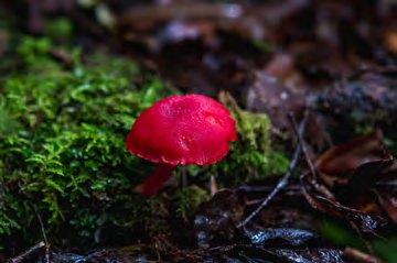
The birds were nice I think? This section is all a bit of a blur. There was a nice mushroom.
We stopped for one final dry ‘breakfast biscuit’ when we reached the Ōhau River track. These would be needed to power us on the last push to civilisation.
We were delighted to discover that the track had recently received some TLC, with the section over the slips being freshly benched. There was no time to appreciate this though, as we had other things on our minds.
It was 3.30pm by the time we caught sight of the green pasture around Poads Road. The cows looked a lot less scary in the daylight.
As we approached the car park we caught up with two older trampers and did the traditional swapping war stories. There wasn’t really a whole lot that the head-to-toe mud and scratches didn’t say. Our car soon whisked us away onto the expressway, the wilderness quickly slipping away, preserved in our memories only.
Our three and a half days in the headwaters of the Ōtaki were certainly an adventure, a reminder of the wilderness we can find so close to home. It was equal parts toxic hutbagging as it was food for the soul. A lesson in navigation, mateship and hard yakka.
Comments
Comments are not open yet.