
Text taken from the club newsletter.
Head in the clouds
Sam Harrison | 23 Dec 2025 | Tararua Forest Park
No plan survives first contact. A saying that is a pretty safe bet for any trip into the hills. I had made the mistake at the tramping club’s happy hour of signing up to lead a ‘medium-fit’ trip into Maungahuka. Maungahuka is one of those places that are almost impossible to get to in a weekend, but if you can it is SO worth it. We’d devised a cunning plan to head in from the Waiohine on the eastern side of the range and swap keys with a party heading in the opposite direction. After work on Friday we planned to stay at Tōtara Flats Hut. Saturday would have us climbing above Hector Forks, dropping to Neill Forks and then climbing up the steep route over Concertina Knob to Maungahuka Hut. Sunday we would battle the infamous Tararua Peaks to Field Hut and Ōtaki Forks where a car would be waiting for us.
1. Darkness falling
Waiohine carpark to Tōtara Flats hut The trip was falling apart before we had even left the city. High wind warnings scared the other party off into the Ōhau, leaving me to frantically work out logistics. Punters were dropping…
Crossing the Waiohine bridge is always a treat, feet suspended high above the river. Once on the true-right we set our noses in the direction of Tōtara Flats. The track was much better cut than the last time we had been through, progress was swift. Twilight slowly descended on us as we climbed above the gorge but this did little to dampen our spirits. Over Clem Creek we trod, followed by Makaka.
In 1878 while prospecting at Tōtara Flats, Richard Sayer and Charlie Potts couldn’t get rid of swarms of bees attacking them. They tried to cross the Waiohine River, but it was too high. In desperation they lit a large fire, which dispersed the bees and the forest. The valley floor was left a mess of smoldering tōtara and beech trunks. Their gold prospecting yielded no return. So much for a land of milk and honey.
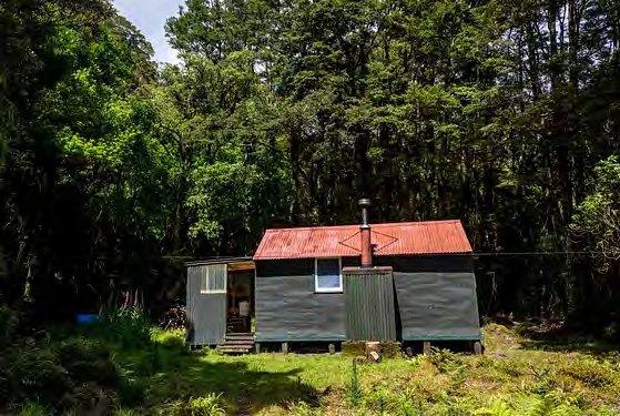
By the time the track had spat us out at Tōtara Flats the sky behind us was ablaze with pinks and oranges. The long grass of the flats did little to slow us, darkness had barely descended when the hut came into view. We happily slouched on the deck, kicking our boots off and stretching our legs. With a look of amazement I caught sight of a roaring fire inside the hut, a tshirt draped over a bench drying. It was a hot muggy night and I couldn’t quite get my head around this, not least the fact that there was probably fifty dollars worth of wood in the stove.
“I’m just drying the sweat off my shirt so
I can sleep in it”
I tried my best to hold my tongue on the fire and instead struck up conversation with the others in the hut as is customary. James sounded quite disappointed when I informed him that there was only shared dinner on Saturday night…
2. Up, down, up
Tōtara Flats to Maungahuka via Concertina Knob Webegan our day’s walk around 8am, briefly along the flat before beginning a steep climb in the direction of Cone. As with most Tararua valleys, the steepest bit of the climb was at the bottom. This seemed to bother Francis little. The same could not be said for me and James.
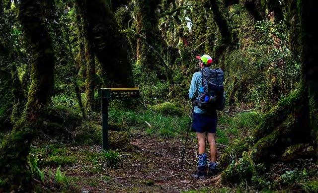
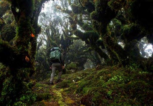
After about 400m of climbing the topography relented, the track winding its way up broad spur with a far friendlier incline. As with many places in the range, ascending above a certain altitude brings you into other worldy goblin forest, a kingdom of moss and gnarled trees. As glorious as this was, it did little to help with my perspiration.
It took us about 2 hours to reach the turn off to Neill Forks Hut. From here the track took a prompt right turn, plunging off the ridge on a spur towards Neill Creek.
Altitude was quickly lost, as was all feeling in my knees. Slowly but surely the sound of the creek could be heard above the rustling of the trees. Finally, we ran out of spur, greeted instead by the pleasant sight of the babbling creek, its waters bubbling in the sunshine.
From the creek it was a short scoot down along the bank to Neill Forks Hut. It was about 3 hours since we had started that morning. By the hut the Neill joins the Hector, beautiful blue water trying its best to call me in. Struck by such a sight we dropped our packs and decided that an early lunch was on the cards.
The sunshine was glorious. The occasional strong wind blew through but for the most part I was feeling quite chuffed with my decision to stick to the mission planned. These were early days though. After a lazy lunch we repacked our packs and readied our minds for the big challenge of the day — Concertina Knob. Concertina rose high above the forks, a buttress to Maungahuka no less fearsome than the peak itself.
The swingbridge danced over the blue waters of the Hector as we crossed. On the far side we faffed a little, putting off the steep climb for as long as we could justify. When we could delay no longer, the climb began. It was hot heavy work, heavy breathing filling the air. Francis again powered upward, only restrained by his two anchors. As chief anchor I finally could take it no longer and called a break, some 400m above the valley floor. The climb did relent higher up, our legs taking us ever closer to the clouds. It was only when we neared Concertina herself that the steep hillside in front of us began to give way.
The knob was covered in a dense cloak of goblin forest — twisted trees sagging under a heavy laden of moss. The valley slowly disappeared out of view as cloud enveloped the canopy, amplifying the feeling of claustrophobia.
The knob was defined as such by a steep descent to the northwest, the ridgeline dropping to a saddle before the final 300m climb to the summit of Maungahuka. Such undulation was little appreciated by our party and soon we were beginning to stomp upward once again. We broke out of the bush around the 1100m contour, the world opening up into a mass of grey swirling cloud. Wind rushed over the ridgeline taking what little heat the day had left with it. As we ascended cairns appeared, followed by poles before a sign materialised out of the mist. Maungahuka at last. It was a quick descent down the northern spur to find the hut, sheltered in a wee hollow from the howling gale.
Happily we collapsed inside, our packs dripping on the otherwise spotless floor. It was a little after 3pm. Soon the contents of our packs were spread about the hut and a billy was on the boil for a cup of tea. The evening was spent snoozing, chessing and reading; tension slowly building for the crux of the trip, the Tararua peaks.
3. The Tararua Peaks and other obstacles
Maungahuka to Ōtaki Forks via Penn Creek Our plan was to avoid the worst of the forecasted winds by attacking the Tararua Peaks early in the morning. To achieve this our alarms went off at 5.30am, the summer sun already rising above the horizon (not that we could see this, we were still enclosed in cloud). By 6.30am we were leaving the sanctuary of the hut for the hostile world of the tops. It was a brief climb back up to the summit of Maungahuka. Here we veered right, heading due west towards the Tararua Peaks.
Some have suggested that the name ‘Tararua’ could have its origin with the twin peaks that sit between Maungahuka and McIntosh (‘tara’ = point, ‘rua’ = two), the Tararua Peaks. However, as with many things, the story is probably more complicated than that. West coast Māori tradition has the peaks known as ‘Ngā Tarahanga’ — the saddle (‘ngā’ = plural, ‘tara’ = point, ‘hanga’ = passive particle). This is the name that appears on the 1851 land deed. Later Tunui-a-rangi of the Wairarapa gave surveyor S. Percy Smith the names Tu-nui and Tu-iti (‘tu’ = to stand erect, ‘nui’ = large, ‘iti’ = small), which are in common usage today. Alternatively some Wairarapa Māori prefer ‘Tarahanga-te- o-Tararua’ — the breasts of Tararua. Either way, the names Tu-nui and Tu-iti are wrongly marked on the topo map. Tu-nui should be shown as the western most peak (1325m) and Tu-iti as the eastern most peak (1310m).
There was little to see of our approach, thick clag hanging to the ridgeline. Slowly we clambered over increasingly precipitous peaks, our hands firmly holding whatever they could to steady us against the rain and wind.
After what seemed like an eternity we crossed over a spur, twin peaks greeting us on the other side, looming out of the mist. The faint outline of a shining grey ladder of improbable proportions lay nestled between the two peaks. A fresh-looking chain led us down from the spur and up along a rocky ledge to the bottom rung.
By the mid-1920s much of the Tararua Ranges had been explored. The southern main range was the exception, guarded by dense patches of leatherwood and with an unsolved crux. This was until February 1928 when a group of six from the Tararua Tramping Club (TTC) successfully traversed the Tararua Peaks using a 90 ft rope and wire. By 1933 the TTC had agreed to install a chain between the two peaks to provide enduring access. By the 1960s this was beginning to become inadequate, to quote tramper Allan Shepherd in 1962 “This 80 foot chain is probably the most diabolical aid to trampers in the Tararuas”. The chain was finally replaced by a flexible chain ladder first in 1965, and again in 1981. A week before this was due to be replaced it was struck by lightning. The current galvanised fixed steel ladder was installed in March 2001.
Francis was the first to ascend into the heavens, followed by James. I lingered at the base until it was finally my turn to climb. Hand over hand I climbed. My arms ached and my chest heaved by the time I was scrambling along the narrow ledge at the ladder’s top. This ended up being the real crux, a steep and twisting path.
This continued for some 300 metres until the ridge began to broaden, our heart rates finally beginning to drop. A short sharp climb followed, bringing us to the head of Pakihore Ridge, northeast of McIntosh. Here a sign marked our exit plan — a steep drop down into the fog in the direction of Penn Creek Hut. This was easier said than done. The gale roared up the spur to meet us, plastering our faces in a fine mist that felt like pin pricks. This began to relent as we lost altitude and soon the sanctuary of the bushline materialised in front of us.
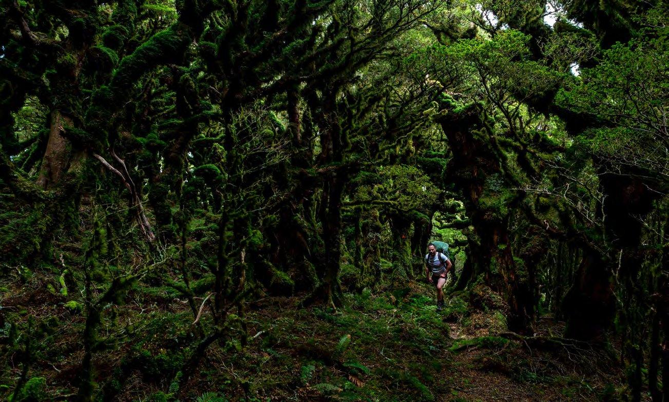
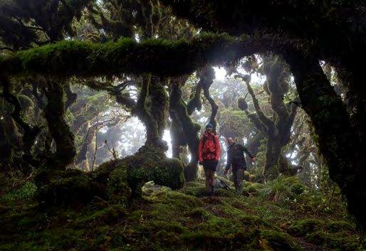
The forest here was perhaps one of the most beautiful I had ever encountered in the range. It scored exceptionally well for twistiness, mossiness and vibes. I even made the others pose for a photo.
From the bushline the well-cut track ambled downward along the gently sloping ridge. This was a welcome change but we knew it wouldn’t last. Sure enough at pt 973 the track veered to the left, plunging down into the valley. Slipping and sliding we descended. Lower down the forest was warmer, a muggy heat prevailing. The sound of the creek rose to greet our ears. Our knees screamed.
Finally around the 300m contour the topography relaxed and we began a slight sidle downstream through webs of kareao and swampy clearings. When the creek appeared through the trees it was somewhat larger than I had remembered from my last visit. A pang of “I probably should have thought about this” flashed through me. Luckily on closer inspection the deepest past only came to my knees. I signaled for the others to follow.
Once over it was a short walk down to the clearings around Penn Creek Hut. It was just before 11am. We stopped here to have an early lunch and to soak up the sun. Unfortunately the rapid transition from the cool wet atmosphere of the forest to the sunny clearing disagreed with my camera lens, which soon began fogging internally. I set this out in the sun to dry while the others waited patiently. After half an hour their patience waned thin and we agreed that they could begin to slowly wander up the hill and that I would follow in five minutes.
My lens finally dried and I was soon sweating in my pursuit of the others. I caught them at the start of the climb proper, which runs up a spur to the ridgeline at Table Top. This climb was far from pleasant in the muggy heat. My legs ached from the previous days’ efforts. I seriously wondered why I did this to myself. Even above the bushline the climb continued, winding through scrub on muddy trails that clawed at our boots.
The cloud hovered above the tussock, flying quickly along the ridgeline. As you might imagine, it was quite a relief to finally reach the top of the ridge. We sat down here for a breather, mentally preparing ourselves for another long descent, this time to Ōtaki Forks.
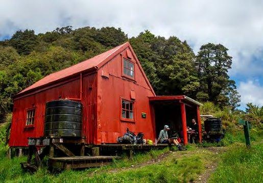
The wide track made for a nice change. Fuel tanks were beginning to run low as we crossed Table Top and the rocky descent to Field Hut seemed to drag on forever. When the red hut eventually appeared we resolved to have a proper stop, least we fail before our final hurdle.
James took this opportunity to devour a cold semi-rehydrated chicken and mash, resulting in me pondering what I had done to the man. From Field Hut we cruised down Judd Ridge, our minds drifting to thoughts of hot showers and mattresses that you don’t stick to. The descent intensified as we traversed the regenerating scrub closer to the forks.
It was bliss to see the bridge over the Waiotauru. I would have happily bounced along its length, had I had the energy to do so. As promised, Ellis’s car lay waiting for us in the carpark, its neat vacuumed carpets wholey unprepared for what was about to hit them.
So we may not have had the perfect weather. We might have missed out on the awesome views from Maungahuka. Yet, I couldn’t help but feel fulfilled by my eventual resolve to continue with the trip. There is a certain feeling of accomplishment from a range crossing, a sense of journey. It was a journey I won’t be forgetting any time soon.
Comments
Comments are not open yet.