
This report is shown as scanned pages until a volunteer types it up. Skip to the machine-read text (unproofread), which a screen reader can read.
Machine-read text (unproofread)
Read from the scans by software, so it contains mistakes. Typing it up properly would help blind readers: use Suggest an edit.
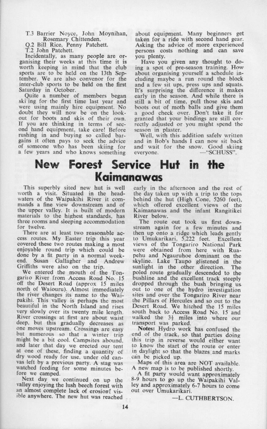
New Forest Service Hut in the Kaimanawas This superbly sited new hut is well early in the afternoon and the rest of worth a visit. Situated in the head- the day taken up with a trip to the tops waters of the Waipakihi River it com- behind the hut (High Cone, 5260 feet), mands a fine view downstream and of which offered excellent views of the the upper valley. It is built of modern Kaimanawas and the infant Rangitikei materials to the highest standards, has River below. three rooms and sleeping accommodation The route out took us first downfor twelve. stream again for a few minutes and There are at least two reasonable ac- then up onto a ridge which leads gently cess routes. My Easter trip. this year to Umukarikari, 5,222 feet. Excellent covered these two routes making a most views of the Tongariro National Park enjoyable round trip which could be were obtained from here with Ruadone by a fit party in a normal week- pehu and Ngauruhoe dominant on the end. Susan Gallagher and Andrew skyline. Lake Taupo glistened in the Griffiths were also on the trip. sunlight in the other direction. The We entered the mouth of the Ton- poled route gradually descended to the gariio River from Access Road No. 15 bushline and the excellent track steeply off the Desert Road (approx 15 miles dropped through the bush bringing us north of Waiouru). Almost immediately out to one of the hydro investigation the river changes its name to the Wai- sites and over the Tongariro River near pakihi. This valley is perhaps the most the Pillars of Hercules and so out to the beautiful in the North Island and rises Desert Road. We hitched the 15 miles very slowly over its twenty mile length. south back to Access Road No. 15 and River crossings at first are about waist walked the 34 miles into where our deep, but this gradually decreases as transport was parked. one moves upstream. Crossings are easy Notes: Hydro work has confused the but numerous so that a winter trip end of the track, so that parties doing might be a bit cool. Campsites abound, this trip in reverse would either want and later that day we erected our tent to know the start of the route or enter at one of these, finding a quantity of in daylight so that the blazes and marks dry wood ready for use, under old can- can be picked up. vas left by a previous party. A stag was Maps of this area are NOT available. watched feeding for some minutes be- A new map is to be published shortly. fore we camped. A fit party would want approximately Next day we continued on up the 8-9 hours to go up the Waipakihi Valvalley enjoying the lush beech forest with ley and approximately 6-7 hours to come an almost complete lack of erosionf vis- out over Umukarikari. ible anywhere. The new hut was reached -L. CUTHBERTSON.
Comments
Comments are not open yet.