
This report is shown as scanned pages until a volunteer types it up. Skip to the machine-read text (unproofread), which a screen reader can read.
Machine-read text (unproofread)
Read from the scans by software, so it contains mistakes. Typing it up properly would help blind readers: use Suggest an edit.
Wangapeka Walkabout Hugh Middleton Lindsay left his stationwagon with direction. Cloud unfortunately a farmer near the Dart Ford in obscured Mt Murchison and the Nelson the Wangapeka Valley. We could Lakes tops to the south. have driven through as the water level was low, but we weren't From Mt Owen we sidled Replica prepared to risk being caught on Hill and descended a long gentle the wrong side if the level should spur to the north west, then dropped rise in a week's time. Barely to the bush edge in Nuggety Creek five minutes up the road Lindsay and camped. Plastic "chateau got stung. The Wangapeka Valley collapsible" containers proved hereabouts is full of beehives, invaluable that evening as water the denizens of which rush about had to be fetched from one sinkhole pollinating ragwort. After that or another. we were careful to avoid anything in bloom. In the morning we were pleasantly surprised to stumble upon a marked A few minutes were spent talking route down to the saddle between to Peter Bell, the local Forest Nuggety Creek and the Fyfe River. Service Ranger, and examining his At this point the markers split, maps and pamphlets. Courthouse those on our left leading down Flats, the road-end, was reached to Branch Creek Hut and those on not long afterward, thanks to an our right dropping into Nuggety Acclimatisation Society ranger Creek. Fortunately our route who regaled us with stories of lay through open bush and we soon farmers slaughtering Canada geese found ourselves back amongst the as he drove us up the Rolling River tussocks. Travel up the spur section of the road. was easy at first, but the steeper country higher up was blanketed By the time we'd had lunch, the in an amazing variety of vegetation heat was becoming oppressive. and intersected by bluffs. Not So we elected to try to reach Granity only spaniards, flax and fuschia Pass by the shadiest possible route. but such exotic delights as foxgloves, Peter Bell had mentioned that you thistles and clover confronted could get up Blue Creek with light us. It took something like an packs. Ours were about 22kg so hour and a half to negotiate those we thought we'd give it a go. masochistic delights and emerge (He'd neglected to mention how amongst the tussocks and limestone you got into Blue Creek though.) outcrops near the crest of this After entering what we thought particularly rugged stretch of was the Blue Creek Gorge, just the Marino Mountains. In retrospect above the resurgence, we were soon it would probably have been much stopped by a steep mossy chute easier to have dropped into a grassy with limestone cliffs on both sides. basin on the bush-edge to the north It was midafternoon by this time of our route, and to have ascended so we retreated to the Billies directly from there to the top Knob track and began the long uphill of the range. grind. Suffice it to say that the two older (and much fitter) The rest of that day's journey guys reached the new Granity Pass to the South Branch of the Wangapeka hut at 7pm, while the others didn't was straightforward. Thanks to make it until about an hour later. the marvellous weather, we had no trouble picking up a good spur on the west side of the range and Next day was another scorcher. descending this to the valley floor Lindsay, the only one of us who'd on a compass bearing. A refreshing been there before, led the assault dip in the cold river made a fitting on Mt Owen. It was easy going end to a hot dry journey. at first through open tussock country. Higher up we were slowed Our third hot fine day in a row considerably by a jumbled conglomerasaw us heading downstream to the tion of limestone outcrops and Boyd confluence. We stopped briefly sinkholes. Packs were dropped to inspect an old fly camp on a near the saddle between Mt Owen terrace above this point. "Mac's and Replica Hill and, after a bite Clearing" was painted on the iron of lunch, we scrambled up the final chimney. Boyd Stream itself presentfew hundred metres to the trig. ed no difficulties until the flats At 1875m Mt Owen is the highest about halfway up were reached. peak in the North West Nelson Forest Above them we sidled gorges on Park and we were rewarded with the true right as far as the forks. excellent views in almost every
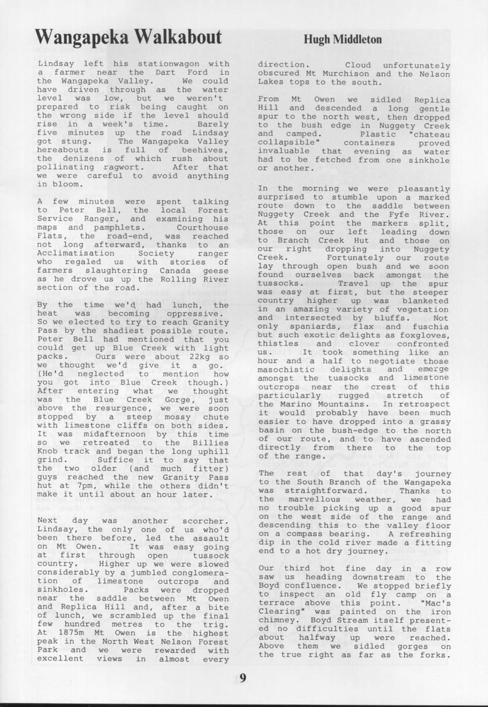
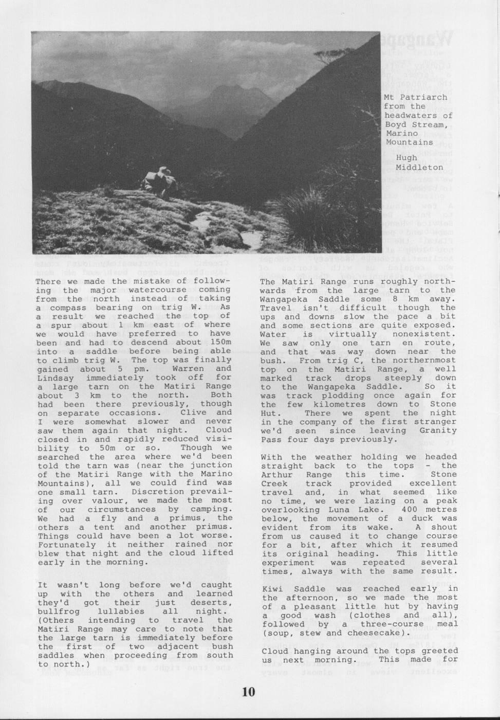
Mt Patriarch from the headwaters of Boyd Stream, Marino Mountains Hugh Middleton There we made the mistake of follow- The Matiri Range runs roughly northing the major watercourse coming wards from the large tarn to the from the north instead of taking Wangapeka Saddle some 8 km away. a compass bearing on trig W. As Travel isn't difficult though the a result we reached the top of ups and downs slow the pace a bit a spur about 1 km east of where and some sections are quite exposed. we would have preferred to have Water is virtually nonexistent. been and had to descend about 150m We saw only one tarn en route, into a saddle before being able and that was way down near the to climb trig W. The top was finally bush. From trig C, the northernmost gained about 5 pm. Warren and top on the Matiri Range, a well Lindsay immediately took off for marked track drops steeply down a large tarn on the Matiri Range to the Wangapeka Saddle. So it about 3 km to the north. Both was track plodding once again for had been there previously, though the few kilometres down to Stone on separate occasions. Clive and Hut. There we spent the night I were somewhat slower and never in the company of the first stranger saw them again that night. Cloud we'd seen since leaving Granity closed in and rapidly reduced visi- Pass four days previously. bility to 50m or so. Though we searched the area where we'd been With the weather holding we headed told the tarn was (near the junction straight back to the tops the of the Matiri Range with the Marino Arthur Range this time. Stone Mountains), all we could find was Creek track provided excellent one small tarn. Discretion prevailtravel and, in what seemed like ing over valour, we made the most no time, we were lazing on a peak of our circumstances by camping. overlooking Luna Lake. 400 metres We had a fly and a primus, the below, the movement of a duck was others a tent and another primus. evident from its wake. A shout Things could have been a lot worse. from us caused it to change course Fortunately it neither rained nor for a bit, after which it resumed blew that night and the cloud lifted its original heading. This little early in the morning. experiment was repeated several times, always with the same result. It wasn't long before we'd caught Kiwi Saddle was reached early in up with the others and learned the afternoon, so we made the most they'd got their just deserts, of a pleasant little hut having bullfrog lullabies all night. by a good wash (clothes and all), (Others intending to travel the Matiri Range may care to note that followed by a three-course meal (soup, stew and cheesecake). the large tarn is immediately before the first of two adjacent bush saddles when proceeding from south Cloud hanging around the tops greeted us next morning. This made for to north.)
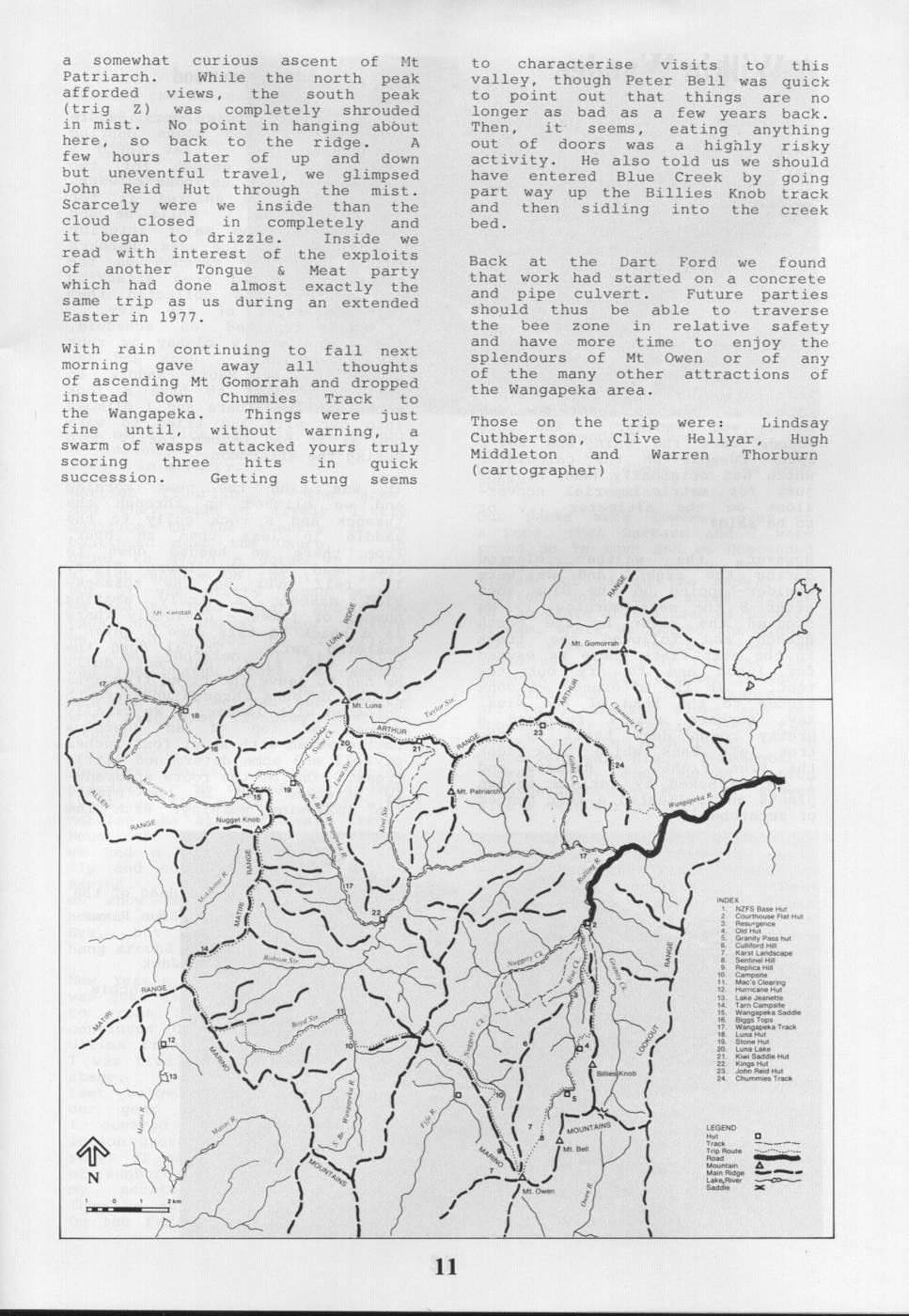
a somewhat curious ascent of Mt to characterise visits to this Patriarch. While the north peak valley, though Peter Bell was quick afforded views, the south peak to point out that things are no (trig Z) was completely shrouded longer as bad as a few years back. in mist. No point in hanging about Then, it seems, eating anything here, so back to the ridge. A out of doors was a highly risky few hours later of up and down activity. He also told us we should but uneventful travel, we glimpsed have entered Blue Creek by going John Reid Hut through the mist. part way up the Billies Knob track Scarcely were we inside than the and then sidling into the creek cloud closed in completely and bed. it began to drizzle. Inside we read with interest of the exploits Back at the Dart Ford found of another Tongue & Meat party we which had done almost exactly the that work had started on a concrete and pipe culvert. Future same trip as us during an extended parties Easter in 1977. should thus be able to traverse the bee zone in relative safety With rain continuing to fall next and have more time to enjoy the morning gave away all thoughts splendours of Mt Owen or of any of ascending Mt Gomorrah and dropped of the many other attractions of instead down Chummies Track to the Wangapeka area. the Wangapeka. Things were just Those on the trip were: fine until, without warning, a Lindsay Cuthbertson, Clive swarm of wasps attacked yours truly Hellyar, Hugh Middleton and Warren Thorburn scoring three hits in quick succession. Getting stung seems (cartographer) à d à LUNA - a Toktas A e oy o INDEX NZFS Pa Hut ar Pass E ape L Nugs gety Hu E Saddle * Track a E P - SE Hut E - Reid Hut $113 Chummies Track D - Matie MOUN LEGEND I ERINO E Aaunt ake, add I i
Comments
Comments are not open yet.