
This report is shown as scanned pages until a volunteer types it up. Skip to the machine-read text (unproofread), which a screen reader can read.
Machine-read text (unproofread)
Read from the scans by software, so it contains mistakes. Typing it up properly would help blind readers: use Suggest an edit.
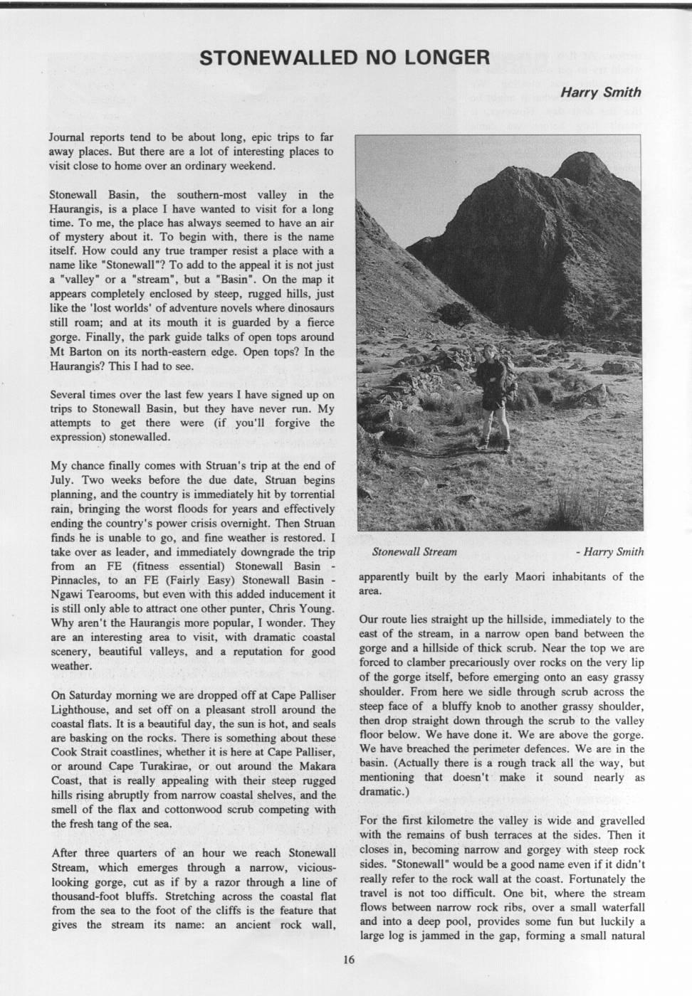
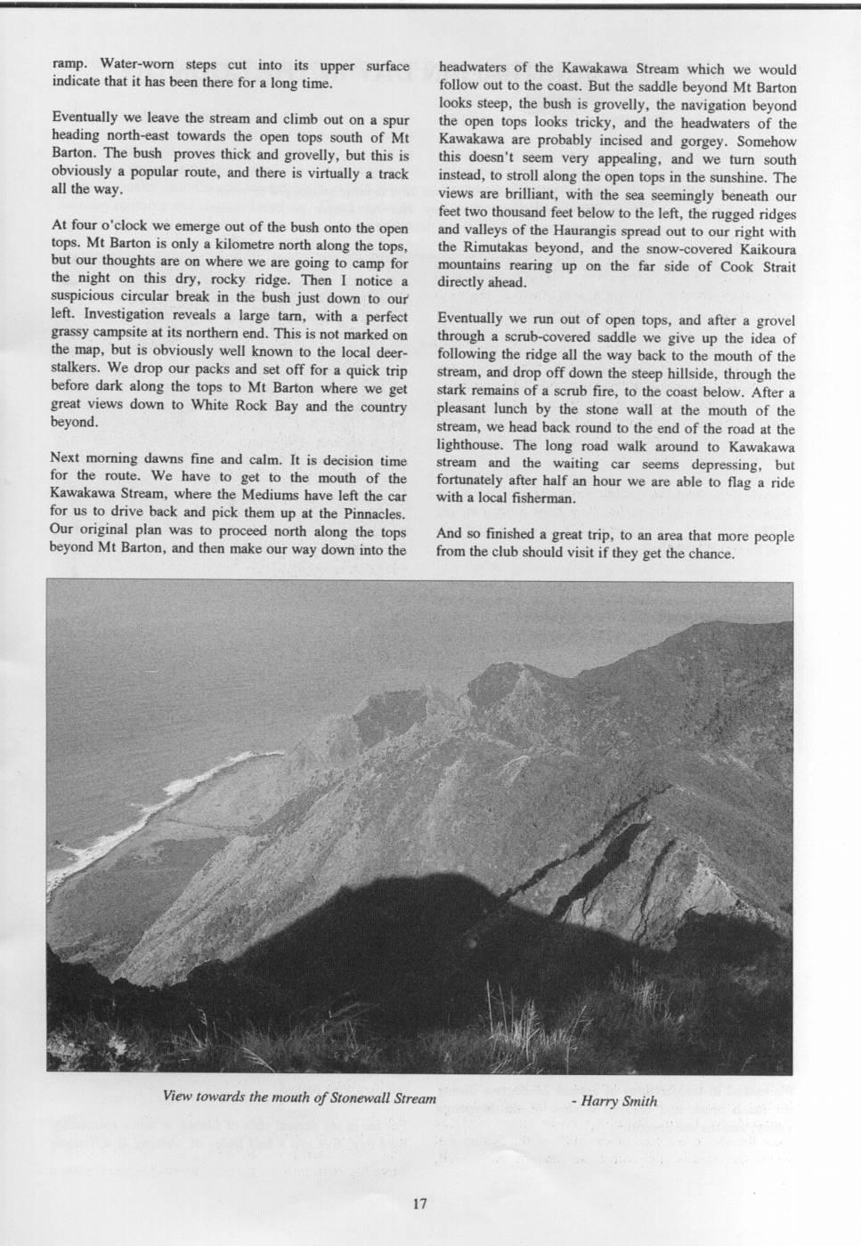
STONEWALLED NO LONGER Harry Smith Journal reports tend to be about long, epic trips to far away places. But there are a lot of interesting places to visit close to home over an ordinary weekend. Stonewall Basin, the southern-most valley in the Haurangis, is a place I have wanted to visit for a long time. To me, the place has always seemed to have an air of mystery about it. To begin with, there is the name itself. How could any true tramper resist a place with a name like "Stonewall"? To add to the appeal it is not just a "valley" or a "stream", but a "Basin" ". On the map it appears completely enclosed by steep, rugged hills, just like the 'lost worlds' of adventure novels where dinosaurs still roam; and at its mouth it is guarded by a fierce gorge. Finally, the park guide talks of open tops around Mt Barton on its north-eastern edge. Open tops? In the Haurangis? This I had to see. Several times over the last few years I have signed up on trips to Stonewall Basin, but they have never run. My attempts to get there were (if you'll forgive the expression) stonewalled. My chance finally comes with Struan's trip at the end of July. Two weeks before the due date, Struan begins planning, and the country is immediately hit by torrential rain, bringing the worst floods for years and effectively ending the country's power crisis overnight. Then Struan finds he is unable to go, and fine weather is restored. I take over as leader, and immediately downgrade the trip Stonewall Stream Harry Smith from an FE (fitness essential) Stonewall Basin Pinnacles, to an FE (Fairly Easy) Stonewall Basin apparently built by the early Maori inhabitants of the Ngawi Tearooms, but even with this added inducement it area. is still only able to attract one other punter, Chris Young. Why aren't the Haurangis more popular, I wonder. They Our route lies straight up the hillside, immediately to the are an interesting area to visit, with dramatic coastal east of the stream, in a narrow open band between the scenery, beautiful valleys, and a reputation for good gorge and a hillside of thick scrub. Near the top we are weather. forced to clamber precariously over rocks on the very lip of the gorge itself, before emerging onto an easy grassy On Saturday morning we are dropped off at Cape Palliser shoulder. From here we sidle through scrub across the Lighthouse, and set off on a pleasant stroll around the steep face of a bluffy knob to another grassy shoulder, coastal flats. It is a beautiful day, the sun is hot, and seals then drop straight down through the scrub to the valley are basking on the rocks. There is something about these floor below. We have done it. We are above the gorge. Cook Strait coastlines, whether it is here at Cape Palliser, We have breached the perimeter defences. We are in the or around Cape Turakirae, or out around the Makara basin. (Actually there is a rough track all the way, but Coast, that is really appealing with their steep rugged mentioning that doesn't make it sound nearly as hills rising abruptly from narrow coastal shelves, and the dramatic.) smell of the flax and cottonwood scrub competing with the fresh tang of the sea. For the first kilometre the valley is wide and gravelled with the remains of bush terraces at the sides. Then it After three quarters of an hour we reach Stonewall closes in, becoming narrow and gorgey with steep rock Stream, which emerges through a narrow, vicious- sides. "Stonewall" would be a good name even if it didn't looking gorge, cut as if by a razor through a line of really refer to the rock wall at the coast. Fortunately the thousand-foot bluffs. Stretching across the coastal flat travel is not too difficult. One bit, where the stream from the sea to the foot of the cliffs is the feature that flows between narrow rock ribs, over a small waterfall gives the stream its name: an ancient rock wall, and into a deep pool, provides some fun but luckily a large log is jammed in the gap, forming a small natural ramp. Water-worn steps cut into its upper surface headwaters of the Kawakawa Stream which we would indicate that it has been there for a long time. follow out to the coast. But the saddle beyond Mt Barton looks steep, the bush is grovelly, the navigation beyond Eventually we leave the stream and climb out on a spur the open tops looks tricky, and the headwaters of the heading north-east towards the open tops south of Mt Kawakawa are probably incised and gorgey. Somehow Barton. The bush proves thick and grovelly, but this is this doesn't seem very appealing, and we turn south obviously a popular route, and there is virtually a track instead, to stroll along the open tops in the sunshine. The all the way. views are brilliant, with the sea seemingly beneath our feet two thousand feet below to the left, the rugged ridges At four o'clock we emerge out of the bush onto the open and valleys of the Haurangis spread out to our right with tops. Mt Barton is only a kilometre north along the tops, the Rimutakas beyond, and the snow-covered Kaikoura but our thoughts are on where we are going to camp for mountains rearing up on the far side of Cook Strait the night on this dry, rocky ridge. Then I notice a directly ahead. suspicious circular break in the bush just down to our left. Investigation reveals a large tarn, with a perfect Eventually we run out of open tops, and after a grovel grassy campsite at its northern end. This is not marked on through a scrub-covered saddle we give up the idea of the map, but is obviously well known to the local deer- following the ridge all the way back to the mouth of the stalkers. We drop our packs and set off for a quick trip stream, and drop off down the steep hillside, through the before dark along the tops to Mt Barton where we get stark remains of a scrub fire, to the coast below. After a great views down to White Rock Bay and the country pleasant lunch by the stone wall at the mouth of the beyond. stream, we head back round to the end of the road at the lighthouse. The long road walk around to Kawakawa Next morning dawns fine and calm. It is decision time stream and the waiting car seems depressing, but for the route. We have to get to the mouth of the fortunately after half an hour we are able to flag a ride Kawakawa Stream, where the Mediums have left the car with a local fisherman. for us to drive back and pick them up at the Pinnacles. Our original plan was to proceed north along the tops And so finished a great trip, to an area that more people beyond Mt Barton, and then make our way down into the from the club should visit if they get the chance. View towards the mouth of Stonewall Stream - Harry Smith
Comments
Comments are not open yet.