
This report is shown as scanned pages until a volunteer types it up. Skip to the machine-read text (unproofread), which a screen reader can read.
Machine-read text (unproofread)
Read from the scans by software, so it contains mistakes. Typing it up properly would help blind readers: use Suggest an edit.
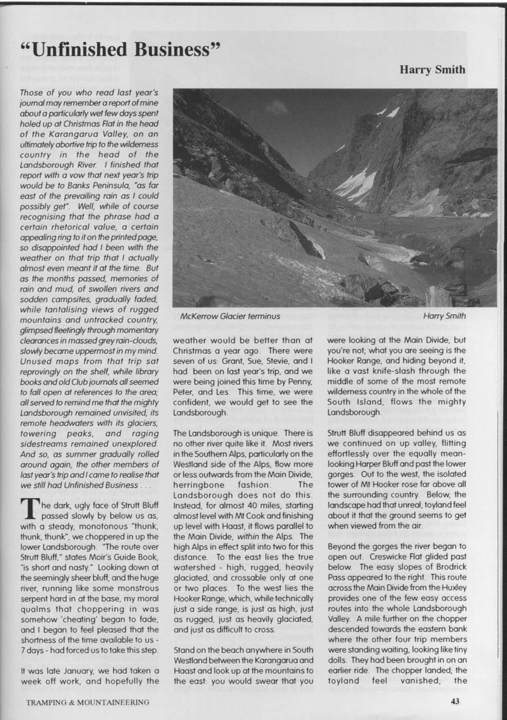
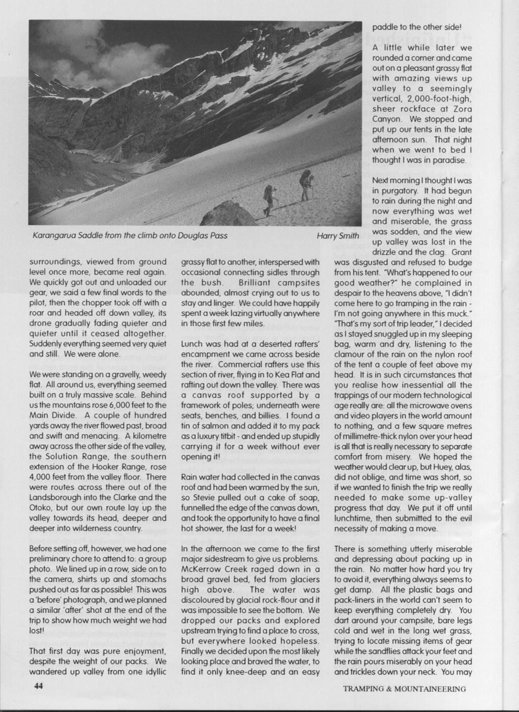
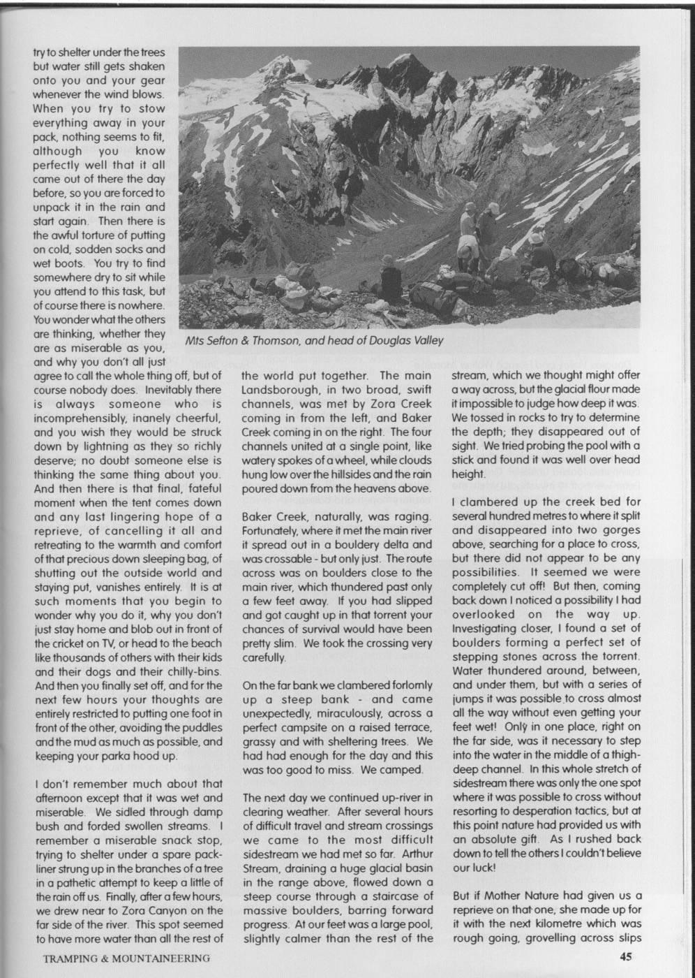
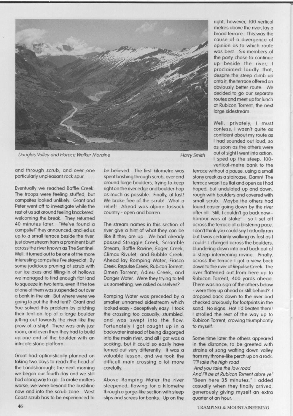
"Unfinished Business" Harry Smith Those of you who read last year's journal may remember ar report ofmine about ap particularly wet few days: spent holed up at Christmas Flati in thel head of the Karangarua Valley, on an ultimately abortivet tript to the wilderness country in the head of the Landsborough River. I finished that report with a vow that next year's trip would be to Banks Peninsula, "as far east of the prevailing rain as I could possibly get". Well, while of course recognising that the phrase had a certain rhetorical value, a certain appealing ring to it on thep printedpage, so disappointed had I been with the weather on that trip that I actually almost even meant it at the time. But as the months passed, memories of rain and mud, of swollen rivers and sodden campsites, gradually faded, while tantalising views of rugged mountains and untracked country, McKerrow Glacier terminus Harry Smith glimpsedfleetinglyt throughmomentary clearancesi in massedgreyrain-douds, weather would be better than at were looking at the Main Divide, but slowly became uppermost in my mind. Christmas a year ago. There were you're not; what you are seeing is the Unused maps from that trip sat seven of US: Grant, Sue, Stevie, and I Hooker Range, and hiding beyond it, reprovingly on the shelf, while library had been on last year's trip, and we like a vast knife-slash through the books and oldClubjournals all seemed were being joined this time by Penny, middle of some of the most remote to fall open at references to the area; Peter, and Les. This time, we were wilderness country in the whole of the alls servedi to remind me that the mighty confident, we would get to see the South Island, flows the mighty Landsborough remained unvisited, its Landsborough. Landsborough. remote headwaters with its glaciers, towering peaks, and raging The Landsborough is unique. There is Strutt Bluff disappeared behind US as sidestreams remained unexplored. no other river quite like it. Most rivers we continued on up valley, flitting And so, as summer gradually rolled in the Southern Alps, particularly on the effortlessly over the equally meanaround again, the other members of Westland side of the Alps, flow more lookingHarper Bluff and past thel lower last year's trip andlcame to realise that orl less outwards from the Main Divide, gorges. Out to the west, the isolated we still had Unfinished Business herringbone fashion The tower of Mt Hooker rose far above all Landsborough does not do this the surrounding country. Below, the he dark, ugly face of Strutt Bluff Instead, for almost 40 miles, starting landscape had that unreal, toylandfeel passed slowly by below US as, almost level with Mt Cook andi finishing about it that the ground seems to get with a steady, monotonous "thunk, up level with Haast, it flows parallel to when viewed from the air. thunk, thunk", we choppered in up the the Main Divide, within the Alps. The lower Landsborough. "The route over high Alps in effect split into two for this Beyond the gorges the river began to Strutt Bluff," states Moir's Guide Book, distance. To the east lies the true open out. Creswicke Flat glided past "is short and nasty." Looking down at watershed - high, rugged, heavily below. The easy slopes of Brodrick the seemingly sheerl bluff, and thet huge glaciated, and crossable only at one Pass appeared to the right. This route river, running like some monstrous or two places. To the west lies the across the Main Divide from thel Huxley serpent hard in at thel base, my moral Hooker Range, which, while technically provides one of the few easy access qualms that choppering in was just a side range, is just as high, just routes into the whole Landsborough somehow 'cheating' began to fade, as rugged, just as heavily glaciated, Valley A mile further on the chopper and I began to feel pleased that the and just as difficult to cross. descended towards the eastern bank shortness of the time available to US where the other four trip members 7days had forced US to take this step. Stand on the beach anywhere in South were: standing waiting, looking liket tiny Westlandi between thel Karangarua and dolls. They had been brought in on an It was late January, we had taken a Haast and look up at the mountains to earlier ride. The chopper landed; the week off work, and hopefully the the east: you would swear that you toyland feel vanished; the TRAMPING & MOUNTAINEERING paddle to the other side! A little while later we rounded ac corner andcame out on a pleasant grassy flat with amazing views up valley to a seemingly vertical, 2,000-foot-high, sheer rockface at Zora Canyon. We stopped and put up our tents in the late afternoon sun. That night when we went to bed I thoughtlwas in paradise. Next morninglthoughtlwas in purgatory. It had begun to rain during the night and now everything was wet and miserable, the grass Karangarua Saddle from the climb onto Douglas Pass Harry Smith was sodden, and the view up valley was lost in the drizzle and the clag. Grant surroundings, viewed from ground grassy flati to another, interspersedi with was disgusted and refused to budge level once more, became real again. occasional connecting sidles through from his tent. "What's happened to our We quickly got out and unloaded our the bush. Brilliant campsites good weather?" he complained in gear, we said a few final words to the abounded, almost crying out to US to despair to the heavens above, "Ididn't pilot, then the chopper took off with a stay andl linger. We could have happily come here to go tramping in the rain - roar and headed off down valley, its spent a week lazing virtually anywhere I'm not going anywhere in this muck." " drone gradually fading quieter and in those first few miles. "That's my sort of trip leader, "I decided quieter until it ceased altogether. aslstayed snuggled upi in my: sleeping Suddenly everything seemed very quiet Lunch was had at a deserted rafters' bag, warm and dry, listening to the and still. We were alone. encampment we came across beside clamour of the rain on the nylon roof the river. Commercial rafters use this of the tent a couple of feet above my Wer were standing on a gravelly, weedy section of river, flyingin to Keal Flat and head. It is in such circumstances that flat. All around US, everything seemed rafting out down the valley There was you realise how inessential all the built on a truly massive scale. Behind a canvas roof supported by a trappings of our modern technological US1 the mountains rose 6,000 feet to the framework of poles; underneath were ager really are: all the microwave ovens Main Divide. A couple of hundred seats, benches, and billies. found a and video players in the world amount yards away the river flowed past, broad tin of salmon and added it to my pack to nothing, and a few square metres and swift and menacing. A kilometre asaluxury titbit and ended lup stupidly ofmillimetre-thicki nylon over yourhead away across the other side of the valley, carrying it for a week without ever is all thati is really necessary to separate the Solution Range, the southern opening it! comfort from misery. We hoped the extension of the Hooker Range, rose weather would clear up, but Huey, alas, 4,000 feet from the valley floor. There Rain water had collected in the canvas did not oblige, and time was short, so were routes across there out of the roof and had been warmed by the sun, ifwe wantedi to finish the trip we really Landsborough into the Clarke and the so Stevie pulled out a cake of soap, needed to make some up-valley Otoko, but our own route lay up the funnelled the edge of the canvas down, progress that day. We put it off until valley towards its head, deeper and andtook the opportunitytol have a final lunchtime, then submitted to the evil deeper into wilderness country. hot shower, the last for a week! necessity of making a move. Before setting off, however, we had one In the afternoon we came to the first There is something utterly miserable preliminary chore to attendto: a group major sidestream to give US problems. and depressing about packing up in photo. Wel lined upi in a row, side on to McKerrow Creek raged down in a the rain. No matter how hard you try the camera, shirts up and stomachs broad gravel bed, fed from glaciers to avoid it, everything always seems to pushed out as far as possible! This was high above. The water was get damp. All the plastic bags and a' 'before' photograph, and wej planned discoloured by glacial rock-flour and it pack-liners in the world can't seem to a similar after' shot at the end of the was impossible to see the bottom. We keep everything completely dry. You trip to show how much weight wel had dropped our packs and explored dart around your campsite, bare legs lost! upstream trying to find ap place to cross, cold and wet in the long wet grass, but everywhere looked hopeless. trying to locate missing items of gear That first day was pure enjoyment, Finally we decided upon the most likely while the sandflies attack your feet and despite the weight of our packs. We looking place and braved the water, to the rain pours miserably on your head wandered up valley from one idyllic find it only knee-deep and an easy and trickles down your neck. You may TRAMPING & MOUNTAINEERING tryto shelter under the trees but water still gets shaken onto you and your gear whenever the wind blows. When you try to stow everything away in your pack, nothing seems to fit, although you know perfectly well that it all came out of there the day before, SO you are forcedto unpack it in the rain and start again. Then there is the awful torture of putting on cold, sodden socks and wet boots. You try to find somewhere dryi to sit while you attend to this task, but of course therei is nowhere. Youwonder what the others are thinking, whether they Mts Sefton & Thomson, and head of Douglas Valley are as miserable as you, and why you don't all just agreet to call the whole thing off, but of the world put together. The main stream, which we thought might offer course nobody does. Inevitably there Landsborough, in two broad, swift away across, butt the glacial flour made is always someone who is channels, was met by Zora Creek itimpossible to judgel how deep it was. incomprehensibly, inanely cheerful, coming in from the left, and Baker We tossed in rocks to try to determine and you wish they would be struck Creek coming in on the right. Thet four the depth; they disappeared out of down by lightning as they SO richly channels united at a single point, like sight. We tried probing the pool with a deserve; no doubt someone else is watery spokes ofawheel, while clouds stick and found it was well over head thinking the same thing about you. hung low over the hillsides and the rain height. And then there is that final, fateful poured down from the heavens above. moment when the tent comes down I clambered up the creek bed for and any last lingering hope of a Baker Creek, naturally, was raging. several hundred metresto where it split reprieve, of cancelling it all and Fortunately, where it met the main river and disappeared into two gorges retreating to the warmth and comfort it spread out in a bouldery delta and above, searching for a place to cross, oft that precious down sleepingbag, of was crossable but only just. Theroute but there did not appear to be any shutting out the outside world and across was on boulders close to the possibilities. It seemed we were staying put, vanishes entirely. It is at main river, which thundered past only completely cut off! But then, coming such moments that you begin to a few feet away. If you had slipped back down Inoticed a possibilitylhad wonder why you do it, why you don't and got caught up in that torrent your overlooked on the way up. just stay home and blob out in front of chances of survival would have been Investigating closer, I found a set of the cricket on TV, or head to the beach pretty slim. We took the crossing very boulders forming a perfect set of like thousands of others with their kids carefully. stepping stones across the torrent. and their dogs and their chilly-bins. Water thundered around, between, And then you finally set off, andi for the On the farl bank we clambered forlomly and under them, but with a series of next few hours your thoughts are up a steep bank and came jumps it was possible to cross almost entirely restricted to putting one foot in unexpectedly, miraculously, across a all the way without even getting your front off the other, avoiding the puddles perfect campsite on a raised terrace, feet wet! Only in one place, right on andt the mud as much as possible, and grassy and with sheltering trees. We the far side, was it necessary to step keeping your parka hood up. had had enough for the day and this into the water in the middle of a thighwas too good to miss. We camped. deep channel. In this whole stretch of I don't remember much about that sidestream there was only the one spot afternoon except that it was wet and The next day we continued up-river in where it was possible to cross without miserable. We sidled through damp clearing weather. After several hours resorting to desperation tactics, but at bush and forded swollen streams. of difficult travel and stream crossings this point nature had provided US with remember a miserable snack stop, we came to the most difficult an absolute gift. As I rushed back trying to shelter under a spare pack- sidestream we had met SO far. Arthur down to tell the otherslcouldn'tbelieve liner strungupi in the branches of a tree Stream, draining a huge glacial basin our luck! in a pathetic attempt to keep a little of in the range above, flowed down a ther rain off US. Finally, after a fewhours, steep course through a staircase of But if Mother Nature had given US a we drew near to Zora Canyon on the massive boulders, barring forward reprieve on that one, she made up for far side of the river. This spot seemed progress. At ouri feet was a large pool, it with the next kilometre which was to have more water than all the rest of slightly calmer than the rest of the rough going, grovelling across slips TRAMPING & MOUNTAINEERING right, however, 100 vertical metres above the river, lay a broad terrace. This was the cause of a divergence of opinion as to which route was best. Six members of the party chose to continue up beside the river; I proclaimed loudly that, despite the steep climb up onto it, thet terrace offered an obviously better route. We decided to go our separate routes and meet upfor lunch at Rubicon Torrent, the next large sidestream. Well, privately, I must confess, I wasn't quite as confident about my route as I had sounded out loud, SO as soon as the others were Douglas Valley and Horace Walker Moraine Harry Smith out of sightlwent into action. I sped up the steep, 100vertical-metre bank to the and through scrub, and over one be believed. The first kilometre was terrace without a pause, using a small particularly unpleasant rock spur. spent bashing through scrub, over and stonycreek as a staircase. Damn! The around large boulders, trying to keep terrace wasn't as flat and open aslhad Eventually we reached Baffle Creek. right on ther river edge andboulder-hop hoped, but undulated up and down, The troops were feeling stuffed, but as much as possible. Finally, at last! rough with boulders and covered with campsites looked unlikely. Grant and We broke free of the scrub! What a small scrub. Maybe the others had Peter went off to investigate while the relief! Ahead was alpine tussock found easier going down by the river rest of US sat around feeling knackered, country open and barren. after all. Still, Icouldn't go back now - welcoming the break. They returned honour was at stake! so I set off 40 minutes later. "We've found a The stream names in this section of across the terrace at al blistering pace. campsitel" they announced, and led lus river give a hint of what they can be Idon'tthink you could sayl actually ran up to a small terrace beside the river, like if they are up. We had already but I was certainly walking as fast as I just downstream from a prominent bluff passed Struggle Creek, Scramble could! - charged across the boulders, across the river known as The Sentinel. Stream, Baffle Ravine, Eager Creek, blundering down into and back out of Well, it turned outt to be one ofthe more Climax Rivulet, and Bubble Creek. a steep intervening ravine. Finally, interesting campsites I've stayedat. By Ahead lay Romping Water, Fiasco across the terrace I got a view back some judicious pruning of scrub with Creek, Repulse Creek, Rubicon Torrent, downto the river at Repulse Creek. The our ice axes and filling-in of hollows Omen Torrent, Adieu Creek, and river flattened out from here up to we managed to find enough flat land Danger Water. Were they trying to tell Rubicon Torrent, 400 yards ahead. to squeeze in two tents, even if the toe US something, we asked ourselves? There was no sign of the others below of one of them was suspended out over were they up ahead or still behind? I al bank in the air But where were we Romping Water was preceded by a dropped back down to the river and going to put the third tent? Grant and smaller unnamed sidestream which checked anxiously for footprints in the Sue solved this problem by pitching looked easy deceptively easy. Itook sand. No signs. Ha! l'd beaten them! their tent on top of a large boulder the crossing too casually, stumbled, I strolled the rest of the way up to jutting out towards the river like the and was swept into the flow. Rubicon Torrent, crowing triumphantly prow of a ship! There was only just Fortunately I got caught up in a to myself. room, and even then they had to build backwater instead of being disgorged up one end of the boulder with an into the main river, and all got was a Some time later the others appeared intricate stone platform. soaking, but it could SO easily have in the distance, to be greeted with turned out very differently. It was a strains of song wafting down valley Grant had optimistically planned on valuable lesson, and we took the frommy throne-like perchupon arock: taking two days to reach the head of difficult main crossing a lot more "TIl take the high road the Landsborough; the next morning carefully And you take the low road we began our fourth day and we still And I'll be at Rubicon Torrent afore ye" had lalong way togo. To make matters Above Romping Water the river "Been here 35 minutes, I added worse, we were beyond the bushline steepened, flowing for a kilometre casually when they finally arrived, now and into the scrub zone. West throughag gorge-like section with steep generously giving myself an extra Coast scrub has to be experienced to slips and screes for banks. Up on the quarter of an hour. TRAMPING & MOUNTAINEERING
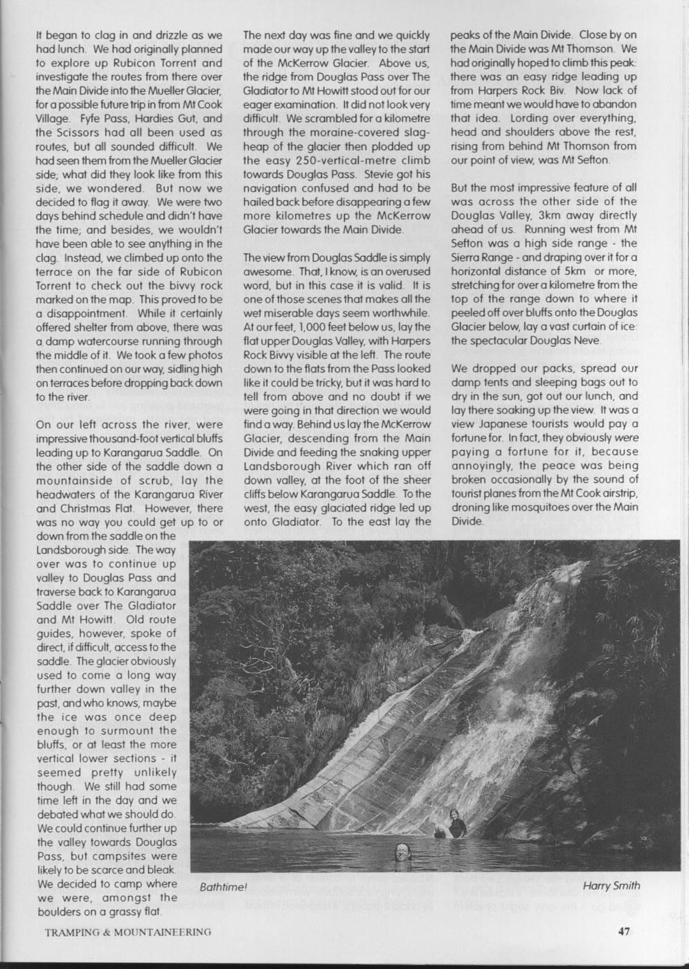
It began to clag in and drizzle as we The next day was fine and we quickly peaks of thel Main Divide. Close by on had lunch. We had originally planned made our way upt the valleyto the start thel Main Divide was, Mt Thomson. We to explore up Rubicon Torrent and of the McKerrow Glacier. Above US, had originally hopedto climb this peak: investigate the routes from there over the ridge from Douglas Pass over The there was an easy ridge leading up thel Main Dividei into the Mueller Glacier, Gladiator to Mt Howitt stood out for our from Harpers Rock Biv. Now lack of for apossible: futuret trip int from Mt Cook eager examination. It didi not look very time meant we wouldhave to abandon Village. Fyfe Pass, Hardies Gut, and difficult. We scrambledi for a kilometre that idea. Lording over everything, the Scissors had all been used as through the moraine-covered slag- head and shoulders above the rest, routes, but all sounded difficult. We heap of the glacier then plodded up rising from behind Mt Thomson from had seen themt from the Mueller Glacier the easy 250-vertical-metre climb our point of view, was Mt Sefton. side; what did they look like from this towards Douglas Pass. Stevie got his side, we wondered. But now we navigation confused and had to be But the most impressive feature of all decided to flag it away. We were two hailedi backbefore disappearingat few was across the other side of the days behind schedule and didn'thave more kilometres up the McKerrow Douglas Valley, 3km away directly the time; and besides, we wouldn't Glacier towards the Main Divide. ahead of US. Running west from Mt have been able to see anything in the Sefton was a high side range - the clag. Instead, we climbed up onto the The view from Douglas Saddle is simply Sierra Range and draping over it for a terrace on the far side of Rubicon awesome. That, Iknow, is an overused horizontal distance of 5km or more, Torrent to check out the bivvy rock word, but in this case it is valid. It is stretching for over a kilometre from the marked on the map. This provedto be one of those scenes that makes all the top of the range down to where it a disappointment. While it certainly wet miserable days seem worthwhile. peeled off overl bluffs onto thel Douglas offered shelter from above, there was At ourfeet, 1,000 feet belowus, lay the Glacier below, lay a vast curtain of ice: a damp watercourse running through flat upper Douglas Valley, with Harpers the spectacular Douglas Neve. the middle ofi it. Wet took a few photos Rock Bivvy visible at the left. The route then continued on our way, sidling high down to the flats from the Pass looked We dropped our packs, spread our on terraces before dropping back down likei it could be tricky, buti it was hardi to damp tents and sleeping bags out to to the river. tell from above and no doubt if we dry in the sun, got out our lunch, and were going in that direction we would lay there: soaking up the view. It was a On our left across the river, were findaway. Behind US lay thel McKerrow view Japanese tourists would pay a impressive thousand-foot verticalb bluffs Glacier, descending from the Main fortune for. Infact, they obviously were leading up to Karangarua Saddle. On Divide and feeding the snaking upper paying a fortune for it, because the other side of the saddle down a Landsborough River which ran off annoyingly, the peace was being mountainside of scrub, lay the down valley, at the foot of the sheer broken occasionally by the sound of headwaters of the Karangarua River cliffs below Karangarua Saddle. To the tourist planes from thel Mt Cook airstrip, and Christmas Flat. However, there west, the easy glaciated ridge led up droning like mosquitoes over the Main was no way you could get up to or onto Gladiator. To the east lay the Divide. downt from the saddle on the Landsboroughside. The way over was to continue up a valley to Douglas Pass and traverse back to Karangarua Saddle over The Gladiator and Mt Howitt. Old route guides, however, spoke of direct, ifdifficult, accesst tot the saddle. The glacier obviously used to come a long way further down valley in the past, andwho knows, maybe the ice was once deep enough to surmount the bluffs, or at least the more vertical lower sections - it seemed pretty unlikely though. We still had some time left in the day and we debated what we should do. We could continue further up the valley towards Douglas Pass, but campsites were likely tol be scarce and bleak. We decided to camp where Bathtime! Harry Smith we were, amongst the boulders on a grassy flat. TRAMPING & MOUNTAINEERING
After lunch we began the climb up the being the possibility of being bowled places by a thin veneer of soil and ridge onto Gladiator The view from the while crossing the slabs by an ice vegetation, but at the sidestreams this summit was even more impressive avalanche peeling off the Douglas is worn clear, leaving a series of steep, than from the saddle. Mt Cook itself Neve above! smooth, slippery rock watercourses. couldi be seen over the top of Mt Sefton Last year this big one had been a and the Sierra Range, while out to the Altogether, the view from Gladiator was raging, uncrossable torrent, forcing US west we had views over the brilliant. The only thing to spoil it was to stop and camp in a miserable spot Karangarua Valley and down the the sight of Stevie's disgusting fluoro- in the scrub; now it was gentle and Douglas Valley to Horace Walker Hut. yellowlong-johns! Eventually we could benign in the sunshine. stand it no longer, SO we hurried on our Horace Walker Hut, I have to confess, way. Several metres out from thel base ofthe has taken on something of the aspect waterfall there was a shallow rock of ar mythical Shangri La to me, despite The ridge along to Mt Howitt proved platform on which we could paddle or, more likely, because of the fact very easy, but just as we reached the across to the other side. But closer to thatl lhave never been there. This view top it clagged in. We had some fun the base of the falls the force of the from the top of Gladiatori is the only time trying to drop down off the summit in water over the centuries had eroded a Ihave ever seen it. It sat there on the 20 metre visibility, then we dropped large pool a perfect swimming hole. flati in the middle of a beautiful, isolated below the cloud level and all was clear stopped for a swim and found it valley, difficult of access from all again. We sidled across the pleasantly warm: the water had been directions. Behind the hut, beside the mountainside, heading towards Baking warmed as it ran down the sun-baked river flowing in from the Horace Walker Oven Creek, intent on dropping down rock channel. I could have stayed in Glacier, was one off the mosti impressive to Christmas Flat Hut that night Then for ages. To make matters even better, examples of a terminal glacial moraine Penny made a suggestion: the weather at one corner the waterfall hadt formed that have ever seen. Beyond that we was good, SO why not camp up high a perfect natural spa pool I couldn't could: see the high sidle route in across on the tops? It was a good idea, and touch the bottom, but there was a the mountainside from Cassel Flat in we soon found a convenient place on branch conveniently positioned the Karangarua via Conical Hill, abroad flat shelf. We: spent the rest of overhead enabling you to hang there bypassing the impenetrable lower the day relaxing in the sun and and get gently massaged by the Douglas Gorge. watching the: sunset turn the peaksr red waterfall sheer bliss. and gold. At our feet, over a thousand vertical Continuing on down valley, we came metres below US, was the Douglas Next morning we dropped down to to the notorious "Void", the name we meltlake. We perched on the edge of Christmas Flat. By a careful choice of had given to alarge slip that hadtaken the bluff and peered down at it. Twenty route we were able to avoid the scrub away the hillside and the track. The years ago you used to be able to get almost entirely as we dropped into previous year, slipperyint the rain, itt had up the valley around the side of this Baking Oven Creek and boulder- been frightening; now crossing it was lake, buti in recent years the glacier has hopped down to the flats. There we a doddle. Finally we arrived at Cassel retreated and the lake has expanded, were surprised to find the foundations Flat Hut for the night. filling the valley from wall to wall, and of a new hut being built. Personallyl it is now impassable at water level. found this disappointing. Sure, the old Next morning came the big event: the Below US, the southern shoreline hut looked al bit dilapidated, but wehad "after" photo! Wel lined up, shirtsp pulled looked completely hopeless, a shown last year that it çould still be a up, stomachs pulled in, trying to look continuous series of bluffs. The very comfortable refuge in bad as thin and scrawny as possible! Then northern bank didn't look SO bad in weather. we wandered out down the valley. fact it looked as though you would be After a fewhours the Karangarua road able to boulder-hop right along. -it Iwent into the old hut and got out the bridge came into sight. We were out. except for onel bluff towards the eastern hut stool on which the previous year I end. Ihad heard of parties swimming had constructed a cribbage board, and And so finished a great trip. Ithadbeen around the base of this bluff, but the Sue and - sat down for a game. Don't great week, spent with good previous year we had heard of an ask me why; it just seemed an company in some off the most remote, alternativel route from a pair of students appropriate thing to do symbolically rugged country in New Zealand. But wel had met at Cassel Flat Hut, andnow celebrating ourt triumphant return tot the despite travelling the length of the we could trace it out from our vantage area, I suppose. Then we headed off upper Landsborough we had not point. From the eastern side of the bluff down valley in the sunshine. managedto do everythingthat wel had you could climb 2,000 feet up a steep, wanted to. We didn't get to explore grassy rib onto a prominent shoulder. Lunch was had lin the sunshine atl Lame Rubicon Torrent and investigate the From there you could traverse Duck Hut. Continuing down valley, we route over into the Mueller Glacier and westwards for a kilometre across soon arrived at the large waterfall in Mt Cook, we didn't get to climb Mt freshly exposed rock slabs to a the sidestream that had cut US off last Thomson, and we didn't get to visit the prominent stream. And finally you year. In this part of the valley the Douglas meltake or Horace WalkerHut. could descend the stream bed back hillsides seem to consist of a steep, So we are going to have to go back down to the lake shore. It looked like it underlying rock surface, worn smooth some time - because we've still got would go the only slight problem by ancient glaciers. Itiscoveredi inr most some Unfinished Business. TRAMPING & MOUNTAINEERING
Comments
Comments are not open yet.