
This report is shown as scanned pages until a volunteer types it up. Skip to the machine-read text (unproofread), which a screen reader can read.
Machine-read text (unproofread)
Read from the scans by software, so it contains mistakes. Typing it up properly would help blind readers: use Suggest an edit.
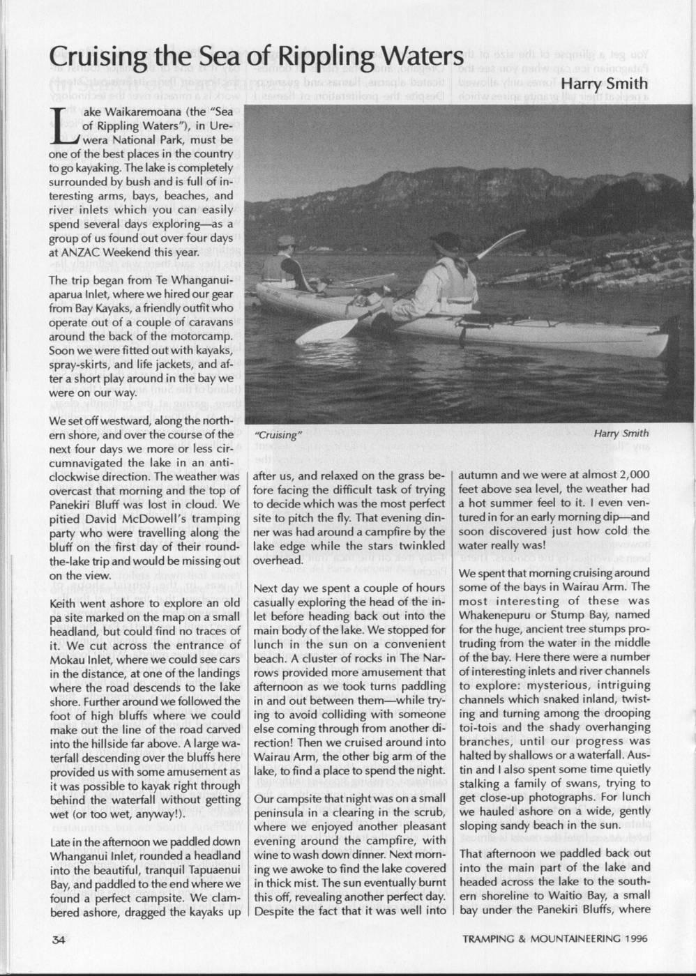
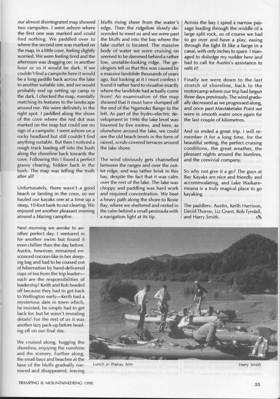
Cruising the Sea of Rippling Waters Harry Smith ake Waikaremoana (the "Sea of Rippling Waters"), in Urewera National Park, must be one of thel best places in the country togol kayaking. Thel lake is completely surrounded by bush and is full ofinteresting arms, bays, beaches, and river inlets which you can easily spend several days exploring-as a group of us found out over four days at ANZAC Weekend this year. The trip began from Te Whanganuiaparua Inlet, where we hired our gear from Bay Kayaks, a friendly outfit who operate out of a couple of caravans around the back of the motorcamp. Soon we were fitted out with kayaks, spray-skirts, and life jackets, and after a short play around in the bay we were on our way. We set off westward, along the northern shore, and over the course of the "Cruising" Harry Smith next four days we more or less circumnavigated the lake in an anticlockwise direction. The weather was after us, and relaxed on the grass be- autumn and we were at almost 2,000 overcast that morning and the top of fore facing the difficult task of trying feet above sea level, the weather had Panekiri Bluff was lost in cloud. We to decide which was the most perfect a hot summer feel to it. I even venpitied David McDowell's tramping site to pitch the fly. That evening din- turedi lin for an early morning dip-and party who were travelling along the ner was had around a campfire by the soon discovered just how cold the bluff on the first day of their round- lake edge while the stars twinkled water really was! the-lake trip and would be missing out overhead. on the view. We spent that morning cruisingaround Next day we spent a couple of hours some of the bays in Wairau Arm. The Keith went ashore to explore an old casually exploring the head of the in- most interesting of these was pa site marked on the map on a small let before heading back out into the Whakenepuru or Stump Bay, named headland, but could find no traces of main body of the lake. We stopped for for the huge, ancient tree stumps proit. We cut across the entrance of lunch in the sun on a convenient truding from the water in the middle Mokau Inlet, where we could see cars beach. A cluster of rocks in The Nar- of the bay. Here there were a number in the distance, at one of the landings rows provided more amusement that ofi finteresting inlets and river channels where the road descends to the lake afternoon as we took turns paddling to explore: mysterious, intriguing shore. Further around we followed the in and out between them-while try- channels which snaked inland, twistfoot of high bluffs where we could ing to avoid colliding with someone ing and turning among the drooping make out the line of the road carved else coming through from another di- toi-tois and the shady overhanging into thel hillside far above. Alarge wa- rection! Then we cruised around into branches, until our progress was terfall descending over the bluffs here Wairau Arm, the other big arm of the halted bys shallows or a waterfall. Ausprovided us with some amusement as lake, to find a place to spend the night. tin and lalso spent some time quietly it was possible to kayak right through stalking a family of swans, trying to behind the waterfall without getting Our campsite that night was on a small get close-up photographs. For lunch wet (or too wet, anyway!). peninsula in a clearing in the scrub, we hauled ashore on a wide, gently where we enjoyed another pleasant sloping sandy beach in the sun. Latei in the afternoon we paddled down evening around the campfire, with Whanganui Inlet, rounded a headland wine to wash down dinner. Next morn- That afternoon we paddled back out into the beautiful, tranquil Tapuaenui ing we awoke to find thel lake covered into the main part of the lake and Bay, and paddled to the end where we in thick mist. The sun eventually burnt headed across the lake to the southfound a perfect campsite. We clam- this off, revealing another perfect day. ern shoreline to Waitio Bay, a small bered ashore, dragged the kayaks up Despite the fact that it was well into bay under the Panekiri Bluffs, where TRAMPING & MOUNTAINEERING 1996 our almost disintegrated map showed bluffs rising sheer from the water's Across the bay I spied a narrow pastwo campsites. I went ashore where edge. Then the ridgeline slowly de- sage leading through the middle of a the first one was marked and could scended to meet us and we were past large split rock, so of course we had find nothing. We paddled over to the bluffs and into the bay where the to go over and have a play, easing where the second one was marked on lake outlet is located. The massive through the tight fit like a barge in a the map,i in a little cove, feeling slightly body of water we were cruising on canal, with onlyinches to spare. I manworried. We were feeling tired and the seemed to be dammed behind a rather aged to dislodge my rudder here and afternoon was dragging on; in another low, unstable-looking ridge. The ge- had to call for Austin's assistance to hour or SO it would be dark. If we ologists tell us that this was caused by refit it! couldn'tfind a campsite herei it would a massive landslide thousands of years be a long paddle back across the lake ago, but looking at it I must confess I Finally we, were down to the last to another suitable site, and we would foundi it rather hard to visualise exactly stretch of shoreline, back to the probably end up setting up camp in where thel landslide had actually come motorcamp where our trip had I begun the dark. checked the map, mentally from! An examination of the map three days previously. The wind gradumatching its features to thel landscape showed that it must have slumped off ally decreased as we progressed along around me. We were definitely in the the end of the Ngamoko Range to the and once past Mautaketake Point we right spot. I paddled along the shore left. As part of the hydro-electric de- were in smooth water once again for of the cove where the red dot was velopment in 1946 the lake level was the last couple of kilometres. marked on the map but could see no lowered by five metres, and here, as sign of a campsite. I went ashore on a elsewhere around the lake, we could And so ended a great trip. I will rerocky headland but still couldn't find see the old beach levels in the form of member it for a long time, for the anything suitable. But then noticeda raised, scrub-covered terraces around beautiful setting, the perfect cruising rough track leading off into the bush thel lake shore. conditions, the great weather, the along the shoreline back towards the pleasant nights around the bonfires, cove. Following this found a perfect The wind obviously gets channelled and the convivial company. grassy clearing, hidden back in the between the ranges and over the outbush. The map was telling the truth let ridge, and was rather brisk in this So why not give it a go? The guys at after all! bay, despite the fact that it was calm Bay Kayaks are nice and friendly and over the rest of thel lake. The lake was accommodating, and Lake Waikare- Unfortunately, there wasn't a good choppy and paddling was hard work moana is a truly magical place to go beach or landing in the cove, so we and required concentration. We beat kayaking. hauled our kayaks one at a time up a a heavy path along the shore to Rosie steep, 10-foot bank to our clearing. We Bay, where we sheltered and restedi in The paddlers: Austin, Keith Harrison, enjoyed yet another pleasant evening the calm behind a small peninsula with David Thorne, Liz Grant, Rob Tyndall, around a blazing campfire. a navigation light at its tip. and Harry Smith. A Next morning we awoke to another perfect day. I ventured in for another swim but found it even chillier than the day before. Austin, however, remained ensconced cocoon-likei in her sleeping bag and had tol be coaxed out off hibernation by hand-delivered cups oftea from the tripl leadersuch are the responsibilities of leadership! Keith and Rob headed off because they had to get back to Wellington early-Keith had a mysterious date in town which, he insisted, he simply had to get back for, but he wasn't revealing details! For the rest of us it was another lazy pack-up before heading off on our final day. We cruised along hugging the shoreline, enjoying the sunshine and the scenery. Further along thesmall bays and beaches at the base of the bluffs gradually nar- Lunch in Wairau Arm Harry Smith rowed and disappeared, leaving TRAMPING & MOUNTAINEERING 1996
Comments
Comments are not open yet.