
This report is shown as scanned pages until a volunteer types it up. Skip to the machine-read text (unproofread), which a screen reader can read.
Machine-read text (unproofread)
Read from the scans by software, so it contains mistakes. Typing it up properly would help blind readers: use Suggest an edit.
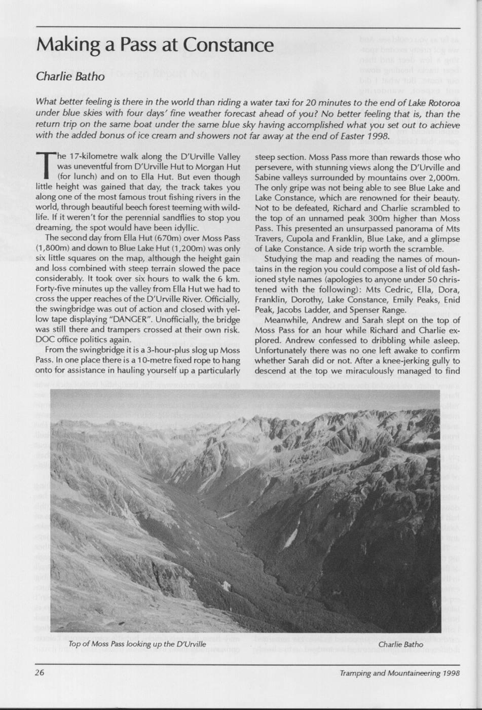
Making a Pass at Constance Charlie Batho What better feeling is there in the world than riding a water taxi for 20 minutes to the end of Lake Rotoroa under blue skies with four days' fine weather forecast ahead of you? No better feeling that is, than the return trip on the same boat under the same blue sky having accomplished what you set out to achieve with the added bonus of ice cream and showers not far away at the end of Easter 1998. "he 17-kilometre walk along the D'Urville Valley steep section. Moss Pass more than rewards those who was uneventful from D'Urville Hut to Morgan Hut persevere, with stunning views along the D'Urville and (for lunch) and on to Ella Hut. But even though Sabine valleys surrounded by mountains over 2,000m. little height was gained that day, the track takes you The only gripe was not being able to see Blue Lake and along one of the most famous trout fishing rivers in the Lake Constance, which are renowned for their beauty. world, through beautiful beech forest teeming with wild- Not to be defeated, Richard and Charlie scrambled to life. If it weren't for the perennial sandflies to stop you the top of an unnamed peak 300m higher than Moss dreaming, the spot would havel been idyllic. Pass. This presented an unsurpassed panorama of Mts The second dayt from Ella Hut (670m) over Moss Pass Travers, Cupola and Franklin, Blue Lake, and a glimpse (1,800m) and down to Blue Lake Hut (1,200m) was only of Lake Constance. A side trip worth the scramble. six little squares on the map, although the height gain Studying the map and reading the names of mounand loss combined with steep terrain slowed the pace tains in the region you could compose a list of oldi fashconsiderably. It took over six hours to walk the 6 km. ioned style names (apologies to anyone under 50 chris- Forty-fiver minutes up the valley from Ella Hut we had to tened with the following): Mts Cedric, Ella, Dora, cross the upper reaches of thel D'Urville River. Officially, Franklin, Dorothy, Lake Constance, Emily Peaks, Enid the swingbridge was out of action and closed with yel- Peak, Jacobs Ladder, and Spenser Range. low tape displaying "DANGER". Unofficially, the bridge Meanwhile, Andrew and Sarah slept on the top of was still there and trampers crossed at their own risk. Moss Pass for an hour while Richard and Charlie ex- DOC office politics again. plored. Andrew confessed to dribbling while asleep. From the swingbridge iti is a 3-hour-plus slog up Moss Unfortunately there was no one left awake to confirm Pass. In one place therei is a 10-metre fixed rope tol hang whether Sarah did or not. After a knee-jerking gully to onto for assistance in hauling yourself up a particularly descend at the top we miraculously managed to find Top of Moss Pass looking up the D'Urville Charlie Batho Tramping and Mountaineering 1998
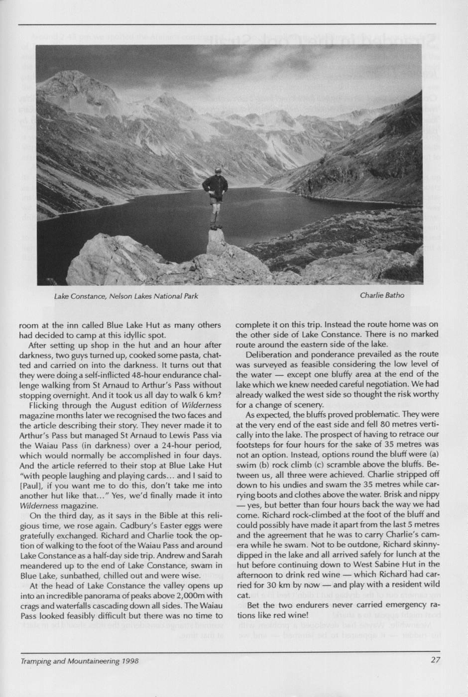
Lake Constance, Nelson Lakes National Park Charlie Batho room at the inn called Blue Lake Hut as many others complete it on this trip. Instead the route home was on had decided to camp at this idyllic spot. the other side of Lake Constance. There is no marked After setting up shop in the hut and an hour after route around the eastern side of the lake. darkness, two guys turned up, cooked some pasta, chat- Deliberation and ponderance prevailed as the route ted and carried on into the darkness. It turns out that was surveyed as feasible considering the low level of they were doing a self-inflicted 48-hour endurance chal- the water except one bluffy area at the end of the lenge walking from St Arnaud to Arthur's Pass without lake which we knew needed careful negotiation. We had stopping overnight. And it took us all day to walk 6 km? already walked the west side So thought the risk worthy Flicking through the August edition of Wilderness for a change of scenery. magazine months later we, recognised the two faces and As expected, thel bluffs proved problematic. They were the article describing their story. They never made it to at the very end of the east side and fell 80 metres verti- Arthur's Pass but managed St Arnaud to Lewis Pass via callyinto the lake. The prospect of having to retrace our the Waiau Pass (in darkness) over a 24-hour period, footsteps for four hours for the sake of 35 metres was which would normally be accomplished in four days. not an option. Instead, options round the bluff were (a) And the article referred to their stop at Blue Lake Hut swim (b) rock climb (c) scramble above the bluffs. Be- "with people laughing and playing cards.. andlsaid to tween us, all three were achieved. Charlie stripped off [Paull, if you want me to do this, don't take me into down to his undies and swam the 35 metres while caranother hut like that... " Yes, we'd finally made it into rying boots and clothes above the water. Brisk and nippy Wilderness magazine. yes, but better than four hours back the way we had On the third day, as it says in the Bible at this reli- come. Richard rock-climbed at the foot of the bluff and gious time, we rose again. Cadbury's Easter eggs were could possibly have made it apart from the last 5 metres gratefully exchanged. Richard and Charlie took the op- and the agreement that he was to carry Charlie's camtion of walking to the foot of the Waiau Pass and around era while he swam. Not to be outdone, Richard skinny- Lake Constance as a half-day side trip. Andrew and Sarah dipped in the lake and all arrived safely for lunch at the meandered up to the end of Lake Constance, swam in hut before continuing down to West Sabine Hut in the Blue Lake, sunbathed, chilled out and were wise. afternoon to drink red wine which Richard had car- At the head of Lake Constance the valley opens up ried for 30 km by now and play with a resident wild into ani incredible panorama of peaks above 2,000m with cat. crags and waterfalls cascading down all sides. The Waiau Bet the two endurers never carried emergency ra- Pass looked feasibly difficult but there was no time to tions like red wine! Tramping and Mountaineering 1998
Comments
Comments are not open yet.