
Text taken from the club newsletter.
THE ROUTEBURN
TRACK by AMELIA WHITE
Friday afternoon I was trying not to worry. Reports in from Queenstown were not good—a severe storm had just gone through and the Glenorchy Road was closed due to tree-fall. Thankfully, by the time we got to the airport on Saturday afternoon, the roads had been cleared and power had been restored to the district.
Our adventure began at Queenstown airport, where Claire’s pack lost a strap when she tried to pick it up to carry it to the taxi stand. Oh dear. A pack with only one shoulder strap is no use for a 3-day, 32 km tramp. Grabbing a taxi the ½ km to our accommodation (because our bags were huge and it was trying to rain on us), we started Googling for pack hire, trying to find one local at Remarkables Park. No such luck. We sent Claire off on the bus to Queenstown to pick up a hire pack in town, while we aimlessly wandered the supermarket for ages getting our tramping food and something for dinner.
Sunday morning dawned incredibly fair, if a little nippy. Up stupid early to get everyone through a last shower before we hit the track, we were all just nicely ready when our shuttle arrived to collect us. The amount of treefall on the side of the road was incredible. It was amazing what the roading staff had managed to clean up since the storm.
We were among the first on to the track that morning, our five, two others who shared our van, and a group of guided walkers all heading off at about the same time. We overtook each other with regularity past the first gorgeous waterfall, and all the way to the riverside where we stopped for morning tea and to soak in the atmosphere of exactly where we were, and what stunning weather we had (just in case it didn’t last—Fiordland weather is fickle!).
Cruising on up the valley, we got to Routeburn Flats Hut at a good time for lunch. Yes, it had taken longer than the DOC suggested time to get there, but while we had fine weather we didn’t care. Chilling out in the sunshine at a picnic table on the grass in front of the hut was blissful. This is somewhere I am determined to get back to. The hut is clearly designed with day walkers in mind, having a huge covered space with benches, sinks, tables and seats.
The rest of our day’s walking was uphill. All of it. So in went my earbuds and off I went. We agreed before we headed off that we would all climb at our own pace, taking long stops in a couple of specific locations, with the person at the front regularly waiting for sight of the person at the back, and each person stopping when they wanted to, for however long they wanted to, since we all walked at different paces up hill.
The climb was a long, plodding slog. I expected to be at the back (like I normally am on club trips) but instead I arrived first in just on 1½ hours, and the others dribbled in one every 5 minutes after that. I had planned to walk back down the track and find the back marker, since I was feeling good, but by the time I had greeted each person and celebrated with them that we had made it, the next person had arrived.
Snagging ourselves some bunks, we also grabbed a prime position on the deck, where we had a view out to the peaks on the opposite side of the valley, and chilled out for a while. It was still early afternoon, but Routeburn Falls Hut was already largely in shade. As we regained a bit of energy, we went for wanders up to the falls proper, and down to the prominent rock below the hut (which is so popular it really needs a track built to it rather than the scramble over slippery boulders that you take at the moment).
Dinner was endured, the hut talk from the ranger was hilarious, and we all stayed up late enough for the lights to turn on. The early loss of sunshine meant the bunkroom was quite cold—and the dining room was only warm because the ranger had lit the coal range around 5 pm.
Waking at 6 am Monday for a toilet break, I discovered that some keen beans were already up, packed and on their way out for the day. The beginning of the morning was beautiful and I contemplated just staying up, but opted to go back to bed for a bit more rest as I knew we had another chunky climb and big descent ahead of us.
Breakfast, pack and a little bit of housekeeping later and we were on our way. Two steps off the deck and the climbing that would be the bulk of our day started. We dawdled our way up to the top of the falls, enjoying our last views over the Routeburn Valley. Then we turned into the upper valley below Harris Saddle. Wow. The valley opening ahead of us was immense. And incredible. The track vanished into the distance where we could see tiny people walking ahead of us.
We took a lot of photo stops on the climb up to Harris Saddle, including to play with some of the fresh snow that had fallen during the storm earlier in the week, and to watch an Australian family climb a huge rock to get a great photo. We briefly debated stopping for something to eat on the promontory overlooking Lake Harris, but opted to continue on the 500 m to the shelter at the saddle and have an early lunch (so we could claim to bag it by stopping in and eating there). We somewhat regretted this decision, as the promontory had been sheltered from what was actually quite a cool breeze that became
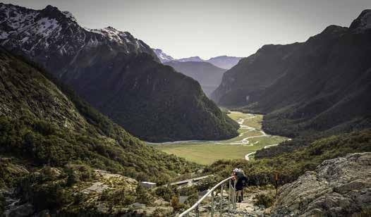
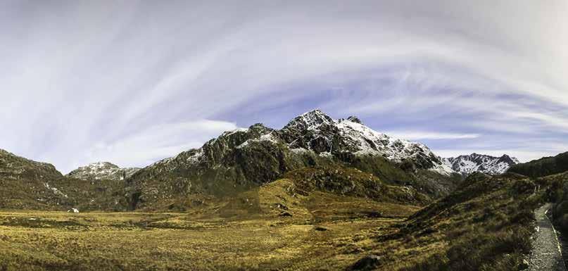
Looking down the Routeburn
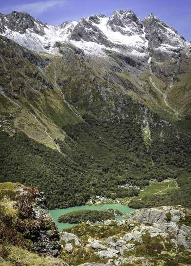
First view of Lake apparent at Harris Saddle Shelter.
Lunch at Harris Saddle was ridiculously early—not long after 11 am. But we figured from the map that it would be our last place to stop and stretch out for a good couple of hours at the pace we were all going. The trip along the Hollyford face is a bit of a blur for me. For a range of reasons (including running out of water and the glare of the sun) I wound up with a near migraine. The views through this part of the day became a bit monotonous, compared with what we had been experiencing, since we were simply walking above the Hollyford Valley for several kms. Some parts of the track are quite tremendously exposed through here, which left some members of our party struggling.
Laurie and I wound up pushing ahead to try and beat my migraine to the hut, leaving the other three behind as a group to make their way at their own pace. Just before we started off, having left a message with the Australians to pass on to Ange, Marion and Claire (who we were confident weren’t far behind us), we saw Ange bounding up the track with no pack on. “Oh feck” went the murmur through the six of us. Thankfully, Ange was just coming to tell us they were fine, just slow, struggling a little with the exposure and Claire having a sore foot and were more than happy to just see us at the hut. I was loathe to break the group up to the extent we were going to. But if I slowed myself down to Claire’s pace with her sore foot, I would have been blind from the headache before I reached the hut.
We tried to cheer them (and ourselves) up by telling them the top should be “just around the corner” (we had checked the map). This was a lesson in how big a distance “just around the corner” is, in such a landscape. Turning the corner at that point, where we thought we had done the last of the uphill sidle and should be starting to drop again was the only point of the trip where I really struggled—more uphill. We were sure the ranger the night before, and the track profile in the brochure had said it was “basically all downhill” from Harris Saddle to Mackenzie Hut. What a load of bollocks. It was a bumpy sidle that seemed a lot more uphill than down and ended with a vicious wee climb (although that may be the migraine clouding my memory!).
A seat in the shade with lots of water, no pack and no sunhat was such a blessing once we finally got to Mackenzie Hut, first spotted as a tiny dot all the way down there. Laurie and I collapsed on the front deck of the hut at about 3:15 pm, just over 7 hours after we left Routeburn Falls (although we did spend nearly an hour at lunch). We dithered for a bit about bunk spaces, eventually signed ourselves in, changed out of our sweaty clothes and into lightweight alternatives (it was still 22 degrees at the hut at 6 pm, despite being at nearly 900 m amsl) and settled in to wait for the others, hoping they weren’t too far behind.
Our relaxed state started turning to nerves as our self-imposed “will go looking for them” (to make sure nothing had happened) time started to draw closer. We asked people as they ambled in if they had seen them, and most indicated their last sighting had been somewhere up on the switchbacks above Lake Mackenzie. Finally, the ranger (who we had seen way up on the Hollyford face) came through and said he had seen them only a couple of minutes prior, taking the turnoff for the high water track. Finally, over 2 hours after Laurie and I arrived, and nearly 4½ hours since we had last seen them, they stumbled in, clearly relieved to be there and be able to take their packs off.
Another dinner was endured (freeze-dry is not really my ideal food, but with 5 kg of camera gear, I was weight saving wherever else I could). We all had a quick wade into the (very cold) lake and wandered around in shorts, singlet and jandals till it was time for the hut talk. We had this on the deck in the sunshine which was bliss— until the sun suddenly vanished and the temperature dropped about 10 degrees in 2-3 minutes. I was stuck in the middle of the group, unable to get out surreptitiously, still in my lightweight warm-weather clothes. Not ideal!
Bedtime followed almost immediately after the hut talk finished (the ranger was certifiable, and hilarious), with a plan to definitely be off early in the morning to allow extra time for managing Claire’s sore foot.
Allowing ourselves 6 hours to complete the track that was indicated to take 4 to 4½ should be plenty, right?
Amazingly, Tuesday morning dawned brilliantly fair again. What a run of weather we had hit! The forecast was for rain “mid afternoon”, which suggested we may just miss it with our 2 pm pickup. The track from Mackenzie hut ambles along with a few climbs for a while, then starts to sidle past a couple of gorgeous waterfalls. We left Laurie at the first to take photos, agreeing to wait for her at the second if she didn’t catch us before then. She caught up to us as we arrived at the massive Earland Falls, which were beyond incredible.
Lunch was a hurried affair, watching the new batch of guided walkers arrive to be greeted with chocolate biscuits, hot tea and coffee and raro on the few picnic tables outside the hut, leaving us standing along the front of the deck. Laurie checked herself in for her night at Howden, grabbing just her camera kit, water and jacket and then hefting Claire’s pack onto her back instead, to help Claire get up the hill in better time. This worked a treat, those of us who left 5 minutes after her didn’t catch her on the slog up to the Key Summit turnoff.
Here we said goodbye to Laurie, who was continuing on to do the Caples track without us. Marion and I stretched out our legs and whipped down the hill as fast as we could to ensure we made it to the carpark before the “15 minutes or so” grace from the shuttle ran out, arriving at about 1:50 (which means, even at our good pace, it still took the full suggested 45 minutes down the hill). Dumping packs and grabbing a drink, Marion headed back to see if she could help the others, who walked out at 2:01 under their own steam, totally stoked (as well they deserved to be!).
Back to Queenstown in the shuttle, windows wide open almost all the way because it was still really warm. We grabbed dinner from the supermarket across the road from our accommodation, and then most of us headed for a walk to the pools (about 2 km) for a shower and then swim, which was absolute bliss after three long days walking!
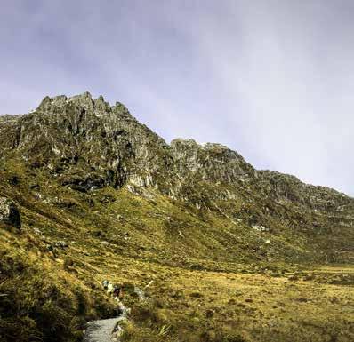
Harris Basin
Those on the trip were: Laurie, Ange, Claire, Marion, Amelia.
Comments
Comments are not open yet.