
Text taken from the club newsletter.
THE TASMAN WILDERNESS
An appetiser by IAN HARRISON
The Plan
I grew up in Golden Bay so Kahurangi National Park (or NW Nelson Forest Park as it was then) was where I developed my tramping legs. Being inexperienced and not one to push boundaries I pretty much stuck to the main routes, but remember hearing of a few hardy souls that would go into the valleys of the Roaring Lion, Beautiful and Ugly Rivers, and I thought that sounded like places I’d like to go one day. One day happened to be about 30 years later….
Somehow I convinced Megan that it’d be good to do a trip up the Roaring Lion to Lake Aorere. Debbie heard of our plans and was keen to join us. Four’s a better number than three so we asked Spencer if he would like to come too; correctly thinking he wouldn’t need much convincing.
Compiling the team was much easier than deciding what route to do. I had thought that taking a week’s leave from work should be enough time but soon realised that if we were to do the ideal route up the Roaring Lion to Lake Aorere and out the Heaphy Track then we’d be cutting it too fine. We needed more days up our sleeve for bad weather and rest days.
Numerous other options and variations of those options were discussed, but in the end Winston decided for us. Winston was the strongest tropical cyclone to make landfall in Fiji in recorded history, and the rather damp remnants of it were due to arrive in NZ mid-week, so we wanted to be out of the valleys by then. As a result our plan became: walk up the Cobb Valley to Round Lake, drop into the Roaring Lion and then come back up Breakfast Creek to Lake Henderson. From there we would have some easy days either in the Cobb Valley or on the Tablelands while Winston was visiting.
I had arranged transport with Jenni of Kahurangi Guided Walks. This proved to be a good choice. My Dad had offered the use of my parent’s old car, but having a shuttle service gave us flexibility of where we could come out. Also Dad discovered a couple of days prior to our trip that the gearbox in the old car had developed issues—mainly that the car had to be drawn to a complete halt to change gear!
Into the wilderness
Saturday morning dawns clear and warm in Golden Bay. When we get picked up by Jenni there is also an older English gentleman in the van she’s taking on a day walk in the Cobb Valley. He seems impressed that we were going where there were no tracks or huts. We don’t feel impressive, and become progressively less impressive over the afternoon as we walk up the Cobb Valley under a hot sun with heavy packs. After a long day we make the final climb up to Round Lake, pitch the tents, listen in to the distant crackle and voices of the mountain radio evening sched, have dinner and go to bed.
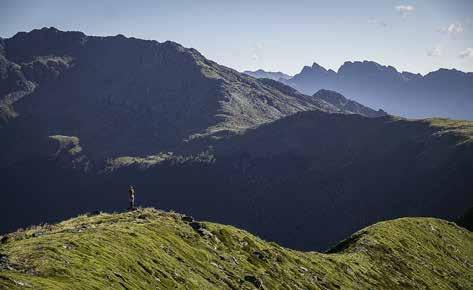
The next morning lives up to the forecast of fine weather. Cresting the Peel Range we get our first views across the Wilderness Area. It’s big and gnarly country with inaccessible ridges and difficult access to the valleys. Its inaccessibility was demonstrated by Frederick Gibbs, a Nelson identity in the early 20th century. He was convinced a gold deposit lay somewhere in what is now the Wilderness Area. Government geologists had noted a deposit of a huge gold reef in 1908, but were so exhausted and hungry they didn’t take any samples and it was all they could do to get back out to civilisation with their lives. Gibbs spent much of his life running trips to find the lost El Dorado but was repeatedly thwarted by the terrain and the deposit has never been found. The book Lost Gold by Paul Bensemann documents Gibbs’ search and much more besides and is an excellent read.
Our destination for the day is the Roaring Lion, lying one kilometre below us and three kilometres in front of us – and I’m pretty sure nowhere near any gold reefs. The first part of our route is easy travel along a ridge where we step over an imaginary line and in the eyes of the law on to an 87,000 hectare parcel of land which is associated with the statutory action: “[Create] Wilderness Area [Tasman Wilderness Area] New Zealand Gazette 1996 p 1641”. It turns out to be something of a day of losses. The first indicator of this is when Spencer realises he’s sprung a leak. Water is streaming out of his bladder (the plastic one, not the bodily one) matched only by a stream of swear words coming out of his mouth. Pushing through stunted beech the nozzle on the end of his plastic drinking tube had got hooked up and pulled off. He had noticed this fairly immediately for obvious reasons and between the four of us we find the nozzle which he’s able to reattach.
A bit past point 1352 we set our compasses to due west and really start losing height. I feel like a deep sea diver with forest replacing ocean and a heavy pack replacing air tanks. Lead boots are replaced by only marginally lighter tramping boots. Our descent is relentless until we reach a small level area around midday which makes an ideal lunch spot. We’re soon joined by a pair of bush robins. Robins are commonplace in Kahurangi and it’s normal for them to appear when stopping for a break. One of the robins is sporting a punk hairdo of sticky-up feathers. He’s acting
Debbie on the Peel Range like a punk too by chasing his mate away from the prime crumb drop zones beside us.
The last 300 m of descent requires some route finding to avoid bluffs. We continue heading west to stay clear of what looks on the map to be very nasty bluffs to our left. Picking our route down through the rock and trees Debbie realises her GPS has unclipped from her belt and now lies somewhere between us and the lunch stop. We mount a hopeless search for it which lasts only 15 minutes before we concede that the chances of finding it are vanishingly small. I also have a GPS so the loss is not a problem for this trip, but it’s an expensive bit of kit for Debbie to turn her back on; not to mention that she is going on a month’s tramping mission starting next week that she will need a replacement GPS for.
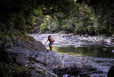
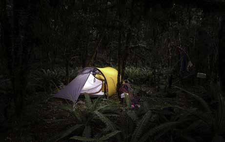
There only remains a little descending before we get to the forested river flats of the Roaring Lion. It’s a beautiful river and the travel is easy boulder hopping along its banks. Our mood improves with the lovely surroundings. After about an hour we find a nice campsite opposite where Downey Creek joins the Roaring Lion. The creek enters the river by way of a rock water slide that empties into a deep pool. It’s a stunning setting and to top it off our camping spot is covered with thick dry moss. We roll out our sleeping mats in the tents because we have them, but they aren’t really necessary. The only sand-fly in the ointment is, well, the sand-flies of which there is no shortage.
Breakfast (Creek) time
The next day dawns fine. According to the forecast we probably have a day and a half of fine weather before Winston pays us a visit. The plan for today is to continue following the Roaring Lion downstream for just short of
Roaring Lion campsite a kilometre and then head up Breakfast Creek to Lake Henderson. Tomorrow we’ll then go back to the Cobb and a hut to shelter from the rain.
Travel down the Roaring Lion is enjoyable. Our presence scares off three whio, but after we leave their section of the river I see them fly back to resume their occupation. We get to Breakfast Creek all too soon. It’s
Roaring Lion River a shame to leave the Roaring Lion after such as short time. There is a great camp site right at the confluence with Breakfast Creek, but not quite as nice as where we had camped.
An old guidebook from the 1980s describes the travel up Breakfast Creek as “exasperating”, but easier the higher up you go. This still proves to be the case. The path of least resistance crosses from side to side of the creek. Lower down there are a few log jams to get through and a small waterfall to get around. Although sometimes progress is slow there are no serious obstacles, and this is why Breakfast Creek has been used as a route into the Roaring Lion for over 100 years. Chaffey of Asbestos Cottage renown apparently would often come down here. We see some old rusty tins but there’s no sign of an old track. Near the headwaters the climb steepens considerably and the creek turns into a cascade. Once above the steep section the creek disappears underground as it drains Lake Henderson by seeping through a boulder field.
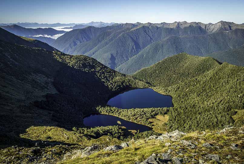
Lake Henderson is a welcome sight after a full day of bush-bashing and scrambling that included an 800 m elevation gain. The south-eastern end of the lake looks like it should be good camping, but the only flat ground is swampy. We can see the head of the lake has a flat looking beach so head there. After a dry summer, the water level of the lake is about two metres below what looks to be the normal level, and it’s an easy to walk around the rocky shore. Up close the flat beach isn’t so flat. Spencer finds a nice spot just above the beach that has obviously been used as a camp site in the past. He and Debbie pitch a tent there, but there’s no room for the other tent so Megan and I make the best of the sloping beach. The normal routine of having a wash and then dinner and mountain radio sched fills the rest of the evening.
Megan and I have a bad sleep. Although the slope is minimal there’s no getting around the fact that the force of gravity is greater than the friction between a sleeping bag and Exped mattress. So the night consists of sliding down our mattresses, waking up crunched up at the end of the tent, jigging back up to the mattress making lots of noise as only an Exped can and waking the other person
The Tablelands between squalls
(if they actually got to sleep somehow), and then sliding down again. The morning can’t come soon enough.
Winston Arrives
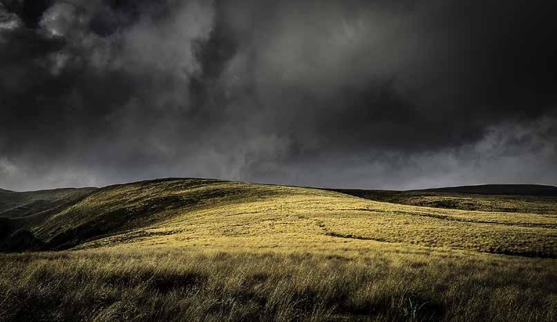
The next day is our forth of the trip. Cloud has come in and the showers arrive before we climb out of the basin in which Lake Henderson sits. We’re heading for a square notch in the ridge mid-way between the two high points 1643 and 1623. It’s good to be above the bush line for a change and to once again get a view out across the wilderness area. We then cross the ridge out of the wilderness area and head down to the Cobb Valley. We arrive at the historic Tent Camp for lunch having followed down an old but well used track to the west of the stream that drains Camp Lake.
We’re all feeling OK so make the decision to push on to Balloon Hut in the Tablelands. However, by the time we get to Chaffey’s Hut we’re starting to flag. Trilobite or Myttons Huts at the road end are looking better by the minute. When we finally get to Trilobite we feel like we’ve walked far enough for the day especially as the showers have turned to rain. However, a family with two young kids has taken over Trilobite, with camping supplies and an eye-boggling number of toys spread everywhere. We hang about outside in the rain contemplating if we should go on or not. Spencer goes for a look inside and is immediately challenged by the girl who’s no more than five years old: “What are you doing in my house?!” she says. That settles it. We’ll move on. Before we do we talk to a very friendly, fit but tired looking guy. He’s in the middle of some big tramping mission and had just come up Kakapo Spur from Roaring Lion Hut, which he said took him two hard days. He also said he is very tolerant and too tired to bother going anywhere else today, although he obviously would rather have more considerate hut mates.
Myttons Hut is occupied by some young hippy, road-end looking types. The hut’s too small to share so with morale at a low, we trudge on up to Peel Ridge. It’s slow going and for some reason I’ve got The Doors song “Love me two times” stuck on repeat in my head. I don’t know why; it is years since I’ve heard it. I’m tired and don’t have the mental wherewithal to change it and don’t even remember all the lyrics properly. Finally after about the 100th mental rendition of “Love me two times girl, one for tomorrow, one just for today”, we arrive at the top of the ridge. It’s clagged in and cold and windy. The light is beautiful though and Megan puts it perfectly saying the sub-alpine flowers glow like little gems in the tussock.
We’re very happy to arrive at Balloon Hut. There are a few others there, but they’re all nice people and very accommodating to us wet, scraggly end of day arrivals. The peak of the storm hits that night with thunder and lightning and we’re very happy to be in a warm dry hut.
My favourite type of day: Hut day
The other people in the hut have places to go the next morning so we have the place to ourselves. In the style of ‘Trilobite Girl’ Balloon Hut becomes our house and we spread out our wet gear to dry. Balloon Hut used to be a bit of a hole, but it has been refurbished in recent years and is a really pleasant hut in a great location on the Tablelands. Heavy rain persists for most of the day and we’re feeling very good about being warm and dry in a hut with as much hot tea to drink as we like.
The next morning we decide to move on to Salisbury Lodge which is only three easy kilometres away. We check in with the morning mountain radio schedule and ask that Jenni be contacted to pick us up the following day from start of the Asbestos track on the Cobb Road. Once we get to Salisbury we shake off some laziness and walk up Gordon’s Pyramid, with Spencer and Debbie going the long way back via the rock shelters. From the top I can see the distant waterfall draining Lake Peel is really pumping from all the rain. Debbie and Spencer come back with news that they came across a guided group of 20 students from the USA that had spent last night in Salisbury Lodge. We’re glad to have avoided them! One of the guides had doubts about being able to cross a couple of the streams on the Asbestos track if there is much more rain. There is quite a lot more rain in the night and so I can’t help but worry that we may not be able to get out.
Out
The next morning the rain eases off and the sun comes out by mid-morning. The rivers were up but don’t look too bad. The streams we have to cross are no problem at all, and we even see a whio near the track high above the Takaka River. Jenni arrives right on time equipped with a watermelon and oranges for us which we relish. We were not the only ones to experience heavy rain with the news reporting flooding in Nelson: “parts of Nelson Tasman were drenched by more than half a metre of rain over the past 48 hours. 528 mm was recorded at the Paradise rain gauge in the hills behind Takaka”.
Although my idea to tramp through the Tasman Wilderness Area wasn’t realised, it was a great adventure and I feel very fortunate to have been able to share it with Megan, Debbie and Spencer. I’m now thinking about plans for another attempt on the Tasman Wilderness Area. One taste isn’t enough.
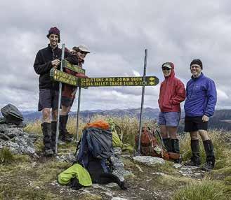
Those on the trip: Ian Harrison, Megan Banks, Debbie Buck, Spencer Clubb.
Comments
Comments are not open yet.