
Text taken from the club newsletter.
QUEEN CHARLOTTE TRACK
Ship Cove to Anakiwa by AMELIA WHITE
As a special treat, this trip comes with a playlist. Just Google the day titles if the song doesn’t immediately pop into your head. It also comes with some stats at the end for those who are still reading!
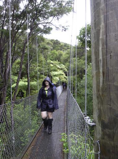
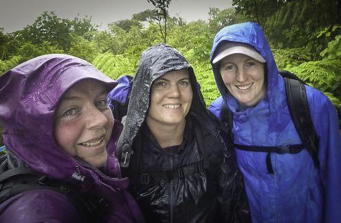
Unlike last time I did this day of the track, however, it didn’t stop raining on us on the way up to the lookout. If anything, it kept getting heavier. And heavier. This weather was not conducive to stopping with any sort of regularity, so no afternoon tea was had. Thankfully the rain eased slightly when we reached Tawa Saddle for a toilet and food break.
By the time we reached Furneaux, we were soaked to the skin. It was 5 pm and we still had an hour’s walk planned to get around to Madsens Camp where our bags had been dropped. Joy of Joys—Furneaux had a spare bunk room available, and for an extra $20 would go and collect our bags from Madsens. While we were aware that this would mean an extra 2-3 km / hour-ish of walking to do on Saturday, it also meant we had real shelter rather than a tent.
We were glad for real beds, and the chance to warm up in front of the fire, but Furneaux is a surprisingly run-down place. $56 per person for a backpacker bed gets you no cooking facilities, a concrete-block toilet akin to a back- blocks DoC campground and no real sheltered spot for getting stuff actually dry (unless you can nab a spot by the fire, which were scarce the evening we were there!).
Day Two: ‘Long Day’ (aka ‘The day that doesn’t end’) Putting sopping wet socks and boots back on in the morning is no-ones idea of a good time. Doing it in the knowledge that we were looking down the barrel of a probably 35 km walk with some big hills was dreadful.
The walk around the edge of Endeavour Inlet was dull, muddy and generally not fantastically pleasant. I begrudge nobody who takes up the offer of getting a ride across the inlet in conjunction with transporting their bags. Views are minimal, and the only excitement we had the whole three-odd hours it took us to Kenepuru Saddle was a fleeting glimpse of a stoat and seeing a pair of pukeko.
Thankfully, the weather was great for tramping—cool and overcast. If the rain of the day before (or the heat
Day One: ‘Ain’t no sunshine’ After spending the night with the parents of a friend (yay for being fed dinner and breakfast), we woke to the sound of rain on the roof. This was not entirely unexpected, although finding a forecast that actually indicated the amount of rain we should expect where we were going had been difficult.
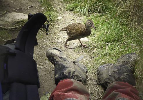
The rain spat at us while we collected our track passes and checked in for our water taxi. By the time we got off the water taxi at Ship Cove it was definitely raining. We quickly headed to the shelter for an early lunch and weka spotting. Yet again, it was too wet for me to want to wander up to the waterfall near the memorial—what is it with me and rain at Ship Cove?
of the day after) had still been with us at Kenepuru Saddle, we would have abandoned the trip across the top and instead opted for either a water taxi or a hitch to Portage/Torea Bay. Instead, lunch was had at Kenepuru Saddle, and at 1 pm we hitched our packs again in contemplation of either 23 or 24.5 km ahead of us to the next road junction at Torea Saddle (depending which signage/information sheet you were reading), including crossing the highest point on the track, at 481 m.
Onwards and upwards and upwards and upwards. We opted not to visit Eatwells Lookout when we discovered it was a 30 minute return walk. This was a stupid long day as it was and we already knew we would be pushed for daylight.
Pausing at Bay of Many Coves Campground at 5:30 pm for painkillers, refilling water bottles (thank goodness the tanks had filled a bit, having been empty in early January) and food, we ran into a German couple, through-walking Te Araroa Southbound, who were continuing on to Black Rock Campsite. Leaving a campsite at 5:45 pm with 15 km still to go seemed entirely wrong.
We found the German couple again at a saddle 8 km later— right where Black Rock campsite should have been according to the distances suggested on all the signage. It was still another 2 km/ 30 minutes away. Boo. Another break there for the toilet and on we pushed, only to be stopped about 1 km later, first by my blisters, then by a sudden torrential downpour.
Our final 4 km for the day was in increasing darkness and rain, though thankfully it was mostly nicely graded downhill that my sore knee could cope with ok as the track was also in good condition. Eventually, we popped out on the road at Torea Saddle, desperately wishing we had the phone number for our accommodation at Treetops to call and ask for a pickup. 9 pm and we finally knocked on the door of the backpackers, tired, sore, damp, and beyond the point of being able to deal with a walk down the dark path to the main backpacker building to use the kitchen. Thankfully the owner gave us a jug of hot water for tea, and we all had sandwiches for dinner around having showers before heading straight to bed.
Day Three: ‘I dare you to move’ Saturday night I went to bed in tears. My boots were falling apart and causing the most incredible foot pain (the wet boots for 35 km issue hadn’t helped either, obviously). For some reason, I had left my sneakers in the car in Wellington, taking only my jandals as spare footwear, despite having our packs transferred. I didn’t want to carry on. In retrospect, I possibly shouldn’t have.
Our lovely host gave us a ride to Torea Saddle to start the track, and we started inching our way up the hill. Unlike the previous two days, we actually saw a moderately significant number of people on the track over the course of the day, going both ways. Oddly, given we had taken a photo with a 21 km marker before exiting the track the day before, at the bottom of the southbound track here was a 24 km to go marker. Yet more proof that the track lies. By this stage, lookouts often had views to Picton itself, which was tantalisingly close, yet also so far away, since we were heading further south and west yet. At one of these stops, we again saw our German friends, powering on through the heat. Guess being 3 months into Te Araroa will do that for you!
Progress was agonisingly slow. The heat compounded the pain I was already experiencing. We struggled to maintain a pace any faster than 2 km/hr and I admit to collapsing in tears on our way down one of the hills when looking at the next climb back up. We took a number of long breaks to deal with the heat, and finally stumbled into Mistletoe Bay at 4 pm, 6 hours after we started our 8 km day. Mistletoe Bay was incredible. While it was a bit frustrating having to collect our bags from the wharf and walk them nearly 1 km through the camp to the house we were staying at, this was offset by the fact that the water at the wharf was incredible for swimming in, there was a shop selling ice cream, Powerade and fresh eggs, and the house had not only a full kitchen, but air conditioning (even if the unit leaked, it at least got the house cool quickly!).
After dinner (chorizo fried rice), we showered, had wine and read our books for a while before taking a short wander to exclaim at the sheer volume of visible stars and the glow worms in the immediate area by our house. The darkness here was incredible. Plans were made for a 5 am alarm to see the Milky Way and watch the sunrise and we all headed to bed.
For some unknown reason, I decided to have my first Coke in 2 weeks at 7 pm. I was wired still at bedtime. Whoops.
Day Four: ‘Eyes on the prize’ At 2 am the smoke alarm in our house goes off. Thankfully it’s not connected to a main system, so we could just turn it off by taking out the battery. But after investigating to ensure there actually wasn’t a fire anywhere it still took 2 more hours to get back to sleep, through many imaginings of headlines ‘alarm on bench with battery taken out, 3 dead’ ….
At 5 am the phone alarm goes off. If the weather had been clear, even having been awake in the middle of the night would not have kept me in bed. We would have been in the perfect location for an awesome Milky Way shoot and sunrise. It was not to be. Overnight it had completely clouded in. So back to sleep we went.
Finally up properly about 7:30 am we cooked breakfast (bacon, eggs and fried rice. Divine.), packed up, delivered our bags back down to the wharf and I finally strapped on my disintegrating boots at 10 am. We had about 12 km ahead of us, and 6 hours to do it in. If we could get back to the pace we had managed on days 1 and 2 (about 3 km/hr) we would be fine and have time to spare.
The climb back up to the saddle wasn’t too bad, and we made really good time all the way along, managing a few good breaks and allowing several shorter ones. We made some track friends through this section, bunny hopping each other frequently when we each stopped.
Nursing my dead boots and painful feet into Anakiwa was almost anti-climactic. I had built it up into this massive achievement potential, but it just … happened. And was done. And I was too sore to just keep walking to the end of the pier and walk straight off. I suspect that had my feet not been in agony, I might have been more excited rather than simply relieved of what had become a mental burden, this NEED to finish the track. The tide being in a long way also put a dampener on my plans to throw my boots off the wharf (because I wasn’t going to leave them in the water, so needed someone there to grab them before they sank).
An ice-cream, a break in the shade, and a very quick swim—shortened by the realisation that the Cougar Lines boat waiting at the wharf WAS for us, rather than a half-hour earlier trip and would leave as soon as everyone was on board—and it was time to head back to Picton, boots still in hand.
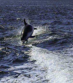
Probably the highlight of the whole trip was the dolphin pod we encountered on our trip back to Picton. Throwing away my boots was bittersweet, and I’m so glad we nabbed a cabin for our trip back to Wellington—hot showers and a dim, quiet room to round out the trip.
THIS TRACK LIES According to the official map online (which is the most widely published one around, used by tour operators and on the walls at several accommodation providers), it is 71 km from end to end on the track, plus any detours to accommodation off the track (say, in Portage or Mistletoe Bay), including taking the route along to Camp Bay and then up.
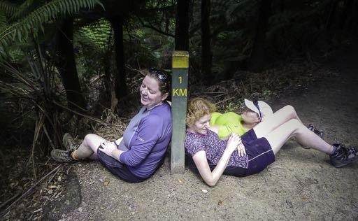
According to signs along the way, the track varies in length from 67.6 km to 76.6 km. The most egregious differences are at Torea Saddle. A short distance (about 1 km) before the saddle, coming from the north, is a 21 km to go track marker. At the start of the south bound track is a 24 km to go marker. The sign here also indicates that the section to Te Mahia Saddle is 12.5 km, while every other record shows it as 7.5 or 8.5 km.
Also annoying is that the track junction below Kenepuru Saddle says it is 8 km to Bay of Many Coves Campsite. Once you reach Kenepuru Saddle (1.5 km later), THAT sign suggests 10 km to Bay of Many Coves Campsite. Every piece of information southbound says the distance between Bay of Many Coves and Black Rock Campsites is 8 km. It’s 10 km, and the signs heading northbound accurately reflect this.
Mostly, we found the variations hilarious. The only really annoying one was reaching a saddle where we expected Black Rock Campsite to be at about 7 pm, and finding a sign indicating it was still 30 minutes away. The sign at Torea suggesting it was going to be a 12 km day on excruciating feet and in serious heat was also not so easily laughed off. Thankfully that sign was well and truly wrong.
Party: Angela, Marion, Amelia
Comments
Comments are not open yet.