
Text taken from the club newsletter.
TWO THUMBS RANGE by STUART BEBAN
With Kevin Cole, Uta Benecke, Matt Cowan
Day 1 – Mt Gerald Car Park to Stag Saddle
With our 21 kilogram packs we drove the short distance from Tekapo Village to the trailhead—cold mountain air and the big days ahead creating a sense of anticipation. Our plan was to spend the next week roaming less travelled areas around the top end of Lake Tekapo. Te mapped route we had created in Wellington was full of features that had exciting sounding names like Two Tumb Range, Brabazon Saddle, Beuzenberg Peak, Alma Col, Black Birch Creek and Trojan Stream. Tere were also very few marked trails on our planned route which gave it a great sense of adventure compared to the conventional orange triangle fare.
Afer parking the car, the temperature quickly warmed up and we had a largely cloudless day. Tis first stage was a relatively simple but somewhat energy-sapping ascent, following a fence line up to a small private hut called Rex Simpson Hut, where we had lunch. We then continued our climb up to the main ridgeline, joined the Te Araroa Trail and headed towards Stag Saddle. We came across several hiking parties coming down from the nearby Beuzenberg Peak. Tey were wrapped up warmly in comparison to us and advised that it was uncomfortably cold where we intended to camp near the saddle. On arrival however, we managed to find a nice sheltered spot in the lea of the wind.
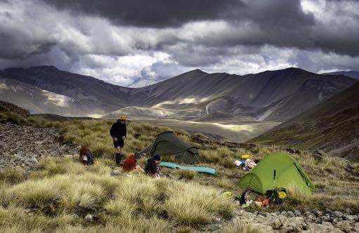
Once settled, we began our nightly ritual for the next seven evenings. Tis involved pitching the tents, cooking our communal meal, cleaning up and finally setting up the mountain radio. Te radio had two long wire cables that attached to a central unit. Tese cables need to be elevated in the middle to create a triangular shape. Ideally a tree would be used for this but in this terrain as none would be available, we improvised with two walking poles cable tied together. We then sat around and waited for the weather forecast. Tere is something vaguely comforting about listening to the crackling voices coming over the radio. (Pro tip: in order to avoid missing anything or confusion, use the voice recording application on your mobile phone to record the forecast).
Day 2 – Stag Saddle to Third Waterfall Stream
Tis was to be our first full day on the tops loosely following the same ridgeline as yesterday. Te weather was perfect with the terrain a mix of gentle scree and knee high tussock. We had incredible views of mountains which we couldn’t quite agree on the name of, even with all our technology. It was reasonably easy going but with our heavy packs and there being little shade from the sun, we were slowed down considerably. An alpine tarn provided a nice lunch spot but by mid-afernoon we were cooked and we opted for a decent camp spot at Tird Waterfall Stream. We amused ourselves by bathing in the stream and spotting tahr and chamois in the distance.
Day 3 – Third Waterfall Stream to Packhorse Stream
We had a challenging day ahead of us as we hoped to get to Crooked Spur Hut for lunch and possibly over to Brabazon Saddle for the evening. Tis would prove to be overly optimistic.
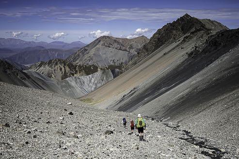
We started with an ascent up Tird Waterfall Stream and back onto the main ridge. Te route took us past some terraced alpine tarns and then onto very loose scree slopes. It was a matter of looking out for the larger rocks for more secure footing when the path became more treacherous. We eventually reached the top and were confronted with a narrow, jagged ridgeline that was different to anything we had yet experienced and probably beyond our collective technical means. So we decided to drop off the ridge on the other side but there wasn’t an immediate, logical point of egress. Afer several minutes of reconnaissance, we found a small notch that led down a very steep scree slope. It was the kind of rock formation that the Flintstones may have utilized as an escalator and it made for fun, quick travel off the ridge.
Once off the ridge, it became clear that the most obvious way to continue our planned journey was to get back up onto it at a more navigable point. Afer a brief meeting a route was agreed upon that took us up some easy-looking scree slopes. However, our eyes betrayed us and the scree was very loose and the gradient steepened significantly towards the top. Tis was very much ‘Type Two Fun’, or ‘sketchy’ for those of us who don’t like heights as there was a large amount of scrambling and climbing up crumbling rock faces. Afer regaining the ridge we eventually made it to Captains Peak, at 2,371 m the highest point that we reached during the trip. Here we rested, admired the amazing views and re-evaluated our plans for the day as it was now mid-afernoon. Crooked Spur Hut was no longer a viable option and the ridge looked like it would involve a good deal more (time-consuming) scrambling. With discretion being the better part of valour, we took another scree escalator down to Packhorse Stream to look for a camp site. Our descent was enlivened by a number of tahr thundering down a ridge in front of us, kicking up a large dust cloud. Our camp site was well situated and we could continue to observe the skills and habits of the animals on the surrounding mountainsides while we cooked dinner.
Day 4 – Packhorse Stream to Crooked Spur Hut
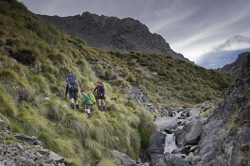
Te day before having taken a toll and with a long night due to some strong winds, we settled for a shorter day down to the intersection with the Te Araroa Trail and over to Crooked Spur Hut where we could stay for the evening. Te route out of Packhorse Stream required us to stringently follow the watercourse. It was a steep sided and slippery ‘river-bashing’ route over grass banks and slips. Tere were several times where we had to backtrack to negotiate tricky sections.
Te stream reached a confluence and we spotted our first orange triangles of the trip that signified we had joined the Te Araroa Trail. Tere were numerous chamois and tahr around the trail path. Apparently chamois are more social than tahr and that was obvious as we got within 20 or so metres of some groups of chamois. Te tahr tended to be more flighty and scamper to higher ground when approached.
Te trail went up to a small unnamed saddle and then descended down to the hut. Tere was some drama at the hut where a hunter had taken seriously ill. A beacon had been activated and the hunting group was anxiously waiting for a rescue helicopter from Christchurch. Te helicopter turned up in what appeared to be very quick time and took the stricken hunter and his friend out to safety. Te one remaining member of their party was kind enough to share with us some meat they had obtained that he could no longer carry out alone.
Afer the hunting party had all lef, we cooked the meat (tahr—yes, very gamey) and had a relaxing afernoon sleeping, reading and chatting. Te cloud had come in and some spits of rain gave us concern for the next day.
Day 5 – Crooked Spur to Black Birch Creek via Brabazon Saddle
Te forecast rain did not materialize but there was a cold mist when we awoke which was a welcome change from the prior hot days. We descended from the hut into the upper reaches of Bush Stream. Te first objective for the day was to cross over Brabazon Saddle. We followed the stream until it petered out and then climbed a broad scree slope to the apex of the saddle. Unlike our previous days, the scree was solid and the gradient gentle. Tere was some slight zig zagging required at the top but that was primarily for energy saving.
Our timing was impeccable with the mist evaporating as we reached the top of the saddle revealing clear sunny skies. We had some great views of Split Peaks and down into the Black Birch Creek catchment. Tis had been our most productive morning so far and we set our sights on going over Inkerman Saddle into Alma Stream afer we completed the one kilometre or so of river bashing down to the Black Birch Creek flats.
Unfortunately, this again proved too optimistic as we struggled with some complex river bashing meaning that we took over three hours to complete the one kilometre of travel. A good indicator is that if you see mountain animal/ tahr bones on a trail then you probably should be wary of walking there. Tere were many animal skeletons strewn around as we negotiated steep gorge walls, traversed rock slips and clung onto wild Spaniard as a last resort against falling. Our exposed skin was turning into a patchwork of cuts, grazes and scrapes but we kept persevering until we finally reached the confluence with Black Birch Creek.
It was now late in the afernoon and we decided that we should continue to walk towards Inkerman Saddle and find a decent camping spot for the night. We found a suitable spot with a small swimming hole nearby where we could have a soak, freshen up and soothe our bones in the cold water.
Day 6 – Black Birch Creek to Trojan Stream via Inkerman Saddle and Alma Col
Today was to be the big day of the trip. We would cross over Inkerman Saddle and head up to Alma Col at 2139 m. Te upper reaches of Black Birch Creek provided more river bashing opportunities and challenges. By now we were getting much better at this and it wasn’t much of an effort compared to the two previous days. Te ascent of Inkerman Saddle was uneventful aside from spotting numerous tahr and chamois on the mountain slopes. Once at the saddle it was a simple walk dropping down into Alma Stream.
We had a lunch at Alma Stream confluence and looked up at Alma Col 1,200 m above us. Tere was still a small snow pocket beneath the saddle which would be unavoidable if we were to get to the top. More uncertainty but it is these kind of small challenges for the intermediate tramper that make this kind of country so rewarding.
Te climb began on large glacial rocks which formed several terraces before the slope narrowed and we entered into the crux of the climb. With Kevin being the most experienced in this kind of terrain, he took the vanguard and led the rest of us up towards the snow. Luckily we didn’t have to do much walking on the snow and, apart from a short section of very fluid scree, the gradient levelled out and we reached the col relatively comfortably.
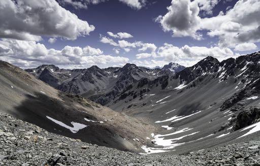
Te col had amazing views of Aoraki/Mt Cook and its neighbouring mountains. It was a privilege to be able to sit there in blazing sun amid the quietness and contemplate the effort that had got us to this point. Also while in deep contemplation, we quickly and unanimously agreed that we wouldn’t do the other col the following day (Plata, which we could see in the distance) but in the morning would take the route down the stream instead.
Once up and about again, we dropped off the col rapidly, slid down some snow patches, drank ice cold water from a mountain stream and got to a decent camping site where we decided to halt. It had been a big day of over 11 hours on difficult terrain and we were all (unsurprisingly) in bed just before sunset.
Day 7 - Trojan Stream to Macaulay Hut via North East Gorge Stream and Macaulay River
We started out from our Trojan Stream campsite early in the morning and made our way downstream while always looking out for convenient scree slopes that might speed up the journey. Te stream met with North East Gorge Stream and it was relatively flat land at the start. We crossed it multiple times until its gorgy nature (as per its name) became apparent. It became impossible to walk in and we had to climb up to a terrace and then boulder hop across several slopes and stream beds. Tis was tiring stuff and when three of us took big tumbles in quick succession on the tippy rocks, we decided to stop, rest and get some nutrition.
Aferwards, the gorge narrowed and steepened radically, but we were able to make our way relatively easily along a terrace on the true lef of the stream. When we needed to get back down to our river bed route at the end of the stream the bluffs were still precarious. It seemed infuriatingly poetic that afer five days of scrambling, river bashing and boulder hopping at higher altitudes, the trickiest slope would be nominally the final one. Luckily a vague route among some short scrub became obvious and we carefully made our way down.
Te stream melded into the Macaulay River and we turned at the confluence to walk nine kilometres up the river to Macaulay Hut. Tere is a four-wheel-drive track here and we could vaguely make out the haze of several vehicles in the distance. Initially it was not clear if they were heading to the hut or heading back from the hut. Afer 30 minutes it became obvious that they were heading to the hut but we didn’t worry as there appeared to be only three vehicles and it is a big hut so we would still get a bed.
Te track up to the hut is quite flat and monotonous, the sun was intense and we were walking into a fairly strong wind that was blowing down the valley. On this kind of track and in this kind of weather, one’s mind can tend to wander as song fragments repeat in your head with nothing changing much visually.
Te hut becomes apparent like a mirage, a long way in the distance and has the appearance of a mountain hill fort perched above the river. It becomes incrementally closer but never quite fast enough until it is all of a sudden five minutes away.
On reaching the hut, there were not three vehicles there. Tere were five and they all contained families (who were part of a four-wheel-drive club) so the place was crammed and there was to be no bunk beds for us that night. Tis was somewhat dispiriting but luckily the occupants were incredibly hospitable towards us. Tey gave us cooked burritos, fruit and lemonade. Tey also took all our rubbish. Pitching the tents again was not such a chore afer our treats.
Day 8 – Rest Day/Tindall Basin
Te four-wheel-drive club members lef reasonably early in the morning. I decided to take a rest day while the others headed up to Tindall Basin for a look. Another four-wheel-drive group arrived for lunch at the hut and brought news of really bad weather coming into the area. Tey mentioned large downpours in the headwaters which was a concern as to get out we would have to cross at the river delta to Lake Tekapo.
Te others returned from Tindall Basin and we decided that we would leave very early the next morning to miss any forecast bad weather. We listened to the mountain radio intently that evening and it didn’t seem as bad as earlier described but it was still worth making haste.
Day 9 – Macaulay Hut to Tekapo
We lef just afer seven in light drizzle. Te clouds were low over the valley as we retraced our steps down the river from two days ago. Luckily, the rain stayed away and was not a factor. We quickly completed the eighteen kilometres to the river delta. Te flat, wide open travel wasn’t as monotonous as two days ago and the bird life on the river kept us occupied. At around midday we crossed the river and made it back to a gravel road that was the end of our tramp and start of civilization.
We were about six kilometres from where our car was parked. We split up, with Matt staying behind with the packs while the rest of us walked up the road to retrieve the car. Luckily while Matt was waiting he managed to hitch a ride with a tourist which meant we got to the car (which came to us) much earlier than we expected.
We returned to Tekapo Village as the weather really packed in and a strong southerly took hold. We found some accommodation and enjoyed a great afernoon drinking beers and eating to our heart’s content in a Tekapo pub. It was great to be able to look up the lake to where we had been with a beer in hand and talk about the past week. We had spent only a small amount of time on marked trails and had a glorious time well off the beaten track, in virtually perfect weather.
Comments
Comments are not open yet.