
This report is shown as scanned pages until a volunteer types it up. Skip to the machine-read text (unproofread), which a screen reader can read.
Machine-read text (unproofread)
Read from the scans by software, so it contains mistakes. Typing it up properly would help blind readers: use Suggest an edit.
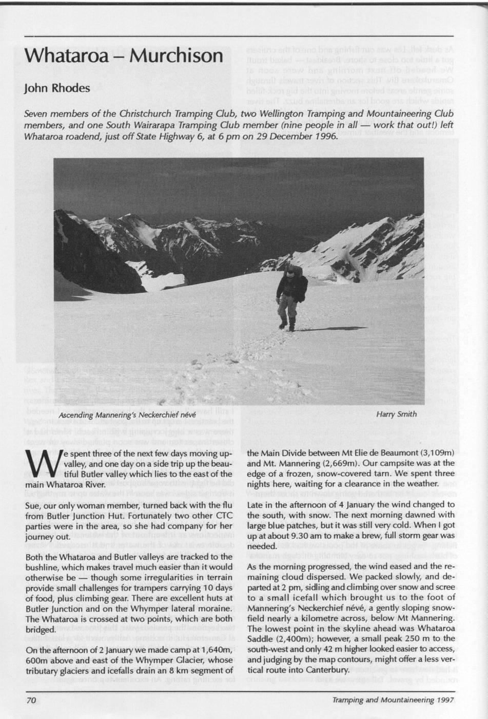
Whataroa - Murchison John Rhodes Seven members of the Christchurch Tramping Club, two Wellington Tramping and Mountaineering Club members, and one South Wairarapa Tramping Club member (nine people in all work that out!) left Whataroa roadend, just off State Highway 6, at 6 pm on 29 December 1996. Ascending Mannering's Neckerchief névé Harry Smith le spent three of the next few days moving up- the Main Divide between Mt Elie de Beaumont (3,109m) W valley, and one day on a side trip up thel beau- and Mt. Mannering (2,669m). Our campsite was at the tiful Butler valley which lies to the east of the edge of a frozen, snow-covered tarn. We spent three main Whataroa River. nights here, waiting for a clearance in the weather. Sue, our onlywoman member, turned back with the flu Late in the afternoon of 4 January the wind changed to from Butler Junction Hut. Fortunately two other CTC the south, with snow. The next morning dawned with parties were in the area, so she had company for her large blue patches, butit was still very cold. When I got journey out. up at about 9.30 am to make a brew, full storm gear was needed. Both the Whataroa and Butler valleys are tracked to the bushline, which makes travel much easier than it would As the morning progressed, the wind eased and the reotherwise be though some irregularities in terrain maining cloud dispersed. We packed slowly, and deprovide small challenges for trampers carrying 10 days parted at2 pm, sidling and climbing over snow and scree of food, plus climbing gear. There are excellent huts at to a small icefall which brought us to the foot of Butler Junction and on the Whymper lateral moraine. Mannering's Neckerchief névé, a gently sloping snow- The Whataroa is crossed at two points, which are both field nearly a kilometre across, below Mt Mannering. bridged. The lowest point in the skyline ahead was Whataroa Saddle (2,400m); however, a small peak 250 m to the Ont the afternoon of 2 January we made camp at 1,640m, south-west and only 42 m higher looked easier to access, 600m above and east of the Whymper Glacier, whose and judging by the map contours, might offer a less vertributary glaciers and icefalls drain an 8 km segment of tical route into Canterbury. Tramping and Mountaineering 1997
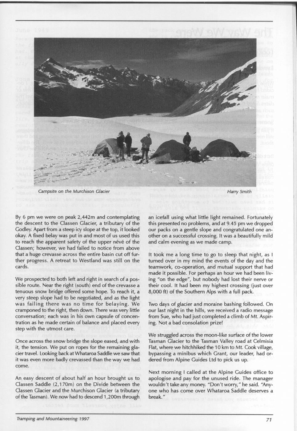
Campsite on the Murchison Glacier Harry Smith By 6 pm we were on peak 2,442m and contemplating an icefall using what little light remained. Fortunately the descent to the Classen Glacier, a tributary of the this presented no problems, and at 9.45 pm we dropped Godley. Apart from a steep icy slope at the top, it looked our packs on a gentle slope and congratulated one anokay.. A fixed belay was put in and most of us used this other on a successful crossing. It was a beautifully mild to reach the apparent safety of the upper névé of the and calm evening as we made camp. Classen; however, we had failed to notice from above that a huge crevasse across the entire basin cut off fur- It took me a long time to go to sleep that night, as I ther progress. A retreat to Westland was still on the turned over in my mind the events of the day and the cards. teamwork, co-operation, and mutual support that had made it possible. For perhaps an hour we had been liv- We prospected to both left and right in search of a pos- ing "on the edge", but nobody had lost their nerve or sible route. Near the right (south) end off the crevasse a their cool. It had been my highest crossing (just over tenuous snow bridge offered some hope. To reach it, a 8,000 ft) of the Southern Alps with a full pack. very steep slope had to be negotiated, and as thel light was failing there was no time for belaying. We Two days of glacier and moraine bashing followed. On cramponed to the right, then down. There was very little our last night in the hills, we received a radio message conversation; each was in his own capsule of concen- from Sue, who had just completed a climb of Mt. Aspirtration as he made certain of balance and placed every ing. Not a bad consolation prize! step with the utmost care. We struggled across the moon-like surface of the lower Once across the snow bridge the slope eased, and with Tasman Glacier to the Tasman Valley road at Celmisia it, the tension. We put on ropes for the remaining gla- Flat, where we hitchhiked the 10 km to Mt. Cook village, cier travel. Looking back at Whataroa Saddle we saw that bypassing a minibus which Grant, our leader, had orit was even more badly crevassed than the way we had dered from Alpine Guides Ltd to pick us up. come. Next morning I called at the Alpine Guides office to An easy descent of about half an hour brought us to apologise and pay for the unused ride. The manager Classen Saddle (2,170m) on the Divide between the wouldn't take any money. "Don'tworry, " he said. "Any- Classen Glacier and the Murchison Glacier (a tributary one who has come over Whataroa Saddle deserves a ofthe Tasman). We now hadi to descend 1,200m through break.' " Tramping and Mountaineering 1997
Comments
Comments are not open yet.