
Text taken from the club newsletter.
RAKIURA TREASURE HUNT
Along the Tin Range by DEBBIE BUCK
I sat on the Bluff jetty watching the white caps as some very green and wobbly-legged passengers stumbled off the incoming boat from Stewart Island. One particularly shaken lady was kind enough to warn me about the 2 metre swell and gave me the hot tip that the back of the boat was the most stable place. Two hours later, a pale shade of green and wobbly-legged me stumbled onto the wharf at Rakiura/Stewart Island. The 40 school kids that minutes before had been vomiting wrecks were scampering round like over-excited puppies.
The next morning’s water taxi ride to Freshwater Landing was serene and shared with two hardy-looking locals. My big pack was fully loaded with ten days of stuff for an anticlockwise Southern Circuit and Tin Range treasure-hunting (i.e., kiwi sighting) adventure. It got some questioning from the locals. Their reaction when I mentioned my Tin Range plans was a bit disturbing— kind of like I’d said I was crossing the Sahara in summer, stark naked with no water. Freshwater landing to Masons Bay
So I made sure I walked extra fast all the way to Masons Bay to avoid their local knowledge that might scare me off my plans and so they didn’t see me struggling through the mud with my overladen pack. Fortunately, this bit of the Southern Circuit was a superhighway, having previously been the ‘road’ to the former sheep station at Masons Bay. I sauntered along through tame muddy patches surrounded by lots of dense manuka bush, gurgling tea-coloured streams, a long boardwalk through wetland marsh with silvery shimmering rainbow water and sighting a furtive whitetail deer bouncing away into the manuka. I adjusted to the sea level altitude and the Stewart Island vegetation—a bit of a change from the previous week tramping in Aspiring NP.
I also adjusted to sharing a big newish hut with 10 other people, including the two hardy locals and another mysterious local. The two hardy locals were going to hang out at Masons Bay hut for the next week or so—which seemed a bit odd to me especially as they didn’t have any guns so weren’t there to hunt. Perhaps the fishing was good. The mysterious other local was heading further down the coast to hang out at another beach for a while. Perhaps this tramping through mud thing was just something the mainlanders/tourists did.
After dehy dinner number 1, I headed down to the beach for some beachcombing and the sunset. Disappointed that the sunset didn’t show itself I headed back to the hut and along the track in the hope that a kiwi would show itself. None did. Oh well I had another 8 nights and 9 days of kiwi sighting opportunities. Masons Bay – Doughboy Bay
On day 2, I had a full tramping day to Doughboy Bay Hut. I started heading south along the long Masons Bay beach, into a blustery southwester that gave my right cheek its best exfoliation since the Kahurangi tops in cyclone Winston a couple of weeks earlier. After an hour or so of cheek cleaning, I stopped for a short detour to the Cavalier hunters hut near the end of the beach to have a pack-lightening snack break.
Then it was onwards and inwards from the beach to climb Adams Hill (401 m). On the map it was only 6 km to the top and looked reasonably direct. But the track twisted and turned and went up and down, taking a rambling route through manuka and then rimu forest. Once I figured out this was not a Tararuaesque gut-buster ascent direct to the heavens, I was able to go with the flow and enjoy the meandering beauty and silence of the rimu forest. Apart from the mysterious lone local who had passed me near the hunters hut I was the only person heading this way. It felt remote and wild. But not wild enough for a kiwi to appear even when I stopped quietly for lunch.
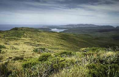
After lunch it wasn’t too far before I was on the tops at 400 m, with views, brooding sky, wind and mud (glorious mud). This was where Stewart Island lived up to its reputation. The Adams Hill plateau was a succession of bogholes, which I gingerly waded through (when I felt guilty about destroying fragile tops heath) or skirted around (when I was feeling fed up with mud bashing). In between the viscous mud I gazed in all directions soaking in the views across the island and out to sea. Soon the track descended following a watercourse which meant the fluid, slippery mud was interspersed with slippery rocks and tree roots. It was slow going. Near the bottom, the track passed through more delightful rimu forest and became more pleasant. After a short section following a stream and manuka forest, I emerged on Doughboy Bay beach. A sculpture made of waste plastic that had washed ashore marked the short track to Doughboy Bay hut. A resident hunter had the fire going in the hut so it was cosy.
The mysterious local was foraging along the beach until the rain started. Over a cuppa I tried to find out from him why the Rakiura locals were so keen on hanging out on the exposed westerly beaches. The answer of fresh air and remoteness seemed reasonable but incomplete. He asked about my plan—and while his response was reassuring I got a hint that he thought I was a bit crazy to be heading to Tin Range. Oh well. After dinner the rain stopped so I went for a stroll on the beach to look for semi-buried whale bones and enjoyed a colourful sunset over the headland. But no kiwi appeared. Doughboy Bay to Rakeahua hut and hut day
Today’s warm-up was a short walk along the beach before I started climbing the 411 m to Doughboy Hill. After a rather direct ascent I was rewarded with sublime views, elementally fresh wind and a few showers and more manageable mud. Today’s plateau continued for a couple of kilometres before it gently wound its way down to meet the Rakeahua River. Because it was a chilly day I resisted the temptation to have a quick dip in a deep pool. Instead, I followed the pleasant and easy track through rimu forest alongside the river for the next seven kilometres. After crossing on a sturdy bridge, the last 45 minutes of track to Rakeahua Hut was a mudfest. Of course I couldn’t leave a Rakiura tramp without memorable mud immersion—so I succumbed to the inevitable and sunk thigh deep into a mud pond, with a saving lunge to the soft bank to extract myself.
I arrived at the empty hut and washed myself down before I entered. This cosy 6 bunker was a 1960s style so I felt that I was back in a real hut. Though it was a bit of a shame that someone had removed all the interesting and useful stuff that is sometimes left in huts. I was particularly disappointed that there were no tasty morsels like cans of tuna. Perhaps, after 20 days of tramping, I was a bit over my repetitive rations.
On day 4 I woke up to the forecast cold front—with swaying manuka, frequent downpours and a biting wind even at sea level, I decided to stick to my original plan of sitting this front out at Rakeahua Hut. In amongst the hut literature I found a NZ Tramper description of the Tin Range route—it sounded gnarly and dangerous. In late afternoon, another tramper arrived, looking muddy and windblown. He’d had a strong tailwind for his jaunt across from Doughboy Bay, where the storm had apparently been more ferocious. Rakeahua hut to Tin Range campsite
The weather abated overnight so on day 5 I set off early, backtracking through the mud for 45 minutes. When I got just past the bridge to the ‘Unmaintained Track’ sign, I turned off into the bush and the adventure began. I followed a reasonably clear foot trail that gradually climbed through open forest along a rambling spur. After about 2 hours, I hit the first bit of scrub and stream crossings. For another hour or so the foot trail became more vague and scrubby as I followed the small stream gradually up, sometimes walking in the narrow streambed in order to stay underneath the leatherwood arch that grew across the stream from each bank.
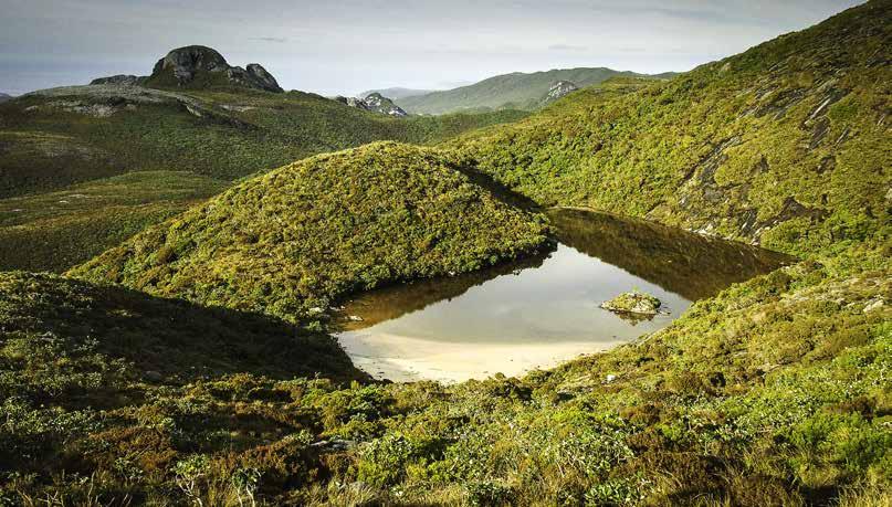
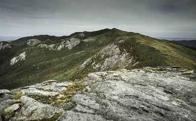
Around midday I emerged in the open near pt 579, relieved to leave the scrub behind. From here, following weatherbeaten stakes/ marker poles, it was swift travel on the tops to Table Hill, 716 m, arriving about 1 pm. There was a lingering strong southerly wind so I rugged up in another layer with full waterproofs and over-gloves to have a quick lunch. The views were pretty stunning as I looked over to the South West Arm, which has Rakeahua Hut at its head. I then headed into the wind, descending 200 m on spongy alpine plants to a saddle and then climbing 200 m on spongy plants to Blaikies Hill 703 m. Here I saw some furtive dotterels, so I stayed well clear of them. The marker poles ended here. It felt amazingly elemental, being in this alpine environment at around 600-700 m, with sea views. In all directions was an amazing vista of alpine tops, descending into forbidding scrubby spurs and valleys.
The alpine sponginess was great for descending because it gave extra momentum to each step, but on the ascents it seemed that to have the opposite effect, absorbing any upward momentum. From Blaikies Hill I headed SSW, following the ‘unofficial’ route, marked intermittently by leatherwood twigs and small oblong obelisks of granite—far more intriguing than orange triangles. It felt like I was on a treasure hunt. Travel was a mix of losing and finding the markers and just using intuition and a compass to follow the undulating terrain, contouring round and then descending through scrubby sections—the threat of being lost in leatherwood kept me focussed on following the faint route through these sections.
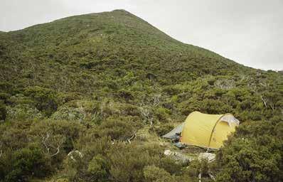
Around 4:30 I decided to head off the route to look for a campsite further west—for some reason I thought the headwaters of Kopeka River, to the east of point 731, looked promising and might be the campsite that several sources had referred to (but not pinpointed on a map with grid references). So I blundered around in alpine bog and scrub and walked up on the true left of the river looking for a sheltered and unboggy campsite, without any luck. At some point in this rambling, probably just before I avoided the temptation to go up to pt 731 and then along the ridge to Mt Allen, I had the revelation that the campsite was probably on the route and not a detour. So I rambled back towards the knoll south of Blaikies Hill to get back on the route, cursing myself for losing an hour. At 5:40 pm and just shy of pt 526, after 10 hours of walking, I spied a flattish, sheltered and not too boggy patch for camping. I set up camp and was in bed before dark. Partway through the night I got up and went to gaze at the sky and listen for kiwi. Tin Range campsite to Port Pegasus
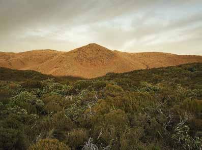
Day 6 dawned with a brilliant sunrise that tinted the hillsides orange. It felt amazing camped at the bottom of NZ. I set off at 7:50 am and was soon navigating my descent through some leatherwood bands to the Kopeka River. Sure enough, I found an idyllic campsite with enough flat and sandy space for two tents. I crossed the river just above the 400 m contour and headed up the broad spur to pt 605. I sauntered along the granity range, contouring around below and east of Mount Allen until I arrived at Mt Allen tarn. Here there were smaller campsites at both ends, though probably prone to inundation in heavy rain. It was sunny with a light wind so the day had quite a different mood to it.
From here I was on the fairly well defined Tin Range. I felt I was getting closer to spotting kiwi—I came across some huge footprints in the mud. I headed on to the base of Granite Knob where I got lost in the leatherwood. So after some leatherwood climbing to extract myself I was at the base of a scramble to the top of Granite Knob. Up I went to get clear of the scrub. This was definitely worth it—I was now following a series of rounded hills topped with granite slabs, interspersed with some low plants, all the way to pt 637. Needless to say, the views were incredible and I could see Gog and Magog far to the south. The Tin Range stretched out before me and again I sauntered in the sun through spongy alpine plants to pt 559. Here there were two marker poles, which were the signal to leave the range and descend due west to the head of McArthurs Creek. When I reached the creek, I followed a well-defined route south—the Surveyors track. I was now in the territory of the Pegasus Tin
Mining. The route weaved in and out of manuka bush and arrived at a dam wall. From here the route became more of a trail, and soon I was on the old tramway that took me to the Diprose Bay/ North Arm junction. I took the North Arm route, and followed the well-worn historic track for the next 1½ hours to arrive at Port Pegasus at 4:10 pm. This was the best bit of track I encountered on Rakiura! I spooked a white tail deer—we stared at each other for about 10 seconds.
At Port Pegasus, there was very little to show of the former tin works—just some old bricks that may have been a fireplace and some hint of excavations. The access to the harbour was down a chute with a bit of a step at the end. Across the bay at a flat site that was the old freezer works, I could see and hear a lot of people and boats and then a helicopter arrived. It seemed a bit incongruous to have all the commotion after two days and about 30 km along the range to a spot that otherwise felt remote. Anyway, by 5 pm, all the people and their machines had gone. I set up camp and wandered back up a small inlet to find freshwater. Once the tide was lower, I clambered down onto a rock and swam in the bay—the southernmost spot of the world that I had been to. As the twilight faded I went to bed, content and happy that I’d tramped along the Tin Range. But still wanting to see the elusive kiwi. Day 7 Port Pegasus to Kopeka River campsite
I left Port Pegasus at 6:55 am, just before sunrise, and wandered back up the track and up onto the Tin Range again. Today the range was overcast and by the time I got near pt 637, the low cloud was drifting across, creating an eerie mood, different to the previous two days. This time I found the route that sidled low around the west side of point 637, weaving its way among the leatherwood flanks of the range all the way to the saddle just north of Granite Knob. I even saw some monster size kiwi footprints in the mud, looking at them closely as if that would conjure up a kiwi. By the time I arrived at Mt Allen tarn, it had warmed up enough for me to contemplate a swim—alas the tarn was only knee deep. So instead I had some tarn side lunch with sun then pushed onwards to the Kopeka river campsite, arriving at 2:45 pm. I spent the afternoon having a (soap-less) wash in the refreshing river—almost removing the smell of 7 day old polypro (perhaps the polypro smell was scaring the kiwi?), and lazing in the sun until it was time to rehydrate dinner and go to bed. Day 8 Kopeka River to Rakeahua hut
After a little rain overnight, I set off at 7:45 am, hoping the weather would stay fine for the day. As I meandered and climbed to Table Hill, it was quite windy and cloudy but manageable for tramping. I thought about the entry I had read in the Rakeahua Hut book, of a party that had to stay camped precariously on the range for two days because the conditions were too windy and cold to tramp. I was relieved to get back into the scrub, but only stayed relieved for a bit. I ducked and weaved, again following the watercourses fringed by leatherwood.
It was about midday when, standing on one bank of a stream. I looked across to the other bank and there was the back of a kiwi—basketball size with greyish brown spiky-looking feathers. It turned 45 degrees for a moment and then shuffled on, seemingly oblivious to the excited human on the other side of the ditch. I hurried across the stream and looked around but it had disappeared. I felt awed and amazed. After all this time living in New Zealand, I had finally seen a treasured kiwi in the bush. With a smile and a sense of wonderment, I followed the route out and back to the main southern circuit track. Well the Tin Range hadn’t been too gnarly and dangerous after all.
When I arrived at Rakeahua Hut at 4 pm, there were two DoC workers and an Australian tramper, Richard. Richard, who had come across from Doughboy Bay, greeted me with ‘so you’re the woman from Tin Range’. Obviously word gets around on Rakiura.
It was a very social night in the hut and the DoC Ranger solved the enigma of the activities of the mysterious locals. Whereas trampers come to Rakiura in search of mud and kiwi, the locals I had met were stationing themselves on the western beaches to look for ambergris after the front of Day 4. Apparently ambergris is a substance that comes from ‘whale vomit’ and is almost as elusive as kiwi—it is expelled by whales, floats around in the ocean, sometimes for years, and eventually it gets washed up on the Rakiura western beaches (and other places too) after big south westerlies. It is a highly valued ingredient in high-end perfumes. Damn—I’d missed the opportunity to finish my retirement savings and start drawing on them. Oh well, I was thrilled with seeing the treasured kiwi. Day 9 Rakeahua Hut to Freds Camp hut
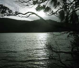
After early starts on other mornings it was luxurious to have an enforced sleep in and late start. The track followed the South West Arm, all the way to where it met Paterson Inlet. It had a low-lying section that was best walked at low tide, which was around 2:10 pm. I set off at 10:30, with the first two hours of manuka forested track being pretty boggy. As it transitioned to rimu forest, the mud decreased. Around 1:10, I tried to take a shortcut across the mud flats, but the tide hadn’t left for long enough and the mud was still too sticky. So I was back on the track until 2:10. Now the mud flats were OK for walking—I scooted along, cutting across the mouth of small bays, sometimes disturbing birds, crunching over mussels that sometimes covered all the mud. After a while, I ran out of mud, so decided to scramble on the rocks instead of getting on the track. This worked for a bit, until I was running out of rocky shore. So, I picked some mussels to carry and scrambled back up to the track meandering through some pleasant rimu forest. At 3:30 I arrived at Freds Camp Hut. I spent the afternoon relaxing in the sun on the jetty, feasting on mussels, and chatting to Richard. I was catching a morning water taxi to Oban, so this was my last Rakiura tramping night—it was crisp and calm with a starry sky. I fell asleep to the sound of the lapping tide—and maybe a kiwi calling.
Comments
Comments are not open yet.