
Text taken from the club newsletter.
UWERAU
Second time lucky by FIONA ELLIOT
The original plan for the 3-day weekend was to climb Manakau, the highest peak in the Seaward Kaikoura Range. But this would require us camping at 1,900 m on Friday night in order to give us enough time to make the summit on Saturday. The poor weather forecast the Wednesday before our trip made it easy enough for me to convince the others, Jessie and Martin, that Manakau’s little sister Uwerau, at 2,213 m would also be a worthy climb, and we would have the benefit of a warm dry hut from which we’d attempt a direct ascent in one day.
I’d attempted Uwerau two years previously on a trip led by Tony Gazley and hadn’t forgotten the seven or so hours we spent bush bashing up a steep gradient to get past the tree line. But following that there was an enjoyable climb with great views—when the clouds allowed—although we were forced to turn around because of lateness and didn’t make it to the top. I also recalled our descent route managed to link up a series of animal tracks that allowed us to cut through a punga forest before hitting the track running between Hapuku Hut and Kowhai Saddle. I was interested in making life as easy as easy as possible this time and finding this same line for our ascent.
Thursday evening was spent at the DOC campsite in Puhi Puhi Valley a 10 min drive from the highway and all-round pleasant spot beneath the totara trees. The rain we were expecting late that night and carrying on through the morning never came, in fact the rain didn’t turn up until Sunday morning when we were heading back to the car. The Southern Alps can come in handy when you’re to the east and there’s a big ol’ sou’wester roaring up the South Island.
Friday morning we drove to Parsons Road near the Hapuku River mouth and had a quick chat with a hunter heading up to Barretts Biv—he was to be the only other person we came across that weekend.
We wandered off at a leisurely pace having all day to complete the easy four hour route to Hapuku Hut. The first section of the route was mostly along the Hapuku River, broken up with shortcuts through the bush and several easy river crossings. An approximate halfway point, and natural sit down and have-a-snack spot, is marked by a 20 m waterfall. After this the track sidles along the river bank for 50 m before dropping back down
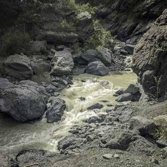
Hapuku Gorge into a fairly gnarly looking gorge. Sedimentation lends a cloudy bluish-grey colour to the Hapuku River here making it difficult it gauge the depth. A few cautious steps in we realised it looked a lot more treacherous than it was and we happily waded across the slightly- better-than-frigid water. From here the track veers into the bush cutting off a particularly bendy section of the river. Thirty minutes into the bush is a track junction marking the northern route up to Barretts Biv and to the west where the Kowhai/Hapuku track continued. From here the track was quite overgrown in places and easily lost, but we always had the option of boulder hopping up the river to the hut instead.
We made it to the hut around 2 pm and had a long lazy lunch in the sun. We checked the hut book for any super- secret backcountry advice on the Uwerau route but the most info we got was to continue up the track after the second side stream on the true left. I headed up there that afternoon to do some scouting, hoping to save us a bit of time the next morning. The track was in much better condition than the uphill side of the hut and steadily gained in attitude. I was surprised to see large amounts of snow settled on the ground, but looking closer it was actually hail that had been deposited in the open areas. After reaching the second stream I recognised the turn off point from my last trip here—and made a mental note to avoid that at all costs. Crossing the stream and heading another 200 m up the track I came to a spread of young punga trees—this is where we would turn off the next morning.
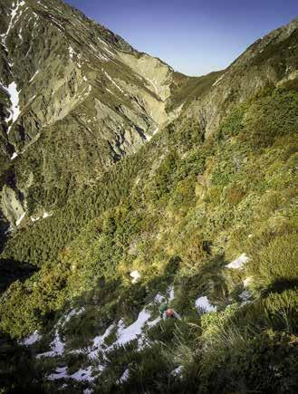
We set off next day at 6:30 am and made our way through the punga forest and it was delightful and easy—but short-lived. The gradient quickly became steeper, and the bush thicker. We ploughed through on a north-western heading trying to stay on a subtle spur. Continuing uphill the spur becomes more pronounced and continues rising towards the north. Around 950 m the pig tracks leading up the spur became obvious, and much appreciated, and the remainder of the climb below the bush line was spent sticking to these as much as possible with bits of bush bashing thrown in when they briefly disappeared.
Climbing through the scrub
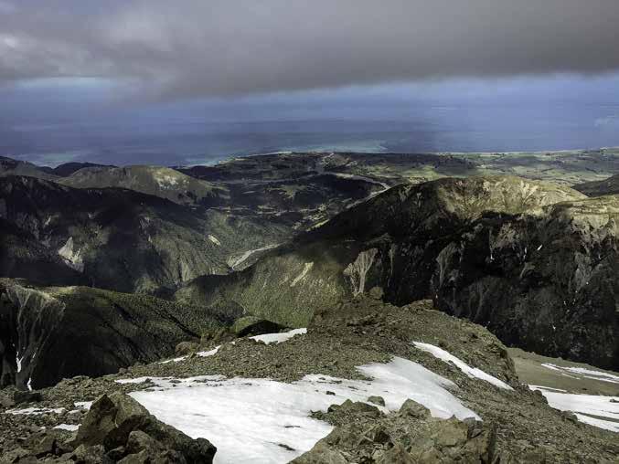
We hit the bush line at about 10:30 and took in the panoramic views. We skirted some bluffy bits for a while trying to go in the general direction of uphill. Deep patches of recent snowfall had built up in the slips and we mostly travelled through these as it required less effort than walking over the alpine scrub, the particularly steep parts required the use of nearby flaxes and scrubs to haul ourselves up. There weren’t too many spaniards around but we still learnt rather quickly to look first and not just grab hold of any old plant.
Once the alpine scrub gave way there was not so much snow, presumably having melted by the heat absorbed by the exposed rock. There were extended steep sections with little or no runout that we found quite unnerving—a lack of snow and ice made the alpine section much more unstable than expected for this time of year and judging from the amount of snow we saw down by the river. The chossy, some call might ‘rotten’ rock, was constantly breaking off when used as a foot or hand hold, and calls of ‘rock!’ accompanied us up this section.
At 1,800 m the spur levelled out for a small section where a couple of massive boulders sat. Another natural snacking spot. It was 11 am and we were happy with our progress so far and had the summit in our sights.
After refuelling we continued onwards at a slightly lower gradient doing a mixture of rock scrambling and scree walking. The scree slopes were tough—under the thin dry scree surface was a soft wet muddy layer leading to the frustrating effect of sinking down a step for every two steps taken upwards. There was no avoiding this in some sections and it was just a matter of putting your head down and switch-backing your way up the slope.
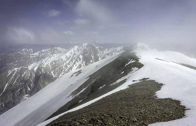
Around 2,000 m we put on crampons although the snow was slushy and thigh deep in places. The conditions probably didn’t demand the use of crampons but with the steep runoffs we were worried about icy bottom layers and figured crampons added an extra level of stability and safety. We continued up towards the
On the summit of Uwerau summit, encountering several false summits on the way. Eventually we reached a low gradient ridge leading to a slight local maxima, the real summit. The views from here were of course awesome—the Kaikoura Coastline to the east and the Southern Alps to the west. Mt Manakau connects to the northern ridge line and towered above Urewau 400 m higher still.
For the descent we managed to surf most of the way down the scree fields and had lunch at the boulder site. We took our last look of Mt Fyffe and the Kaikoura coastline before starting our bush bashing and rock hopping trip back the same way we had come up. We reached Hapuku Hut after about 10 hrs travelling to find we had it to ourselves again.
Then we managed to hustle out on Sunday in time to catch the earlier ferry at 2 pm for the trip back to Wellington.
Those on the trip were: Jessie Go, Martin Sandwell, and Fiona Elliot (leader).
Comments
Comments are not open yet.