
Text taken from the club newsletter.
. . . and another view by HEATHER GARVEN
The names of interested trampers filled both sides of the sign-up sheet in no time. I wondered why an easy-medium summit climb of Ruapehu was so popular, especially when there were four other trips to the central plateau on offer that weekend. The reasons for signing up to Tony’s late summer ascent of Ruapehu were probably as varied as the peaks on the mountain itself.
For me it was an opportunity to get some familiarisation of Ruapehu’s terrain before winter once again hides his features under blankets of snow. For others it might have been a stay at the club’s Whakapapa lodge. A spacious lodge that offers comfortable bunk rooms, hot showers, flushing toilets, a full kitchen, a drying room and electricity. It’s backcountry accommodation at its best.
Leaving Wellington on a perfect summer afternoon wasn’t the easiest when we were heading for a weekend on the edge of the ‘Tasman Tempest’ – the wettest week the upper half of the North Island had experienced in a long time. While the forecast wasn’t dampening the spirits of any of the 24 trampers I’m sure several of us doubted we would be lunching on Tahurangi the following day.
We woke Saturday morning to wind and rain beating against the windows of the lodge. Within the confines of the lodge, we were however very comfortable. Given there was no head-out time set the night before, breakfast was a leisurely affair. In dribs-and-drabs- like fashion, trampers slowly appeared from the bunk rooms. As coffee brewed, cereal was consumed and the conversation crescendoed, the lodge came to life. We enjoyed the second cup of coffee and an extra slice of toast as we waited in anticipation for a proposal or two of how we would like to fill in the day ahead.
Ascending Tahurangi summit was off the cards but would be considered for Sunday morning if the weather improved. Instead, Tony suggested a walk to Tama lakes. This would be the long option. The shorter option was a trip to Tupapakurua Falls led by Mike (Gilbert). Of 24 trampers only two chose to have an indoors day. They were tasked with making scones for our return. I joined Tony’s Tama Lakes trek as I wanted distance for a good day’s exercise.
Taking the upper Taranaki Falls circuit track, we made the falls lookout in good time—the wind and rain gave us little reason not to. We decided to continue on to Tama Lakes and leave a visit to the falls for the return trip. With raincoats on, hoods up and heads down, the walk on to the Tama Lakes turn off was easy—despite dampened feet thanks to the unbridged creek not long before the turn off (we didn’t know at the time but our feet would be getting a whole lot wetter). We regrouped at the turn-off to the lakes and again at the Lower Tama Lakes lookout. I then expected we would continue up the track to Upper Tama Lake. Instead, Tony suggested we head down to the lower lake. Given the moon-like landscape, I was definitely keen for such a side trip. I had been off track before but in bush but in this environment it was going to be fun and interesting and I knew it would increase my confidence in doing something a little different.
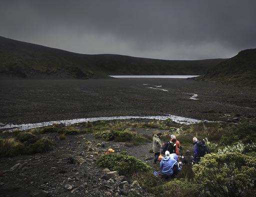
We made our way down the loose surface to the crater. As we ate lunch in a sheltered spot at the base of the crater’s slope, Tony made a further suggestion—head across the crater to the lake’s edge. It was about now that I realised today’s trek would not only be fun, it was going to provide some unexpected navigation practice. Out came my map and compass. From up at the lower lake lookout, the crater had looked vast. But from where we were now, and using the ruler lines of the compass on the map, we looked to be less than 500 m from the lake’s edge. Estimating our speed across the flat crater might be around 4 km/h, I expected we would be across at the lake in less than 10 minutes. We took longer, but then we did stop to assess signs of wildlife and test if very moisture ladened-looking sand was sinking sand.
Tony’s next announcement was to walk around the lake, leave the crater via one of the rocky gullies on the other side and make our way over to Upper Tama Lake. A further check of my map revealed we would likely head along the ridge above us up to spot height 1,450 m. From the base of the gully, and at an estimated climbing speed of 300 m/h up the gully, we arrived on the ridge overlooking the Eastern side of Lower Tama Lake 15 minutes later. The roughly 80 m scramble up the gully provided a perfect balance between physical challenge and fun.
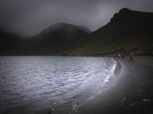
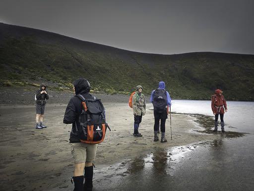
With now gusty gales and driving rain, and after a check of the map, Tony suggested we sidle around the high point to lessen the impact of the wind and rain. We would head to a saddle we could just make out in the limited visibility. The compass provided a NE direction. Sidling without a track added to the fun. From the saddle we headed NNE and a short time later we were looking down on Upper Tama Lake. An easy meander down to the lake, close to the creek that enters the southern shore, returned us back into calmer conditions. The lake was surprisingly tepid although no one was keen enough to take a swim. We vowed to return next summer with our togs and a picnic and spend the day on one of the lake’s beaches.
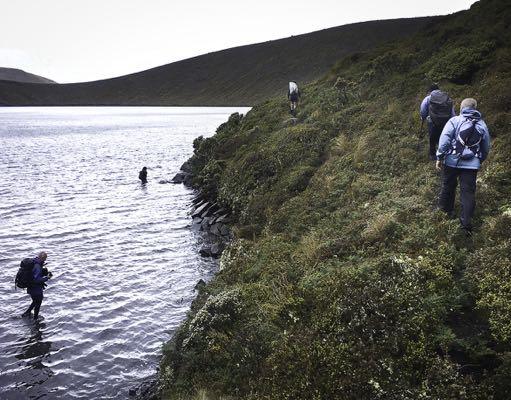
Thinking we might then just head back up, Tony further surprised us with a ‘we’ll go round it’. So the fun continued. In an anti-clockwise direction, we skirted the shore taking advantage of sandy beaches where we could. Part way round we climbed up and over the end of the bluffy spur that comes down from spot height 1,584 m. Although there were patches of climbable exposed rock, we mostly had alpine vegetation to grasp. The level of difficulty getting over the spur moved our confidence level, in being off track and trying something different, up a notch rather well. We soon descended back down to the beach and continued around the lake. An attempt to shortcut a cove by crossing it in the water was made. But despite the warm water, we retreated to the bank when the water neared the bottom of our packs.
We reached the SSW corner of the lake that offers a respectable looking (wide and not steep) egress back up to the Tama Lakes poled route. With a little zig zagging we quickly regained about 100 m in height and found ourselves back up around 1,440 m, again overlooking Upper Tama Lake but with a different aspect to where we had been an hour or so earlier.
The return to Whakapapa Village was back along the Tama Lakes track. We stopped at Taranaki Falls and boulder hopped behind it. The effect of the recent rains had made the noise and moisture levels in behind the falls quite spectacular.
What initially seemed like a tame itinerary—a walk to Tama Lakes—ended up offering so much more. The highlights being off track navigation, a near full circumnavigation of Upper Tama Lake and a greater appreciation of how easy it can be to spice up a day walk in the backcountry by doing something a little different to the norm. A two course meal and a very sociable evening back at the lodge topped the day off well.
Sunday dawned to the sound of rain only. Saturday’s wind appeared to have dropped away to a breeze. Being keen to get up the mountain, I was ‘up and at em’ early to help get breakfast underway. As breakfast came to an end with 24 trampers up and about, fed and looking quite content, Tony and Mike offered Sunday’s activity options. Tony would take a group up the mountain as far as the weather conditions would have it enjoyable. Mike would take a group and walk the Old Coach Road between Horopito and Ohakune. We would regroup in an Ohakune café mid-afternoon. Fortunately, for transport reasons, an even mix of interest was expressed. Half would go in search of glaciers. The other half would marvel at engineering history—the Hapuawhenua and Taonui railway viaducts.
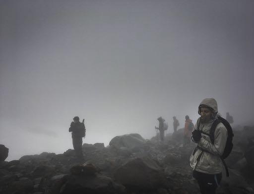
Tony led a baker’s dozen from the lodge and into gloom. It was grey, cool, and moist and a little eerie knowing there was an awe-inspiring yet rugged mountain cloaked in cloud looking down on us. But it was quiet and peaceful. Visibility was reasonable in the upper carpark but soon petered out. The low cloud got a lot more personal and would test our location awareness in no time.
With Tony at the back, he was leaving the route finding up to us. What level of navigation would we need to find a glacier? Would we travel up a ridge or a creek? Use technology (anyone with a GPS?), or perhaps go traditional and use the map and compass? The latter, if and when it might be needed (perhaps to get us back down), seemed a good choice – that is, had we not had Tony. Tony knows the mountain well. This allowed us the luxury to focus on practising other navigation skills yet still enjoy the walk even if our navigation skills let us down.
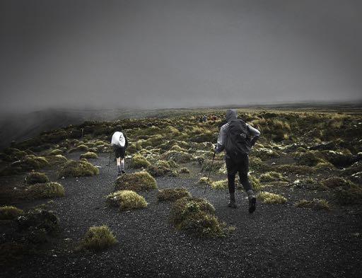
We started easy and simply followed the 4WD track that leads from behind the Iwikau Village café for as long as the track was obvious. But like the visibility, the track soon seemed to peter out, although only making the adventuring more interesting. Possibly due to the rain, our maps and compasses didn’t come out. Instead, individually we used more primary navigational skills – our senses, observing what was immediately in front of us, to the left, to the right and occasionally looking back to what was behind (knowing that was what we would want to see in front of us on the way back down).
Given the low visibility, we used our hearing more than we would in the bush. Listening to the proximity of the creek on the right going up, we could recall the sound of that volume of water coming back down. When using my hearing on the river, I relied on something else at the same time - the sound of the water and a nearby tower, or the sound of the water and an unusual rocky outcrop. Of the two, the visual marker acted as a secondary indicator on sections where a route ahead was particularly obscure.
The surface of our climb was undoubtedly rugged with the exception of a strip of concrete which made gaining several metres in elevation an easy task. Otherwise, every step was different. We got up and over rocks of every shape and size. The rain didn’t make the rocks slippery but it did somewhat mask their natural colours —mostly grey, black, brown and orange.
When we weren’t following a section of 4WD track, we were clambering straight up banks of rocks (those where we could see the top), following poles, cables or chairlift towers, while keeping an eye on nearby drops or fencing. The more recognisable features were buildings - huts, shelters and ski lift terminals. The less recognisable features included the location of the WTMC 2016 bum sliding competition (less recognisable due to the run surface devoid of snow).
All of a sudden the silhouette of a large building loomed above us. It was the Knoll Ridge café. Reaching the café (2,020 m) was a highlight. Finding it closed, was not. We took shelter under the covered entry, noses pressed against the glass in the hope that someone was inside cranking up the coffee machine. Instead of coffees and soup, we pulled out our water bottles, thermos tea and snacks, then added another layer under the raincoats.
The discussion around turning back or continuing on in search of our glacier was short. The quest to reach a glacier had overwhelming support.
We left the shelter of the café entrance and continued upwards continually looking for the easiest path immediately in front of us. The next breather was in an unlocked ski patrol shelter at 2,245 m. Although small, it could accommodate us all. Given the temperature continued to drop as we climbed it was a nice reprieve to be out of the dreary conditions. Before moving on, Tony described what would be ahead of us. We listened and visualised. A short distance up from the shelter we would turn a slight right, go up and over a small knoll then along a little ridge to the end of the narrowing spur. As the spur dropped away both sides, we were to keep to the middle. The end of the spur would dip into a flatter area where we were to regroup. I realized soon after leaving the shelter why Tony had given us a description of what to follow ahead—we had run out of markers of any kind—no 4WD track, no T-bar towers, no cables, no poles. Being above the ski field boundary, we were on our own amidst the cloud. We could only imagine how awesome the landscape either side of us might be.
We finally came across snow when we next regrouped. Despite it being uninviting (old, firm and slippery) it provided an opportunity for some early season snowcraft practice. Body balanced, knees slightly bent, and feet flat-footed, I began edging my way across the slope. Step, reposition pole (proxy ice axe), step and repeat. Step, reposition pole, step and repeat. The more of a rhythm, the easier it got. It whisked me back in time (well, eight months) to WTMC’s 2016 Snowcraft course. Getting off the slab of snow back onto the rock was the tricky part. The fragile overhangs of ice looked to be waiting for an unsuspecting foot to step through into a small and jagged cavity below.
Keeping at the same elevation and less than 100 m further on, there it was—what we had aimed to reach— one of Ruapehu’s small remnant glaciers at 2,300 m.
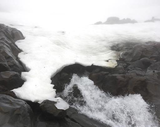
It was no Fox or Franz Josef, but nevertheless it was a glacier. We duly inspected the edge of the ice (not being keen to step upon it) then wandered down to its tapered end. The contrast from glacier to rushing water was striking. Although the width of these headwaters was only the size of a creek, Tony decided it was best we remained on its true right. Having reached our glacier, it was time to head back down to the lodge.
Despite the continued low visibility, we had little trouble finding our way back down. We had a fresh mental picture of the big spur we had just ascended and memory of the route we had taken; in particular, notable areas like the steeper rocky climbs, or where we had crossed the 4WD track rather than go along it, or where we had been parallel to fencing, or been a stone’s throw from the creek now on our left.
So, retracing our route to each waypoint—we headed back to the little ridge, passed the ski patrol shelter, over to the uppermost T-bar tower followed by a meander back down to Knoll Ridge Café. From the café we zig zagged slowly back down the mountain. Interspersed with the odd section of 4WD track, we journeyed up, over or around endless mounds of rock. There were no well-worn trails to follow—individually we stepped where it worked for us.
One navigational approach we didn’t use going up but did coming back down, was to use a scout. In a couple of places where the visibility was particularly low, someone would head off a short distance, to the left or right when we had an obstacle in front, to check out the better way around. Once we reached the Waterfall Express Chair terminal building, the descent for the most part was a breeze on the 4wd track. We got back to the lodge, changed into dry gear, repacked the packs and headed to an Ohakune café for a substantial afternoon tea.
Did we feel short changed without the views? If the trip was our only opportunity to be on Ruapehu, then yes, but otherwise no. Having the whiteout conditions gave us an opportunity to develop a heightened sense of location awareness using navigational tools other than the usual ones of sight, map and compass.
Comments
Comments are not open yet.