
Text taken from the club newsletter.
NAVIGATION
How to not get lost by RICHARD HOUSE
The club runs regular trips classed as ‘navigation’ (or nav), that are often local day trips or sometimes weekend tramps. It is generally left to the trip leader to work out what navigation training to provide, so my aim in this article is to share some experiences and ideas.
I have had a lifelong interest with maps, and have used not only terrain maps but also nautical and air charts to get from A to B. I have been walking wild country all my life mainly in UK but also Africa, and in my running days, used to orienteer competitively, and I planned a few events. It has taken quite a bit of practice, but I would class myself as a reasonable navigator. A September club EM nav trip to Cow Creek in the northern Tararuas prompted me to pull together some thoughts on the subject of navigation.
Navigation trips are fairly popular, especially among newer members who are keen to learn new skills. It is difficult to guess what to teach over a weekend, so I asked those who signed up what they hoped to learn and improve on the trip. These were some of the responses:
I’d be really interested to learn more advanced stuff (triangulation etc/how to figure where I am if I happen to get lost), maybe picking a route etc. Really just want to brush up, also I don’t use map/compass often. • If possible improve the use of my GPS. • I know some very basic navigation but have yet to use it properly in real life so keen to learn more and put it into practice. • We did some compass skill and navigation skills on Snowcraft, but it made me realise how lacking in skills I am! • I’ve been on two club trips but know nothing about navigation. • I’m afraid I am a bit of a novice at backcountry navigating which is why I’m coming on your trip. I can read a map and know how to measure distances and I have minor map navigation skills. Search and rescue news stories often report lost or disorientated trampers as a factor in the rescue event, often on well known tracks. Compared to UK for example New Zealand tracks are well sign-posted and marked, so navigation on DOC tracks seems relatively easy. The real navigation problem starts once you are off the track or can’t see the track markers. People signing up for navigation trips appear to recognise their lack of confidence in dealing with those challenges.
We tend to think of navigation skills being use of map and compass but it is much more. While bush bash navigation is great for experienced trampers for most club members it is having the confidence in navigation skills to get into the backcountry and back home safely, and where unexpected things happen being able to make the best route choices. The higher-level navigational skill requirements are therefore:
Being able to plan a feasible route • Knowing where you are on the map • Following a route safely in limited visibility (e.g. darkness, cloud) • Assessing the route ahead against the capability of the group • Identifying alternative route options. An often forgotten navigation factor is speed. A couple of years ago, some UK friends on their first NZ tramp (not with the Club) told me how their planned short weekend walk ended up being a couple of 12 hour days. In Easy/Easy-Medium groups, people don’t usually appreciate how slow progress can be with an average speed of around 2 km/hr on tracks. Knowing what speed you are doing and what you are capable of is essential knowledge for route planning. Being able to do those mental calculations with speed, distance and time are also useful in locating yourself on the map, at least to within a bracket of uncertainty. It is also key to that group confidence building question, ‘what time are we going to get there?’
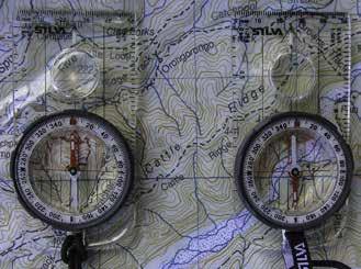
Orienteering taught me the value of ‘orientating the map to the ground’ and ‘staying in touch with the map’. We often teach taking bearings from the map and walking on a compass bearing but for much of the time orienting the map to the ground is all that’s needed. This means aligning the map north with magnetic north (allowing for magnetic declination) so that features on the map align with features on the ground. It makes it much easier to mentally process the information we read from the map to what we see on the ground. For example if we have oriented the map, then the track we are walking on should be in the same direction as the track on the map we think we are on. It saves the mind having to re-process direction which reduces errors when tired. Staying in touch with the map means at all times being able to locate yourself on the map, as opposed to not knowing where you are on the map for periods of time and having to work out where you are afresh. If you are staying in touch with the map you are never lost—and if you can’t exactly pin-point your location the margin of error is small.
The navigation trip to Cow Creek in September gambled with the winter weather. With a wet cold week leading up to the weekend’s improving forecast we anticipated muddy Tararua tracks. Navigation refresher training started prior to the trip with some suggested short YouTube videos on grid references and walking on a compass bearing which most of the group managed to watch.
On our Saturday morning arrival at Kiriwhakapapa
Road end (300 m altitude) we parked next to a van from the Hutt Valley Tramping Club. A couple at the campsite told us that a group of 9 had left an hour or two before us also heading for Cow Creek Hut (6 bunks). We all understood that we faced the certainty of camping at Cow Creek.
The group of eight was large for a single instructor especially on narrow steep tracks but familiarising everyone with grid references prior to the start enabled the whole group to shout out a grid reference for where they thought they were, without having to visually point to a map. This regular question was posed every 15-30 minutes with the GPS providing final arbitration. After a couple of hours everyone was getting it to about 100-200 metres accuracy.
Right from the start and throughout the trip we practiced time and position estimating. It’s a sign of our interconnected generation that few people wear watches but mobile phones are not as convenient as a watch for measuring time for speed and distance calculations. Regular time announcements got over the immediate problem for the trip.
Being able to read contour lines and understand the shape of the ground is an important skill for accurate location in the bush. A little kink in a map contour line means little at the stage of route planning but when observed on the ground where you have an approximate knowledge of your location, it can pin-point you exactly. People need to spend time reading map contour lines and associate them with what they see on the ground to develop that skill. Part of that is understanding what a 20 m contour interval looks and feels like on the ground. Early on in the climb out of the valley we stopped and everyone estimated the elevation we had climbed. People generally over-estimate their climb progress until they get the feel of it.
The occasional gap in the bush canopy provided some visibility of the rising ground ahead. That raised a question of ‘are we going to walk over that mini-peak?’ and provided the opportunity to explain and practice taking back bearings from the ground and translating them to the map.
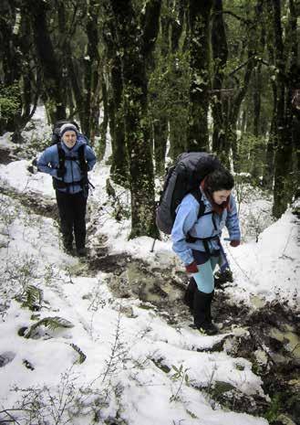
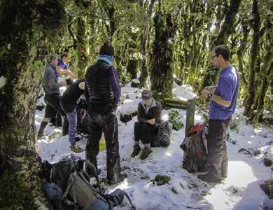
Climbing in light rain up a muddy steep track to Blue Range Hut (970 m) the group’s speed became evident— less than 2 km/hr. Being a nav trip with regular stops for questions and discussions was a factor, but at 600 m we hit slushy snow on the track which slowed progress. Over lunch in Blue Range Hut we evaluated progress. The next couple of hours along a ridge (1000 m) was going to be in snow with a steep descent into Cow Creek (500 m). Although track-signed as a 5 hour DOC time, it was going to be a 7-hour day, with the last hour in darkness. A potential bush bashing navigation option was no longer feasible in the conditions and within the time available.
Leaving Blue Range Hut after a late lunch and heading up onto the ridge we met the Hutt Valley group returning to Blue Range Hut. They had decided to turn back as their progress was slow and taking its toll on the less fit in the group. We were still going well according to our revised plan and continued with the encouragement that we might yet have hut accommodation that night. Surely no one else could be out here this weekend!
The route provided plenty of contour reading opportunities and by the end of the day all of the group were locating themselves on the map to within a couple of hundred metres. As we approached the bottom of the descent into Cow Creek we donned head-torches to complete the last kilometre or so in darkness. With some scrambles across old slips the track markers were difficult to see in places but the location confidence in the group enabled those at the head to find their way through.
Arriving at 7 pm at Cow Creek Hut we were pleased to find that we were the only ones at the hut. A possum did make a bid to share the hut with us but the group screaming sent him looking for a quieter location. With lights out at 10 pm after a great dinner and warm fire everyone slept well, even the two on the floor.
The return trip to the road end on the Sunday was in better weather, less snow, but wetter. A few ridge vantage points allowed us to identify local peaks by back bearings. The navigation novelty is somewhat less on a previously trodden route, but with relatively hard conditions for a group of new members, a better walking Sunday ended the weekend on a high note. The weather conditions on a relatively simple route had added to the navigational challenges and route progress assessment. All agreed they had learned a few things about navigation.
Trip Statistics:
Sat 10 Sept 2016 Start time Kiriwhakapapa Road end: 11:20 hrs Blue Range Hut lunch stop: 14:15 - 14:55 hrs Cow Creek Hut: 18:55 hrs Duration: 6 hours 55 mins Distance: 10.5 km Average Speed: 1.5 km/hr.
Sun 11 Sept 2016 Start time Cow Creek Hut: 08:20 hrs Lunch Stop: 12:05 - 12:45 hrs Kiriwhakapapa Road end: 15:05 hrs Duration: 6 hours 05 mins Distance: 9.2 km Average Speed: 1.5 km/hr.
Comments
Comments are not open yet.